I seen it

My first unmasked shopper and blue sky.

Today was wash day drive into town resupply day. Another day of unhealthy air and needing a new book to read and propane as I have been running the furnace at night.

First was laundry at only one in town. Fox news blared. Loaded machine, hit reg, cold wash. Came back when cycle complete, they were rinsed anyway on hot. Hot is bad for stretch and wool. Propane hunt was google, found likely place outside of town. Drove out, no they do not fill tanks sent me back towards town to an RV park which did not ping on google. Filled up, burning about .4 gal a day. Grocery store: Ridleys, Big time store enhanced by a sporting goods dept. Aisles are direction arrow. I was 6 foot + away from this white man with no mask. I missed how the store handled him.

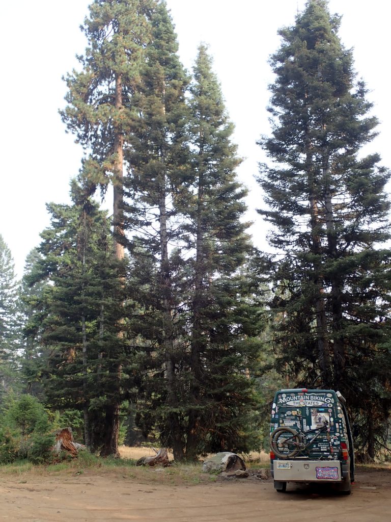
Drove back out to Bear Basin spot which was empty. Site has a slight slope to it which requires placing correct number of stacking blocks to level the van. Amazing how shallow a slope can require inches of height to make level. I use a bubble level to establish level. A first reading determines if I can level the van, if so then figure which wheel (s) and number of blocks, put them under wheels, get back behind the wheel, drive forward onto blocks, check level, success if bubble in inside the inner circle, if not repeat process till level. Blocks are breaking down, will put a new set on my bucket list.

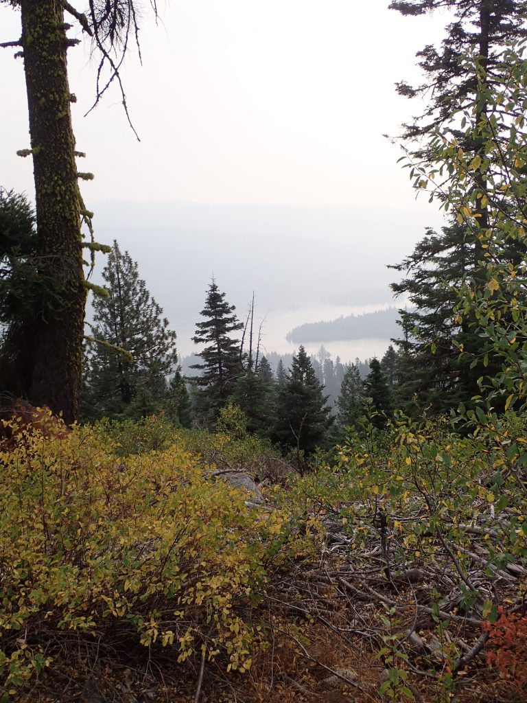
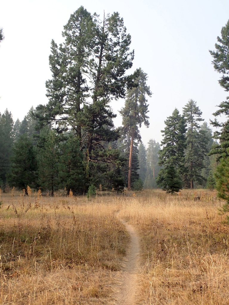
Yesterday was a no ride day as the AQI was unhealthy. I satyed at same spot, nice not needing to move. Finished Hoot, a Hiasson novel. Went for a 2hr walk late afternoon. There is a peak that I can see thru the smoke, I can not see anything beyond it which could be because of cumulative smoke or that was it. Anyway, while out here the skies were lighter than in town where the measuring station at the airport is located. Here smell of smoke was almost nonexistant. I could breathe this air during a ride. I went for a long walk out around Bear Basin.

Bear basin

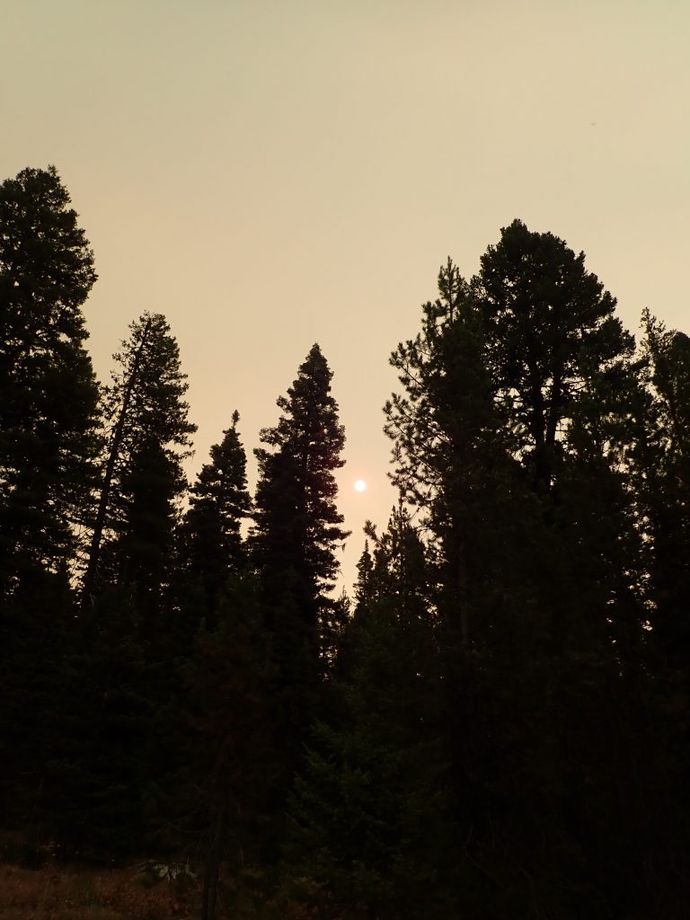
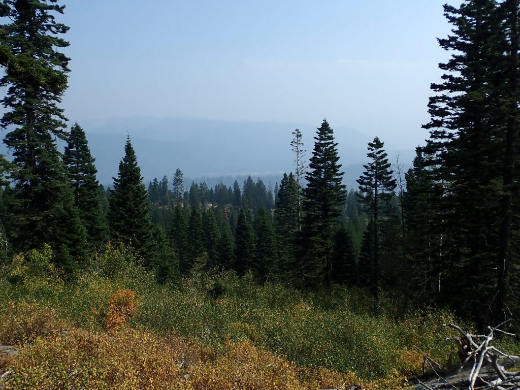
Last night I thought a plan for today to do the town stuff first while it was chilly then drive back out here and ride. AQI was unhealthy but clear air here. Geared up. Pedaled up Brundage lookout rd. 3.14 miles gaining 869′ took 37 mins pedaling. As I climbed I climbed out of the smoke, I seen clear blue sky.

blue sky on climb up Brundage lookout rd.

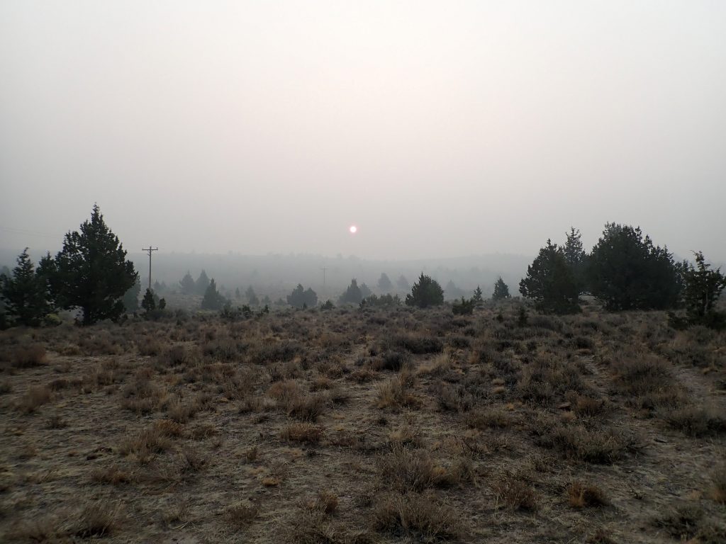
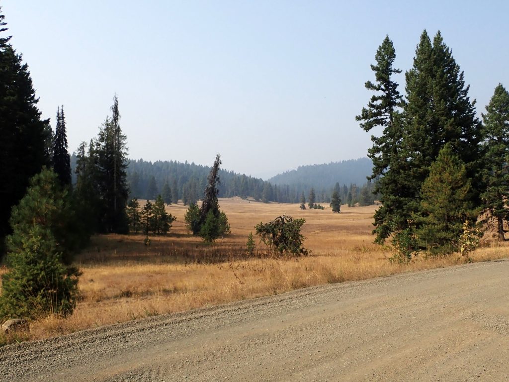
Then prolly why the McCall AQI is unhealthy

looking east over lake, mtns are faint line
they were big trees

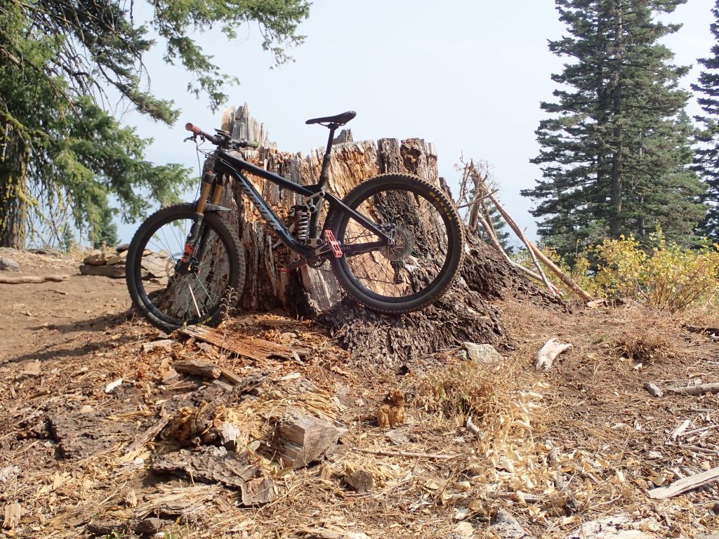
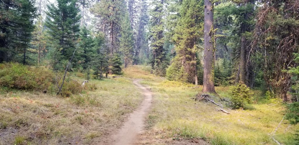
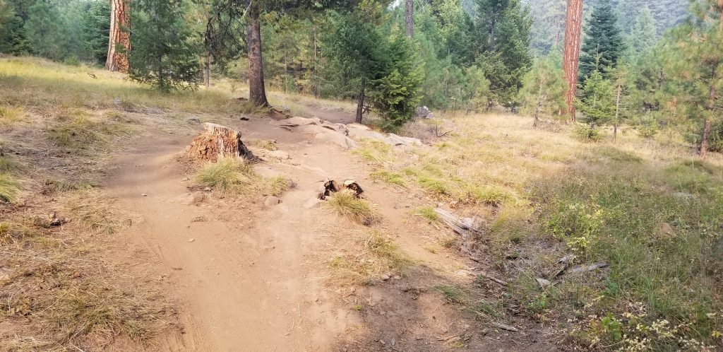
So the ride was pedal up main gravel FS rd, coast down a secondary FS rd to finally join the Payette Rim trail right where I rode climbing previously. This place seems to be a perfect place to ride the trail as going north was the new piece down to road ride to town or right down. I huffed and puffed the climbs that today seat down, limber body, look ahead, and control speed. There are numerous rock features for decision making. A social side trail connected over to Bear Basin and home. Short ride. Was nice to be smoke more free.

Planning Sunday Fisher Creek ride over near Stanley. There is an 80% prob of precip on Sat and Sun being sunny. Riding that ride after rain will be sweet. Steve is coming over.

Sun came up, smoke never left

I am outside McCall, ID breathing what’s in the air. All is relative, here the AQI this afternoon is 112, unhealthy for sensitive persons. Bend’s numbers are in the 500s. Sheesh. My only whine is I have not traveled far enough away to breathe clean air. My problem. I have no solutions for people affected by these fires and shitty air. Offering trite wishes have no value. What compassion do I have for them? What value does sympathy have for wishing recovery and safe living conditions? I feel for these people but I lack empathy because I have not walked down the road with them. May we all make wise choices to protect ourselves and others. May the grifters be given short shrift. My vibes go out for measurable precipitation.

Yesterday the air was same level of contamination, I consider myself not to be sensitive. From sleep spot I worked over to pick up Payette Lake west side trail which runs on West side of lake for the most part a ways above said lake. Newly built single track connects with several pieces of old logging roads now closed. Rode this same loop last year during my visit. Today the trail was worn in more and intersections were signed. The trail has many rock features au natural. And the tread shows lack of rain: dusty and loose. A road piece crosses a flowing clear stream that I rode thru which is no normal for me as I prefer to keep water off my bike. Water was deep enough to wet the brake rotors. Wet rotors and pads squeal loudly until friction dries them off. I did not need my bell to alert 2 women riders pedaling up.

Looking east, upper Payette lake, AQI around 120

My ride went out the bench then down to newly paved Warren Wagon road for a road spin back to van. Dirt was 11.8 out of the 21.4 miles climbing 1529 taking 1 hr 36 mins, road back was just under an hour. What a change to ride smooth pavement and working on spinning.

Afterwards I returned to sleep spot just passed TH at Bear Basin, tucked in behind small stand of trees and off the main road which has hunter traffic creating dust and noise.

Last night was chilly enough for furnace. Daylight has a smoke degree of opacity. The sun is red.

early morning Tues

At least the sun is visible here. No daylight headlights needed.

Bear basin, smokey

Forecast temp was in 70s. I stuck my sensitive nose outside to determine ride clothing choice. Shit, it was in 40s for me chilly. I wore knee warmers, a short sleeve wool t shirt under a light weight wool jersey. I did wear my orange wet gear jacket for visibility. My plan was to ride up the old lookout road to the top of the mountain or… there is a bail point to connect to the trail I rode yesterday. I pedaled a way up the road passing several hunter camps. Road steepened. I warmed up. I stopped to adjust layers. I spied several knapweed flowering plants which I uprooted. I looked at my rear wheel noticing a wet spot around a spoke nipple. I swiped it off then checked spoke tension, discovered adjacent spoke tension was loose, it had unthreaded from the hub. Shit, that never happened before. Pulled out multitool and found spoke wrench which does not fit I9 spokes. I have a small pocket knife with pliers which I tried to no success. Loose spoke affects strength of carbon rim. I was close enough to turn around and ride back to van where I have a workable wrench. However, I do not have a truing stand and I am not good enough to just eyeball spoke tensions. I changed clothes then drove back to town to Gravity Sports, the shop I visit. I asked the wrench for wheel check and to have my bike back this after. He said should be. I left my bike and phone number then did a short walk about town to the book store and health food store. Grocery shopped. Returned to shop, bike was finished shortly after. Wheel spokes tensioned properly. Drove back to same spot at Bear basin. Air quality is still unhealthy. Decided to rest the remainder of the day.

I have SIBO which requires restricted food choices and am intolerant of gluten which eliminates beer. No beer presents adaptation challenges as a post ride beer can no longer be a reward. Should I choose to socialize in gathering places I will drink wine. I can’t wrap my head around sipping Scotch post ride. Yet.

Bear basin is closest FS land to town as town is built right to forest, Payette NF. Over the years I have stayed here every visit.

Tomorrow give a restart of today’s ride depending upon air quality.

This morning ash fell. The sky said precip but none was forecast and it was too warm. Small white pieces floated down.

Still in it

Sat AM out east of Burns, OR at look outside time the sky was smokey and the air pollution index said don’t breathe deeply.

sunrise

Excellent internet speed 3 bar way out here allowed further research. What’s east? McCall, ID showed yellow which is just below green for great. Perhaps i would be far enough down wind to be either lesser or smoke free. I made it happen. Drove the 3 or so miles of bumpy gravel BLM rd to hard road US 20 east bound thru Oregon desert. Dry. Drivers mostly burned headlights for visibility to on coming traffic. Strange light and elements. Sky appears to be foggy but there is no precipitation. It’s not like some storms that one could drive out of. It never cleared. Resupplied at a dispensary in Burns. I sought the supplier was the tightest with the selling shop.

superb packaging, data collecting

Continued eastward o US 20 still burning headlamps mid afternoon. Crossed into Idaho following google map which routed me north on US 95 a main N- S conduit for Idaho. Not much traffic but still smokey enough for headlights. Just outside McCall the turn for Bear Meadows takes off to the left, braked hard enough to make the turn. I shit on the driver behind me making my move. I was unsure of the turn although I was here last year but coming from the other direction. Drove out to the basin. Found a spot off the old Brundage lookout rd that I saw last year. Chilly night. Just before arriving the air quality dropped to unhealthy, 2 below green.

This morning was more of the same air quality. Shit, no ride. I drove into town which was really hopping compared to Bend. Just a weekend past school start would not expect the lots of people. Visited a bike shop, new faces from last year, asked for water, request permitted. Groceries at downtown Albertsons then drove back out to Bear. This time I took the left on a spur road out to the meadow where I watched smoke jumpers land a practice jump. Tree cover appears to be mixed old growth which is strange as town and a mill is so close. Big Doug firs and P pines, firs mixed in. I have stayed in the area every time I have visited going way back.

big and tall old growth
tall

A trail system trail is right off my bumper. I walked the road further out coming to a single track crossing the road. Hmm. Pulled up Trailforks for navigation then turned right on the trail. What I noticed right a way: hard pack tread with no dust. Understory in fall colors.

hard pack tread plus vegetation
go around set up for rock feature

At 9:30 air quality is 195 which is several points lower than this afternoon but I am more affected by the smoke now. I only cracked the roof vent to keep this smokey air inside. I am experiencing conditions here. Bend is 364, Spokane 469. Piece of cake here. 9:30 number dropped to 176.

Steve sent me a link to a noaa smoke forecasting site. Shit, don’t want to be anywhere west of here, hazardous. Where is there no smoke? Forecast shows like Gunnison, CO with light smoke. Good for me. Tomorrow’s conditions will determine my action. Sun Valley is 161 with a large fire burning just N of US 20 on the way. Twin Falls is 154. Moab is green as is Fruita. Salt Lake area reads much yellow. Traveling during the covid I did not want to do. Conditions will force me out of my comfort zone,

I will head to clean air which will be the focus of my traveling. Maybe to Arkansas Ozarks?

In Mountain time zone, lost an hour. 5476′.