
River. Today I decided to make a rest day and drive to Twin Falls, ID and the closest Walgreens for me anticoagulant med. Drove out of Steve’s driveway and turned left then straight for like 50 miles to pay $115 for 30 days of meds. Bellevue is at the end of the mountains, from there the land flattens and straightens. Up and down little rollers past lava fields, irrigated fields, and several very very large feed lots. Steve told me that animal care givers remove the cow’s ovararies which eliminates them attracting equipped bulls (hence the name) that harass them for the good stuff, this rebuffing burns the weight off that is being almost force fed into them before ending up as a fatty piece of red meat on your plate.
Picked up meds. Steve told me of a bike trail system right down on the Snake River. I checked it out on Trailforks. High density trails as a loop. I picked the 6 mile ride as digitally defined in Trailforks. I used maps to navigate me thru neighborhood then connecting to main road down the cliff face to the river road which passed a golf course resplendent in lush green, including the fairways from stolen water. Sewage treatment plant on same road. Pavement turned to wash board stutter bumps that shake contents of van, I avoid as much of this road type as I can. A pullout appeared, I steered in. TF showed a trail right above the road leading back to trail system. I geared up then pedaled back up the road to pick up the start of the trail which parallels the road and routed to suit natural features. Deep soft sand was the tread right at the start, fine grain offered little resistance. I gave quick thought to turning around and ride the 1 1/2 miles of road to trailhead. Quit that. Bunch more pedal strokes rolled onto to firmer packed tread. Blue level. Same mountain bike and rider pedaling and coasting sustainably built single track yet it was different.
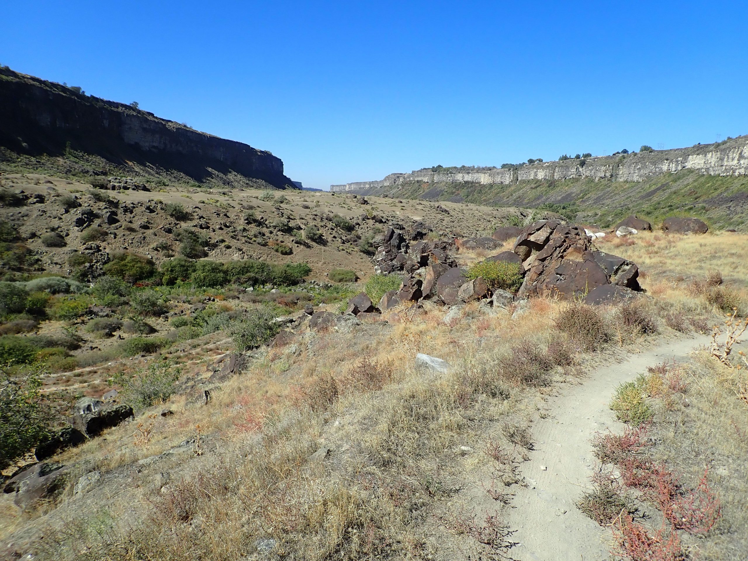
Both Trailforks and backcountry navigator could not receive gps info rendering them useless. I figured if I kept the river on my right and the cliff to my left going out to end point then switching refence points on return I would be found. I rode a trail named Porcupine, one of namesake scampered out of my way before steering around a small squashed skunk which didn’t foul the air.
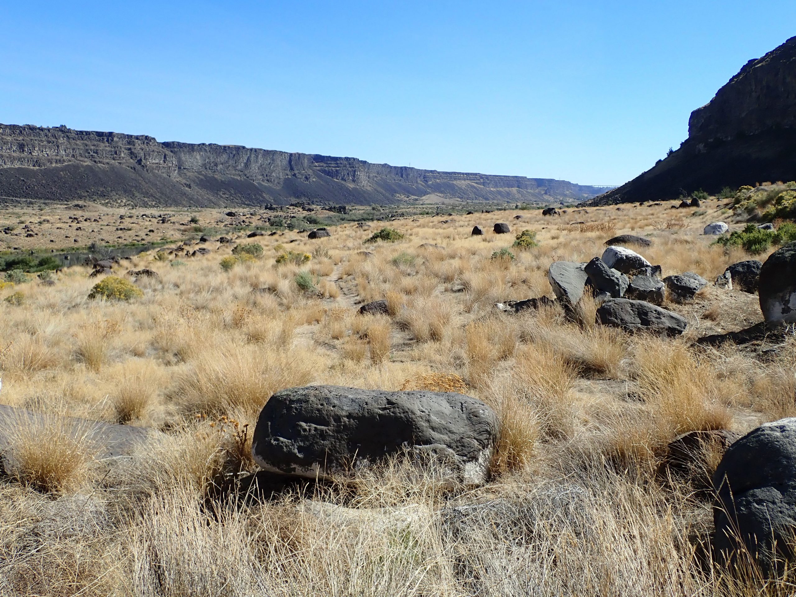
I believe I hit the end point then turned around riding another trail back. Many of the trail labels were weathered blank. I just wandered my way back to the van. I rode a new place.
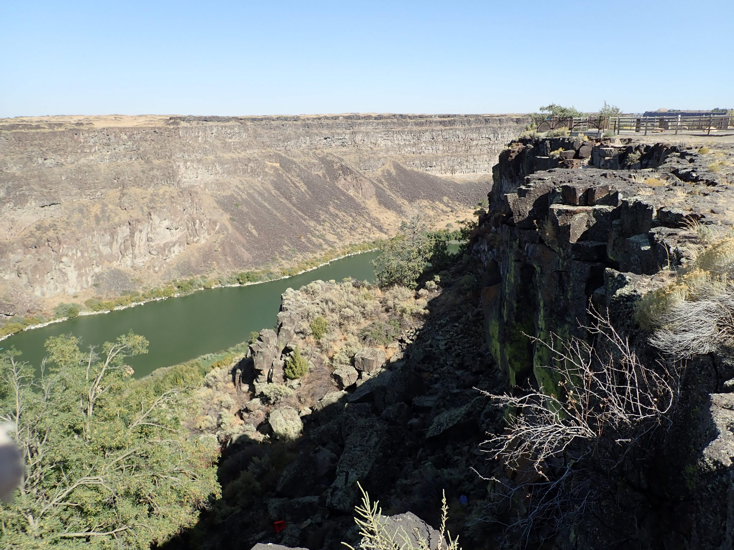
The road from the top of the river canyon descends steeply making 2 real tight sweeping switchbacks. tested my brakes. The climb out would test the drive train. I am always apprehensive of van’s performance. Climbed out downshifted into 3rd. Once on top I drove over to shopping mall which is built almost to the edge of the canyon.
Turned right out of the parking lot heading N back to Wood River valley. I decided I have more enjoyment forthcoming riding out of the valley. Bought propane, 4.4 gallons in a week, burning the furnace.
Riding here, Wood River Valley, is mostly legacy narrow hiking trails deep in the forest. The trails form a network with infrequent connectors which makes for big loops and bigger loops. The Augar trails are more park like with high density. I struggled with riding them. These would be so different and less than Wood River. I persuaded myself for the experience. It is what it is, the locals worked with a piece of land and created riding trails.