Fruita Day 1

sunrise was at 7:40 a bit after I crawled out of bed. Sun rise filled my living room window during breakfast.

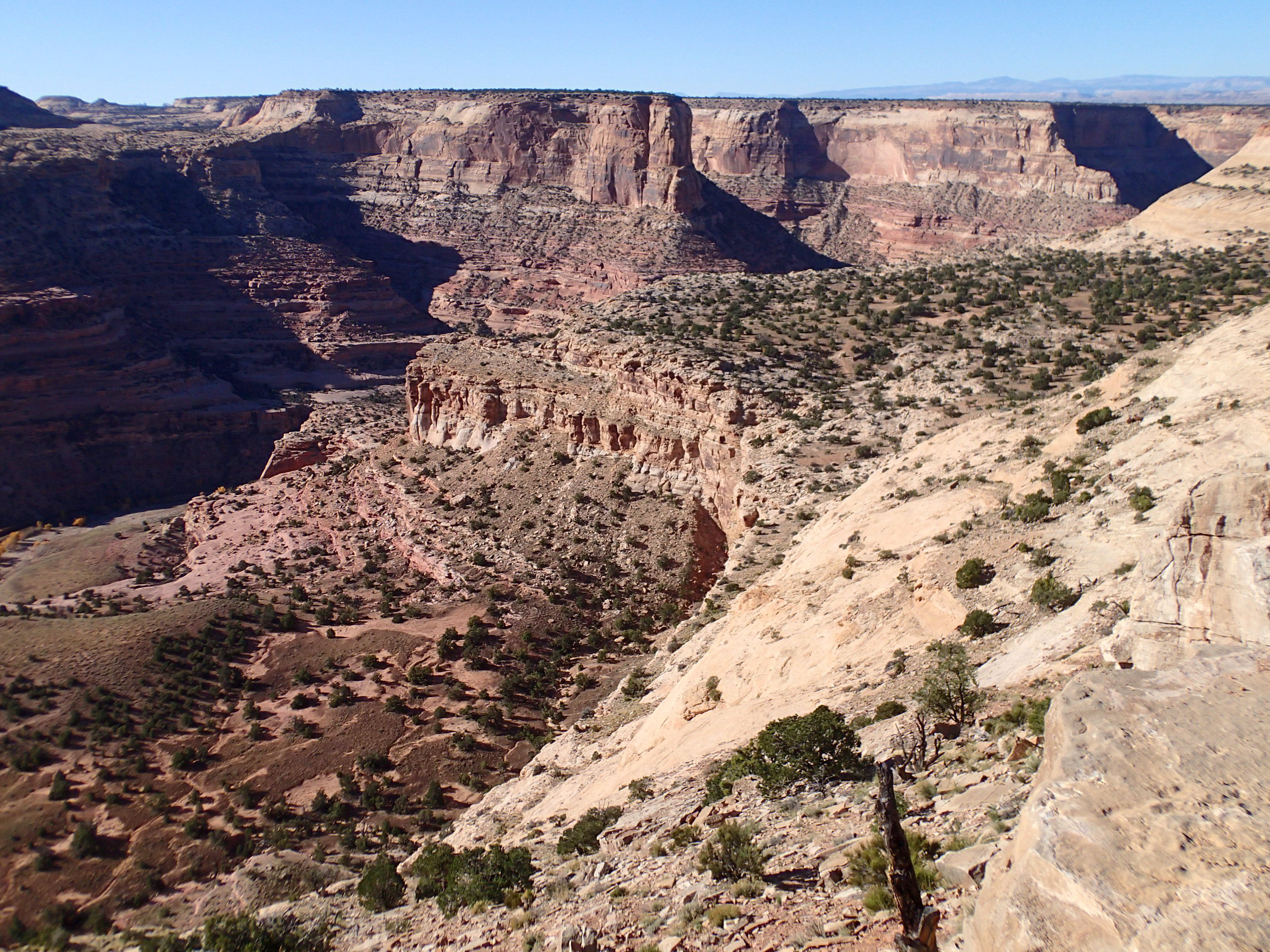
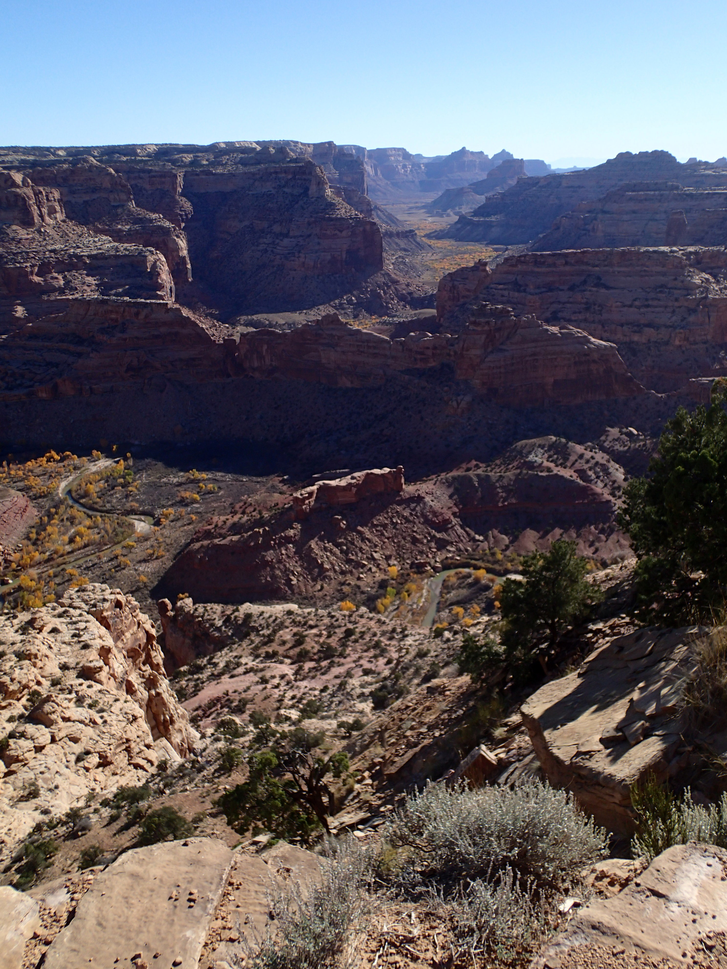
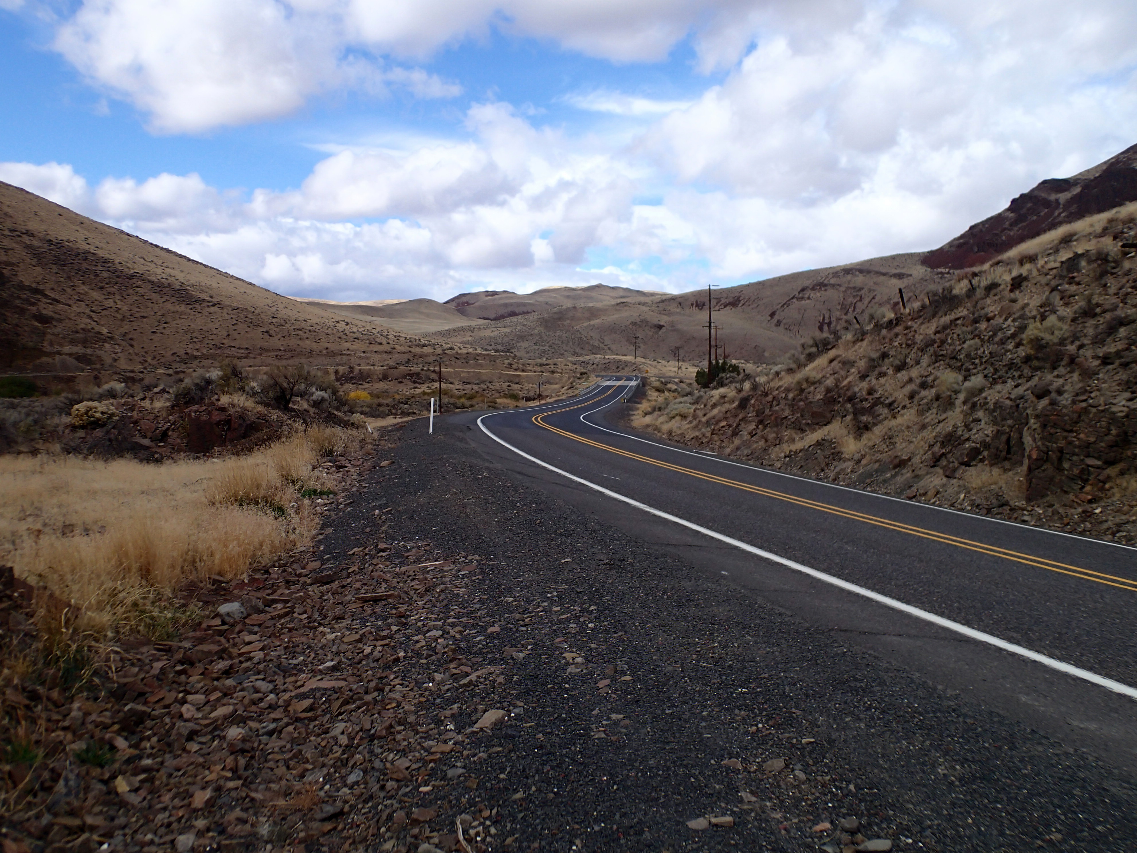
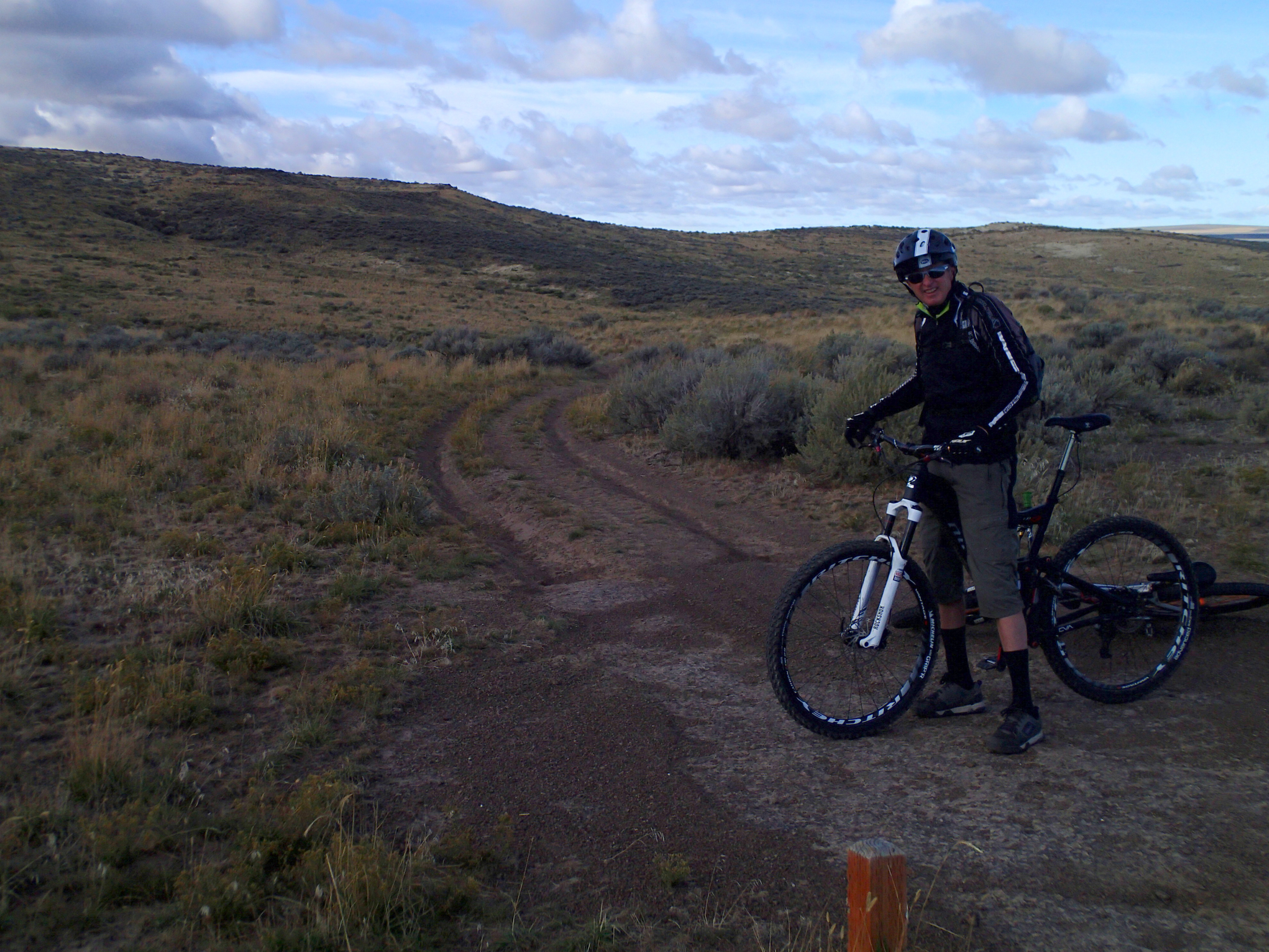
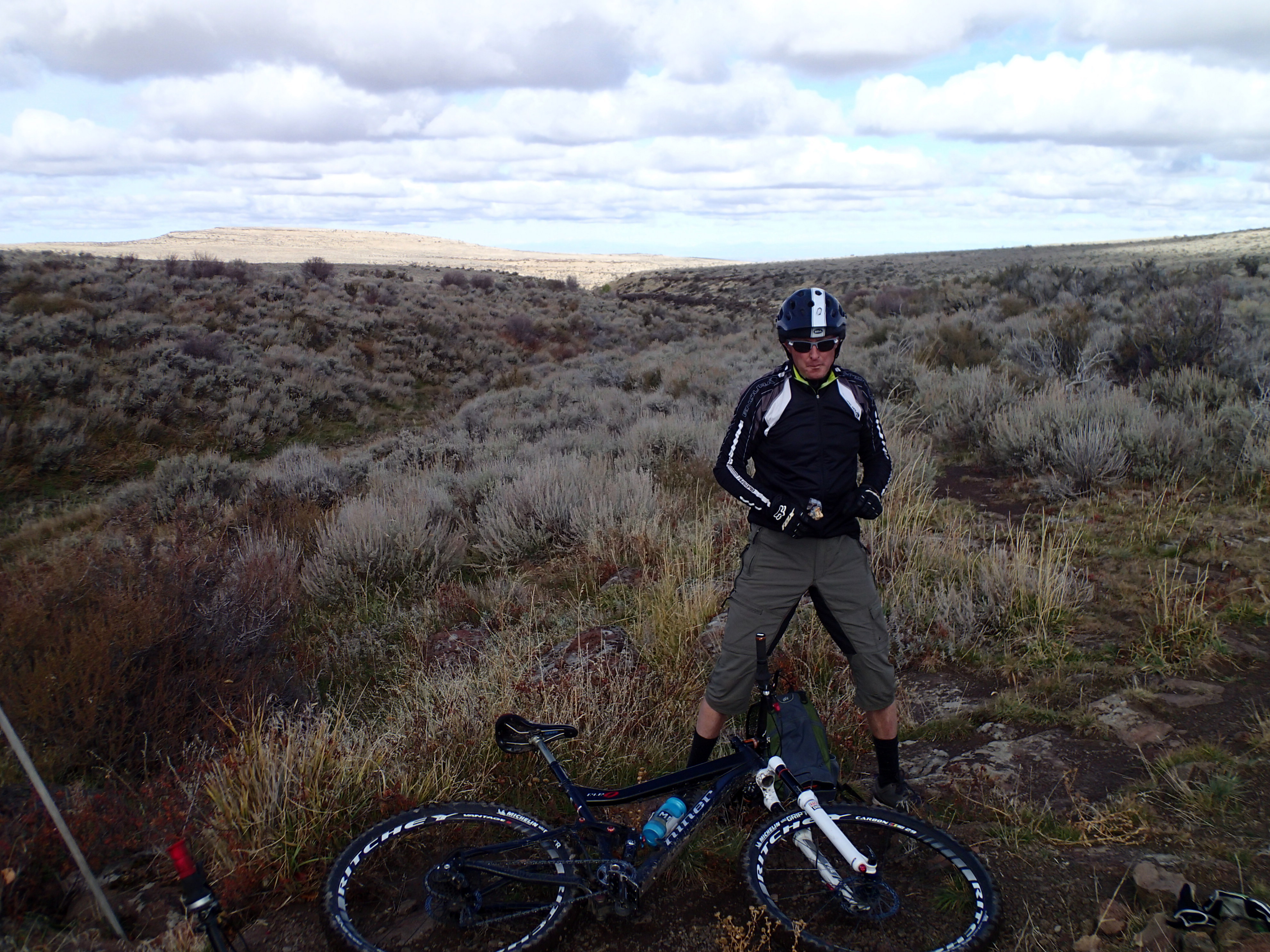
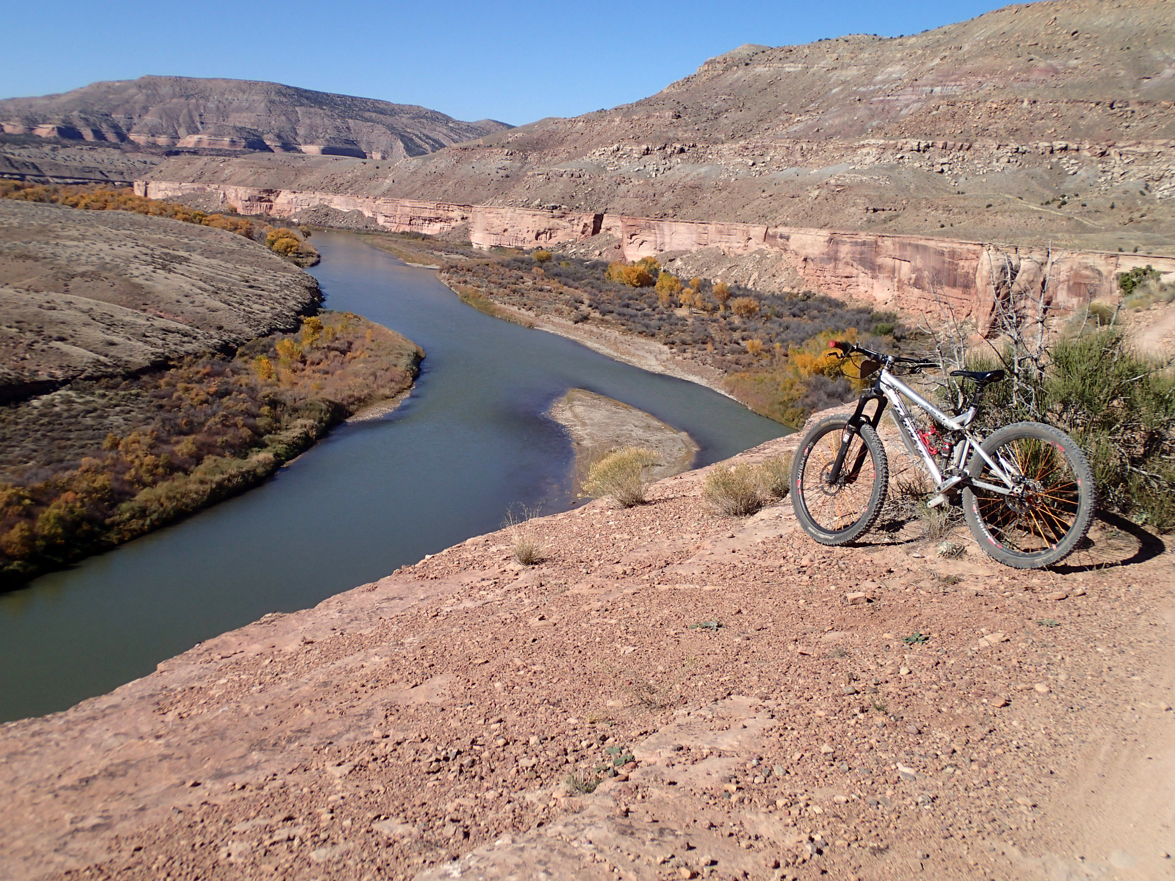
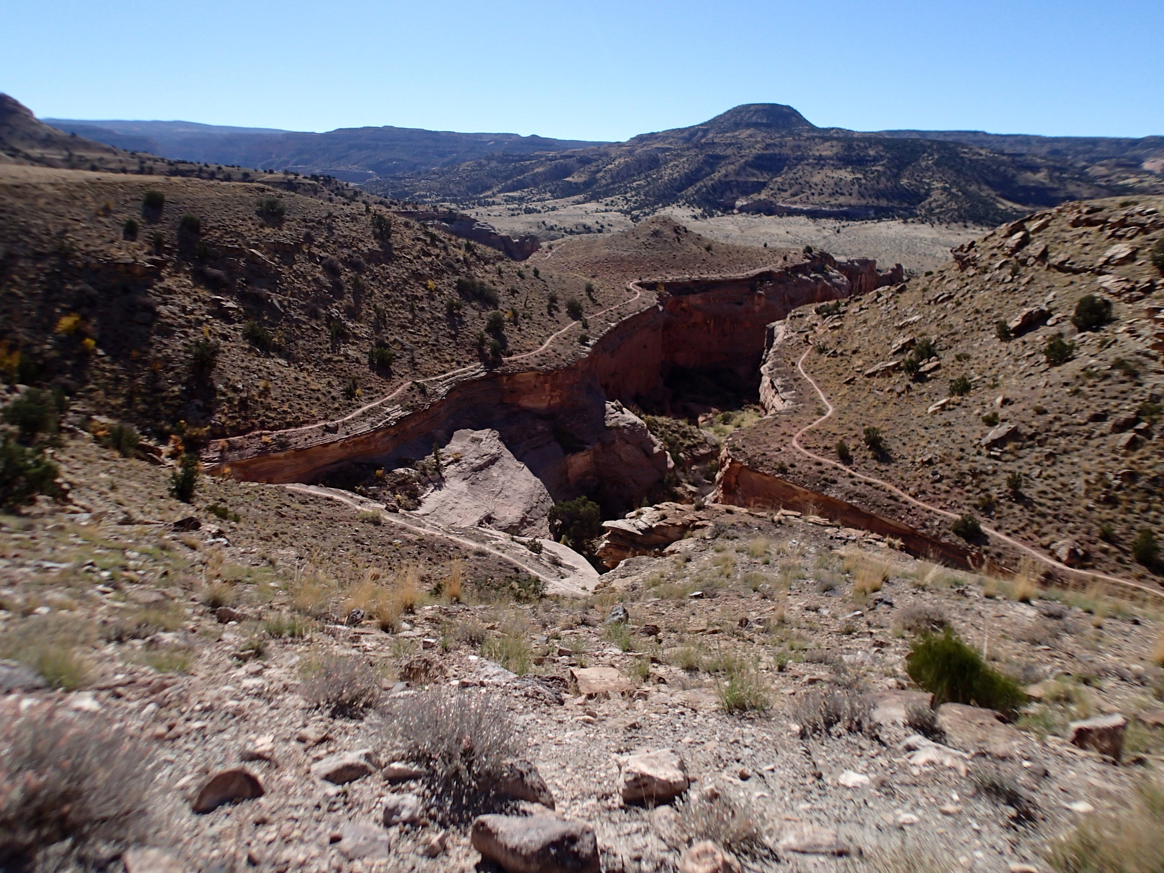
Today I drove 15 miles on I70 to the Kokopelli trail head. Beautiful day, a bit chilly, but hey, no clouds and no wet trails. Just a few rigs in the parking lot meaning solitary riding. I rode Marys out to Steves which is a loop then rode back Marys. Chunky riding a bunch that was way over my head and others I just bailed and walked. I am walking more now. Introduction to chunky technical riding on sandstone. I did have successes making moves. Spectacular scenery:

looking downstream Colorado River
some of Steves
some of Steves

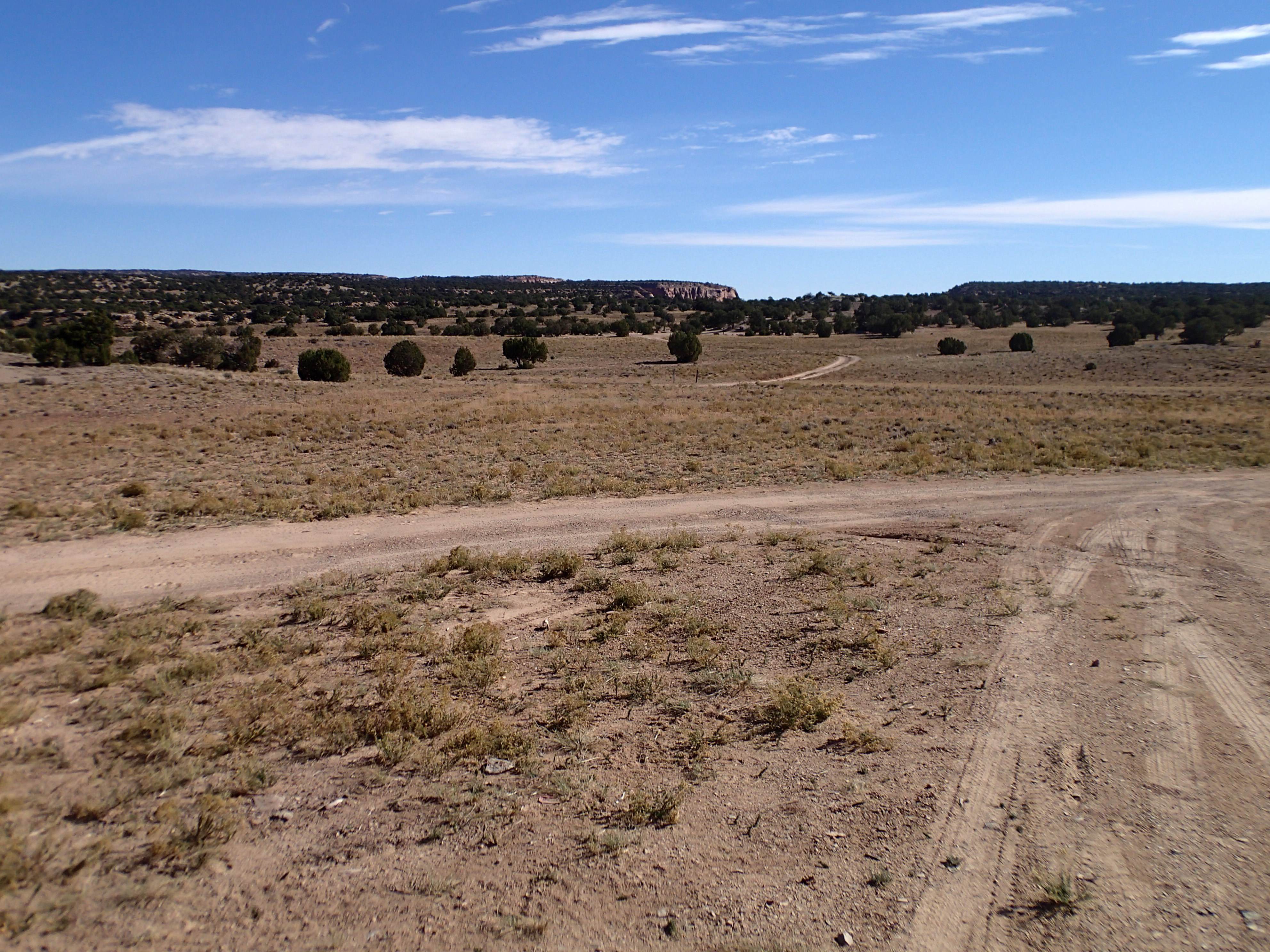
Even lesser tree cover than Good Water.

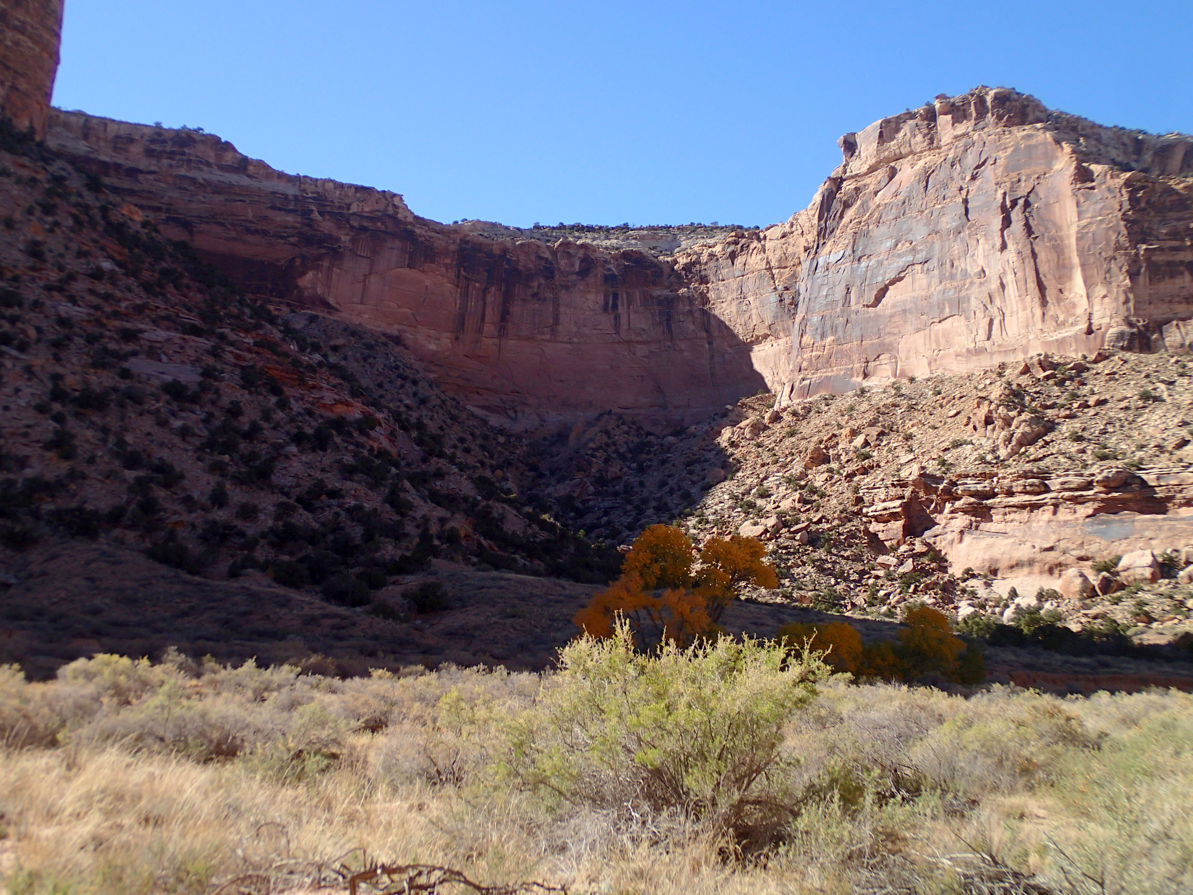
Challenging riding. Several places there were killer climb a bike moves including the drop in to Horsethief. Much upper body effort that my right arm can not engage in. I could lower the bike OK but boosting it up face took several steps.

As the day wore on I started seeing riders. retired or on vacation in the shoulder season. Great time to be here.

Drove to Fruita’s Community Center for a shower. During my last visit back in ’12 I received a membership card thru my health insurance plan. Locker room shower. Clean body, next stop was the laundromat. Clean clothes and 5 gallons of water in the tank.

Next was Over the Edge bike shop. I learned that Drew no longer was working there. We have run into each other over the years and country. I hung out for a short while then hit Hot Tomato for dinner hoping to see owners Jen and Anne. They weren’t working. I sat at the bar. An attrractive woman sat beside me on the empty bar stool. We were conversing when I was bumped into by Drew and wife Kimila. The woman seized the moment and dashed. Drew invited me to stay in the street in front of their house which is where I am on a residential street in front of a house permissio as the n given.

Tomorrow I travel to Grand Junction to do some business then ride Butterknife and the Ribbon. More desert chunky riding.

Next stop is Moab next week. Driving from the west the La Salles are visible that are still not white (snow). That means that  the shuttle for the Whole Enchilada could be running. Something like 8,000′ descent. I have only been as high as the second stop Upper Porcupine. However rain is called for this weekend here.

Hello Southwest

Yesterday I left Indian Springs outside Kimberly, ID in sage desert and basalt, tonight I am above Rabbit Valley west of Fruita, CO in juniper tree cover laded w/ purple berries. Lots of interstate miles.

Plan yesterday was to be on the road early to Ogden to ride a recommended trail above town. SLC metro is huge hemmed in by the mountains to the east and the lake to the west. Too many people crammed into too small an area. I bagged the ride. I chose not to fight over scraps right outside of town in favor of making Price @ Fuzzy’s ( a different Fuzzy) Bicyclewerks shop b4 closing. I drove off the interstate to in town Ogden to catch a shower @ Anytime. Traffic was non rush hour but still absurd. I picked up rt 6 towards Price and left the valley behind climbing up to Soldiers’ Pass. The aspen have shed their leaves leaving dark bare trunks up high.

I rolled into Price and found the bike shop. I walked in and Fuzzy greeted me saying he knows me. He has a braided tail but no dog. His comment to me on my first visit years ago was if there is not a long haired guy or a dog, don’t trust the shop. His dog is too rambunctious for customers. We chatted about trail advocacy. He told me about Good Water rim trail that I tried once b4. I listened then changed my plans to drive to the TH. He told me about Lamar who gets credit for building the trail. The TH is @ The Wedge overlook way out in the toolies, BLM land. I navigated from a hand drawn no scale lacking details map by Lamar. 2 lane gravel dirt road treated w/ mag chloride which kept the dust down and fast driving. After dark. A coyote ran smoothly across the road in my headlights. The map lead me to a camp site in the dark.

And the sun rose lighting sand stone and junipers. Southwest pretty last seen back in May in Sedona. I saw my first cactus since Oklahoma. Ride right from my side door.

Sunshine and no wind yet chilly enough for a long underwear top. My plan was to ride the road out to the overlook start of the gps trail. This time I was going to find the start. Cows grazing on desert scrub and trampling the cryptobiotic soils w/ hoofs and defecation. I found the overlook

San Rafel river, good water rim trailThe trail followed the canyon edges snaking around junipers and pinyon pine. Lesson: don’t brush the trees as there is usually a hidden stiff branch that will grab my upper body. When riding along the edge of a big drop you are either a bike rider or a tourist, not both.

that's the river down below that carved all of this
that’s the river down below that carved all of this

The trail is not in MTBProject. Just need the ends as the trail is obvious.

Great warm day. Trail just twisted around one way then the other. Non technical. I learned for Lamar that the BLM said the trail must be rideable by all. I rode all the single track in 1 direction then rode the dirt road outer road back to my van.

trail is way out there

This place is far out in the toolies. Lamar’s map showed direction to I70. His phone number is on the map and there is cell phone coverage. I called and introduced myself and asked about the route to the interstate. He said my van would make it. I had 3 route choices, 2 were known roads but 170 miles to the CO border. The Buckhorn draw was only 120 miles. Adventure into the unknown. He told me he would be out riding later in the morning. Our schedules put us face to face. He was out doing trail work moving rocks and cutting branches.

I drove down Buckhorn draw following BLM signs. There were no disclaimers about passenger cars which gave me assurance. Road dropped off the plateau down into the river bottom finally crossing it. Spectacular scenery of canyon walls. Cottonwoods were in full fall color gold.

from down below
from down below

The road surface was babyheads on the other side of the river that I drove over @ about 20mph. 30 miles of dirt to get to I 70. Most spectacular road I have been on if you like canyon country.

I figured that I had enough fuel to make it to outside Fruita. I would need fuel around 600 miles. It would be close.  I could have bought fuel before the 45 miles of no services which would have given me peace of mind. I went for the very ffrequent reading of the odometer, fuel gauge, and the mileage markers. I made Loma w/ about 3 gallons to spare. I filled up then drove back west to Rabbit Valley exit to my favorite camp spot above the valley floor. 25.5 mpg.

I found an RV repair shop in Grand Junction and made an appointment for next Wed to service the heater per Gowesty’s instructions.

My license tabs expire in Nov. This year I also need new plates. I called the county licensing dept to explain my situation and work out a solution. The tabs are shipped right away, the plates taking maybe 2 months. The tabs and a paper temp tag will be mailed to Fruita the plates will prolly be shipped to my Seattle address. Took several phone calls for me to understand the state’s workings and to synch mailings.

Southwest desert country until I head north in the spring.

Allison and Mike, I finished American Nomads. I am of the last chapter nomads.

In CO where my self medication is legal albeit not on Federal lands.

Tomorrow is a ride on Marys then into Fruita for laundry, shower, and Hot Tomato.

I paid my mailing service $12 to ship my election ballot to Fruita; just need to have it postmarked by election day.

Halloween party @ the Tomato.

Yesterday I let the brisk west wind blow me to Indian Springs

Sunday I left Bend on US 20 sharing the road w/ almost nobody. The further east I got the stronger the winds, like I was catching up w/ the tail of the storm yesterday in Bend.  The van is a  handful to drive in winds of almost anything above calm. Then the road was not always down wind and the topography shaped the wind. 2 hands on the wheel and overcome the self medication. Bend sits right on the western edge of the sage desert to where I am now which extends  further east. Volcanic past is front and foremost:

looking west on US 20

Boise has trails to the N of town. I checked out public land for camping and found nothing that was close which caused me to skip town. I was going to camp and ride today or maybe yesterday. Worked out OK as I watched s very black storm front almost on top of where I would have ridden.

I texted Steve in Bellevue that I would be riding Indian Springs today and invited him. He, being retired now for a year, said yes. I camped @ the TH. Windy. Propex didn’t start but the Olympian did. I slept under double down and medium setting. Mountain time zone lost an hour. Sunset is 6:25, sunrise 7:59.

This AM I turned on Propex and it caught and ran during our ride until it reached the high temp then shut off. Back after the ride I manually attempted to start it to no performance. Go westy called me back. Problem Propex says is in the fuel valve which needs to be removed and cleaned out. He tells me it is simple that the heater doesn’t  have to be dismounted. I will find an RV repair service and make an appointment then coordinate the service w/ the tech. Till the I turn the dial occasionally as I am rewarded w/ heat maybe 5% of the time. No start this evening.

Steve arrived. Windy, chilly, and slightly cloudy. Warm clothing, not full cold gear. We rode the front side as i have heard from several riders that the back side is horribly eroded. We rode up Dry Gulch to the top where Steve showed me a new to me trail that we rode across the top then back down to Dry Gulch. We spooked a herd of mule deer. And rode thru lots of cow shit.

Steve, erosion damage on trail

Further up

Indian Springs sage desert. Steve

Descent was on almost a cow path leaving the sage brush grabbing @ my handlebar ends. Back down to Dry Gulch where the sage is brushed back then the climb out on Matts to descend down Brennans which is chunky technical on basalt rocks. My bike just is nimble. Wide handlebar levered me around corners.

Back @ the TH my heater has been told about. Steve bid adieu however he discovered he left his lights on and a dead battery. I have jumper cables from a Boeing Spokane award from years ago. Steve was able to drive away.

My next stop will be Ogden, UT to ride Bonneville trail Jen told me about. I thought about driving there this afternoon then decided to stay here. I drove up the road a ways and found a flat spot.

OLYMPUS DIGITAL CAMERASun is going down.

I am 457 miles away from 20,000 miles on my odyssey. Math tells me if I ride 5 days a week for at least 12 miles for the remaining 10 weeks on 2014 I can make  the milestone.