McClure Pass 8753 feet above sea level


Writing this at the pass with 0 service on 9/27.

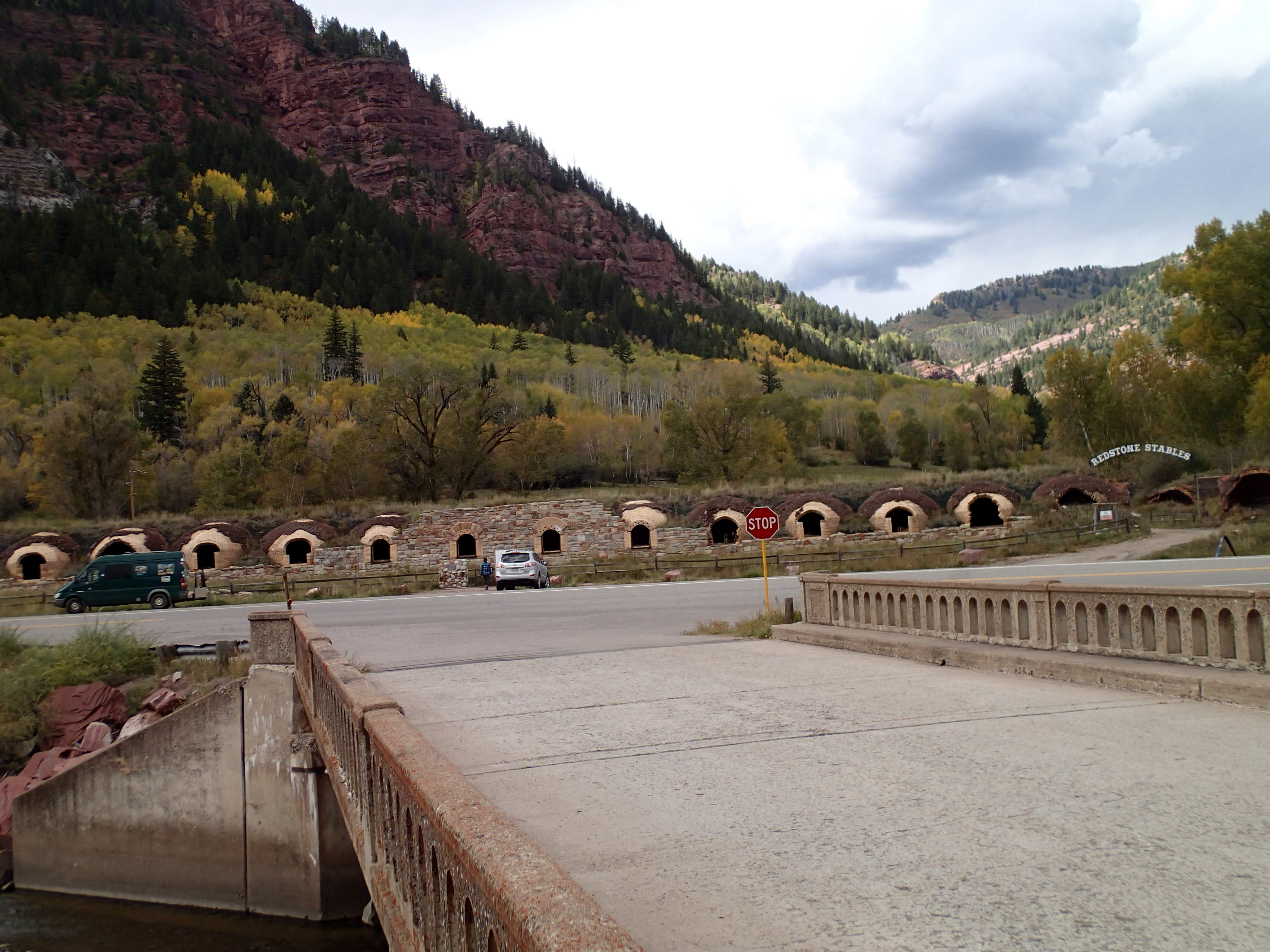
This AM I drove into Redstone, a former coal extractor and coker. Redstone was a company town while the original owner made it a place where workers were treated well to be better workers. I have no knowledge of its efficacy but I believe it. Sold out to Rockefeller….. . Coal was extracted up Coal Creek then transported downhill on a narrow gauge railroad to the coking ovens. Noxious air pollution as coke is made by burning coal in just the right amount of no air which must have been like wood stoves not getting enough air. Maybe 25 ovens. Great living but can’t hang the wash out.

coking ovens

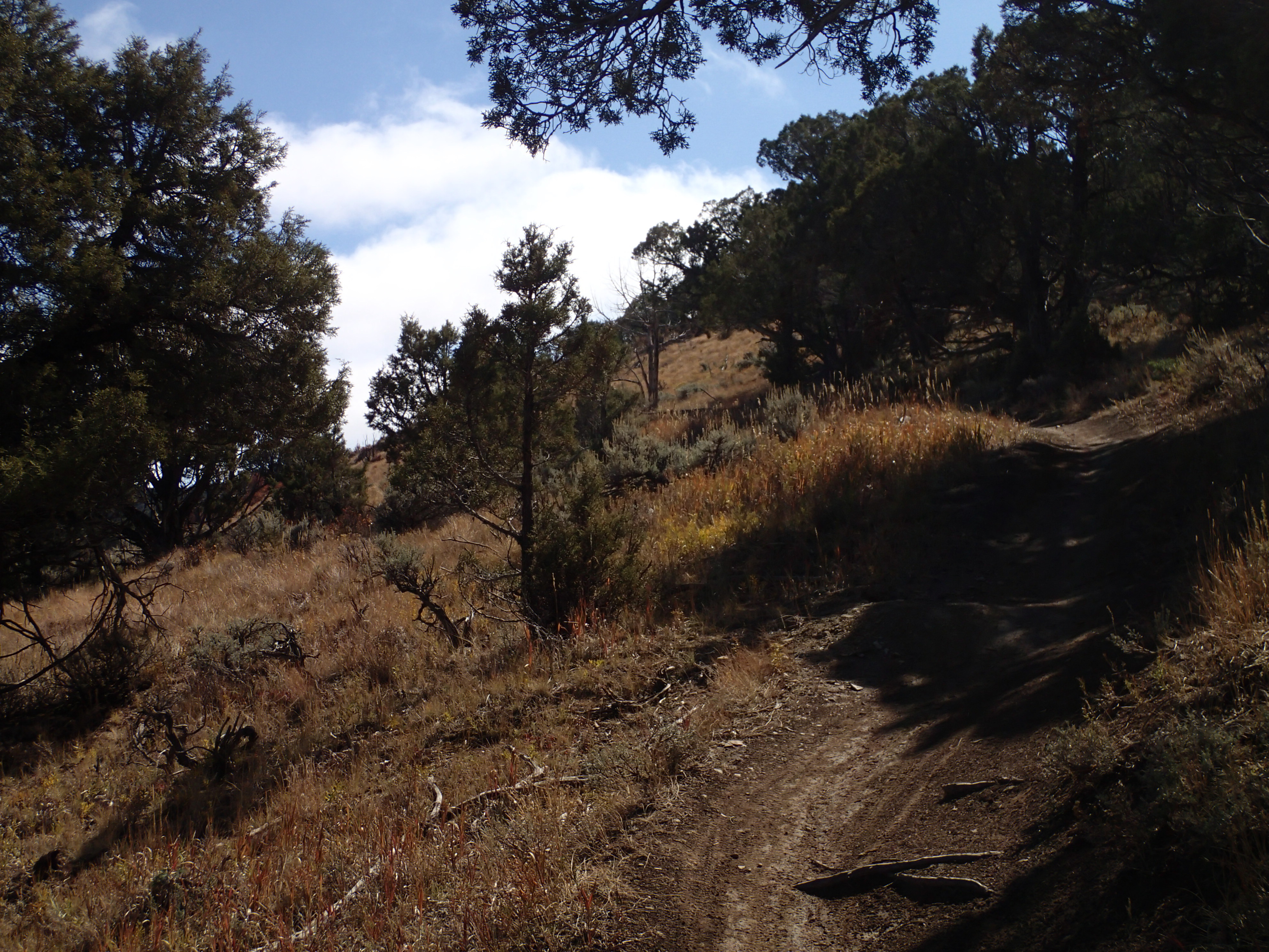
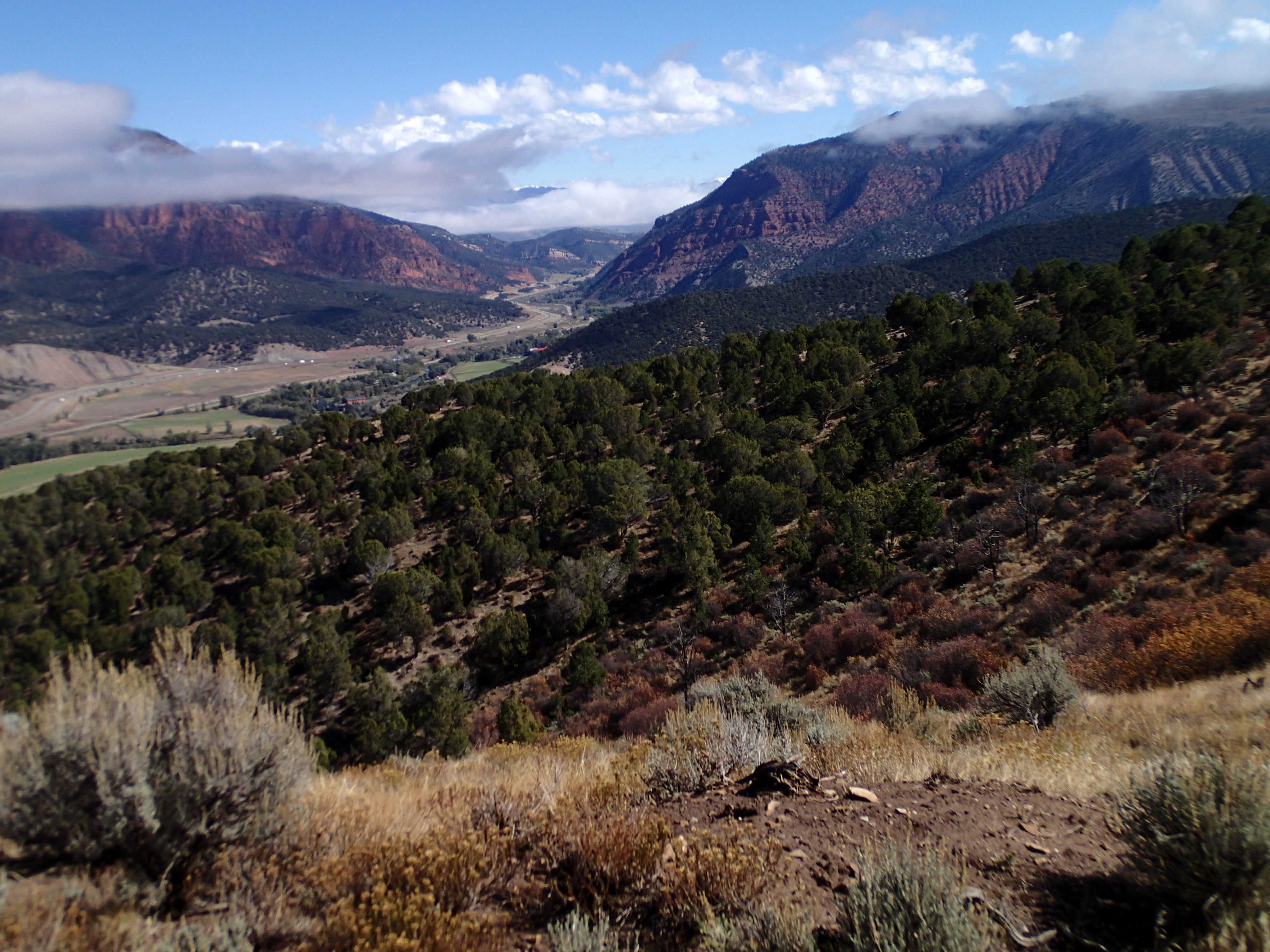
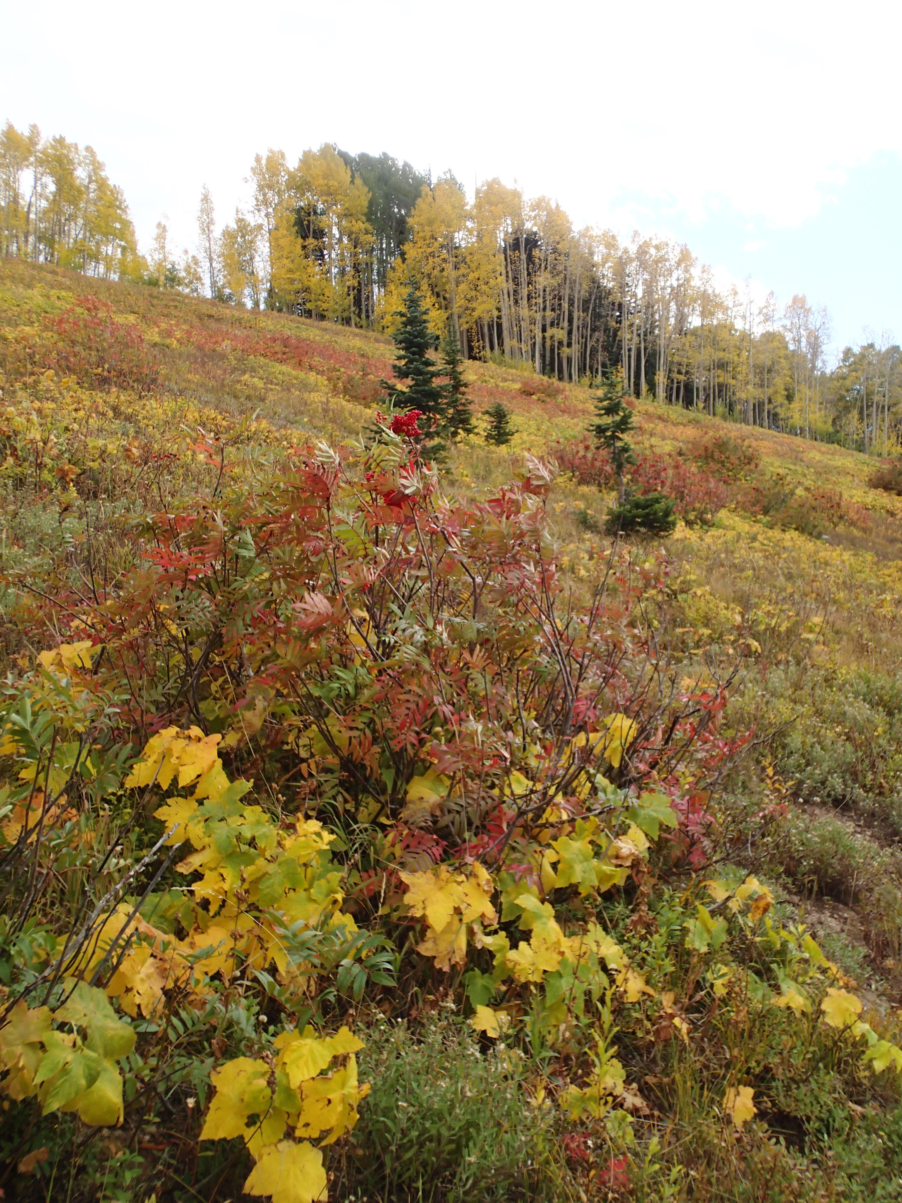
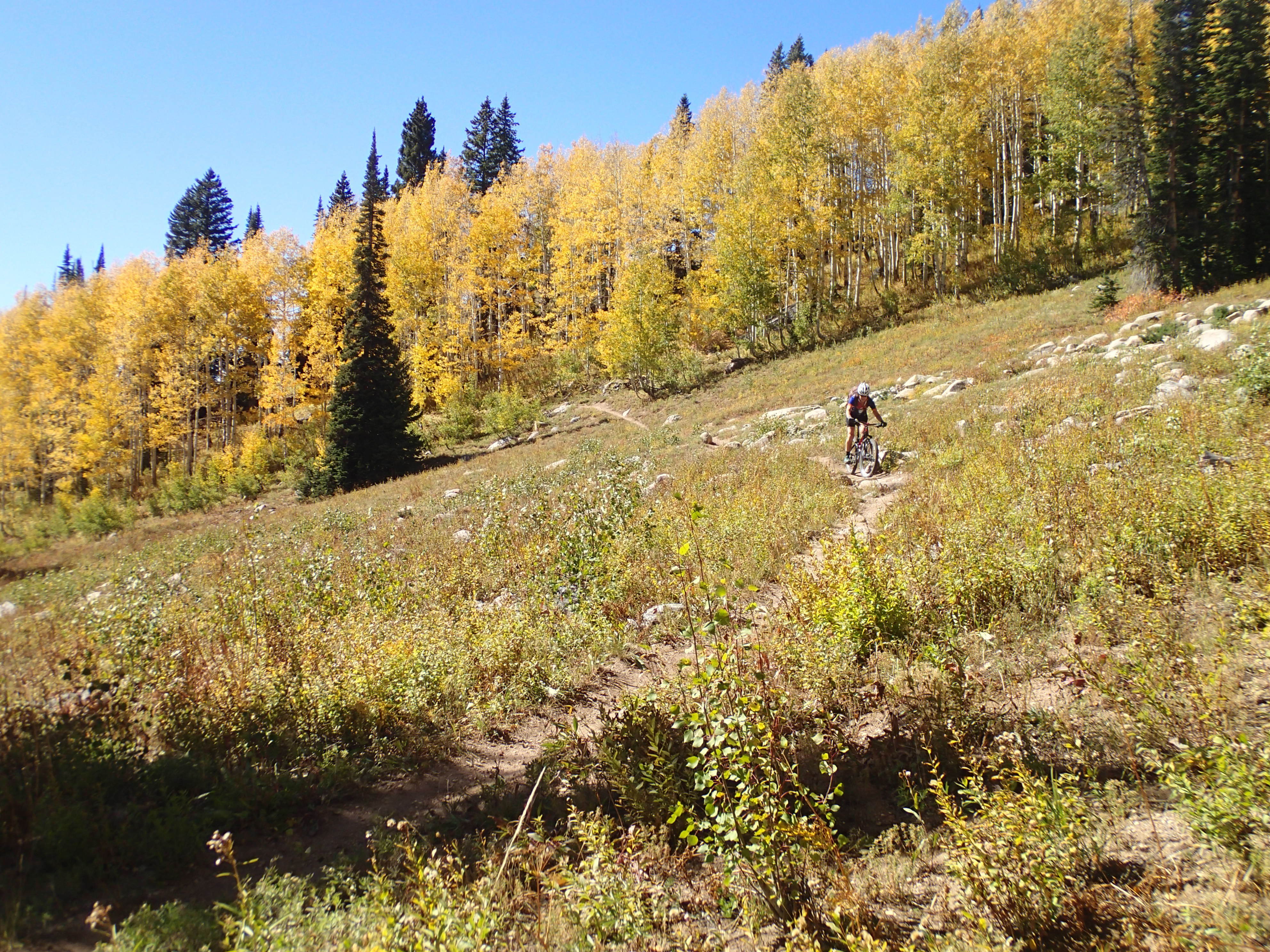
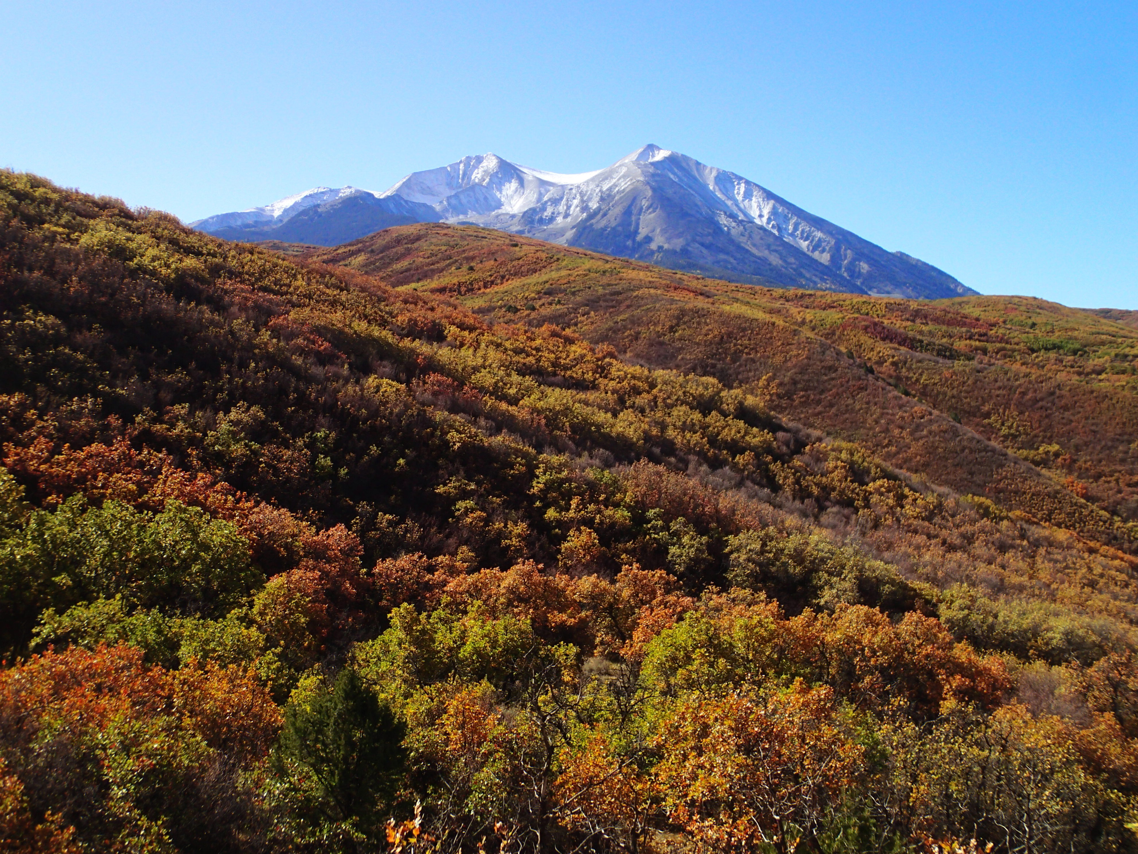
I had a choice to either ride a trail up and back or a rehabbed double track. I was looking for getting high for fall colors. I chose the double track that lead me to what’s left of the coal mining. Watched 2 cow persons and dogs move cattle. Dealt with the left overs on the trail. Weather is changing, clouds moving in. I rode a ways up then bailed for the downhill. Color was way up. Aspen drop their leaves shortly after turning and are blown down quickly.

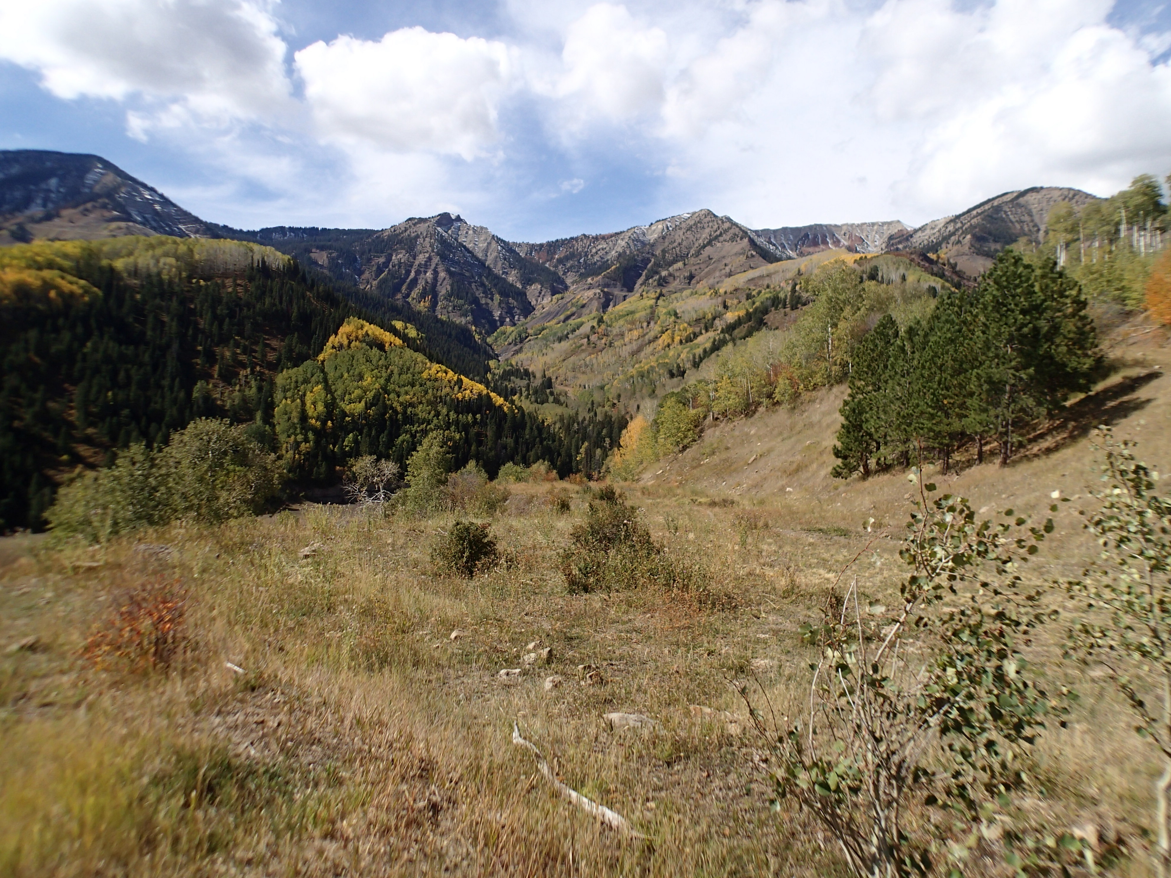
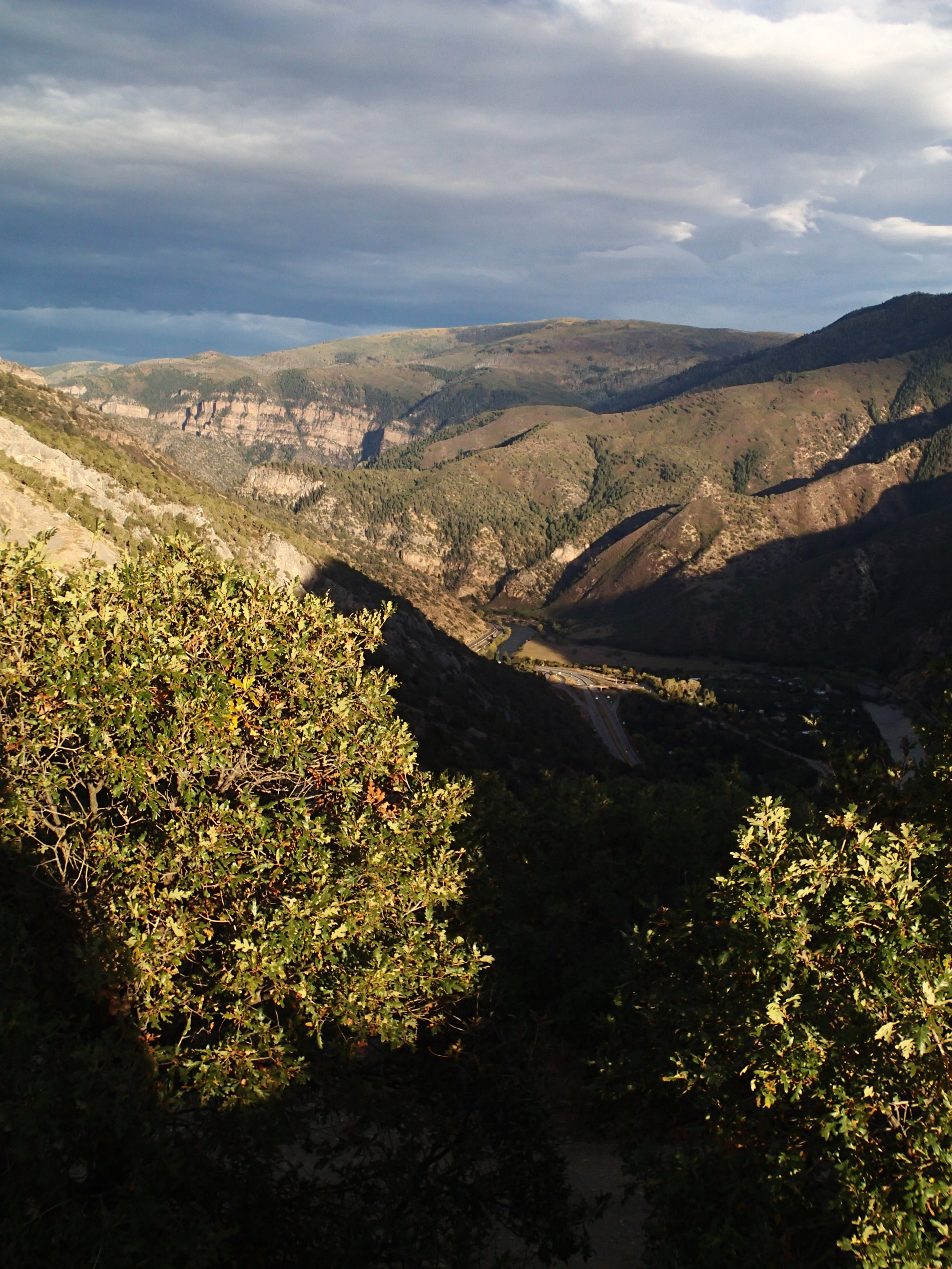
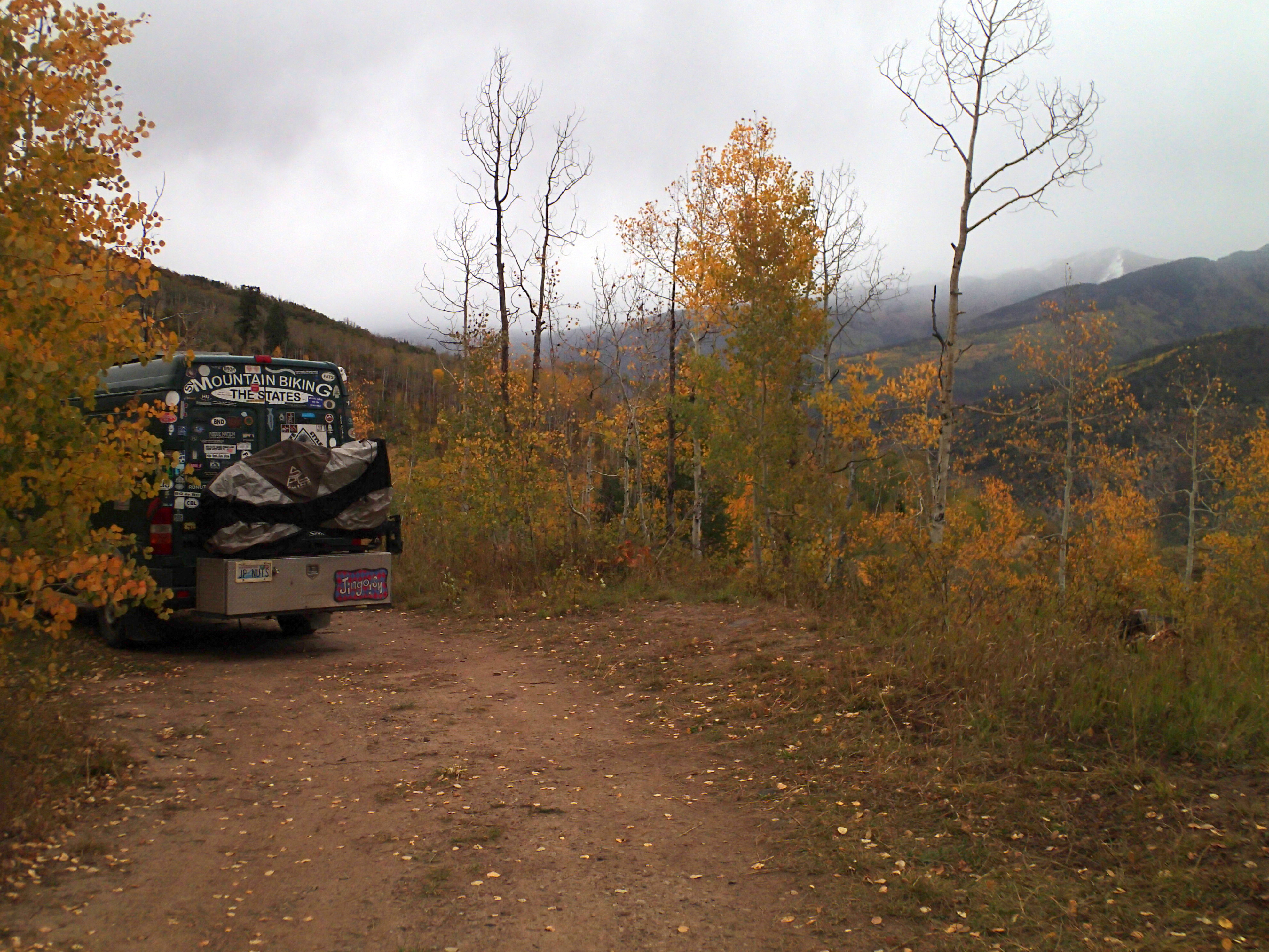
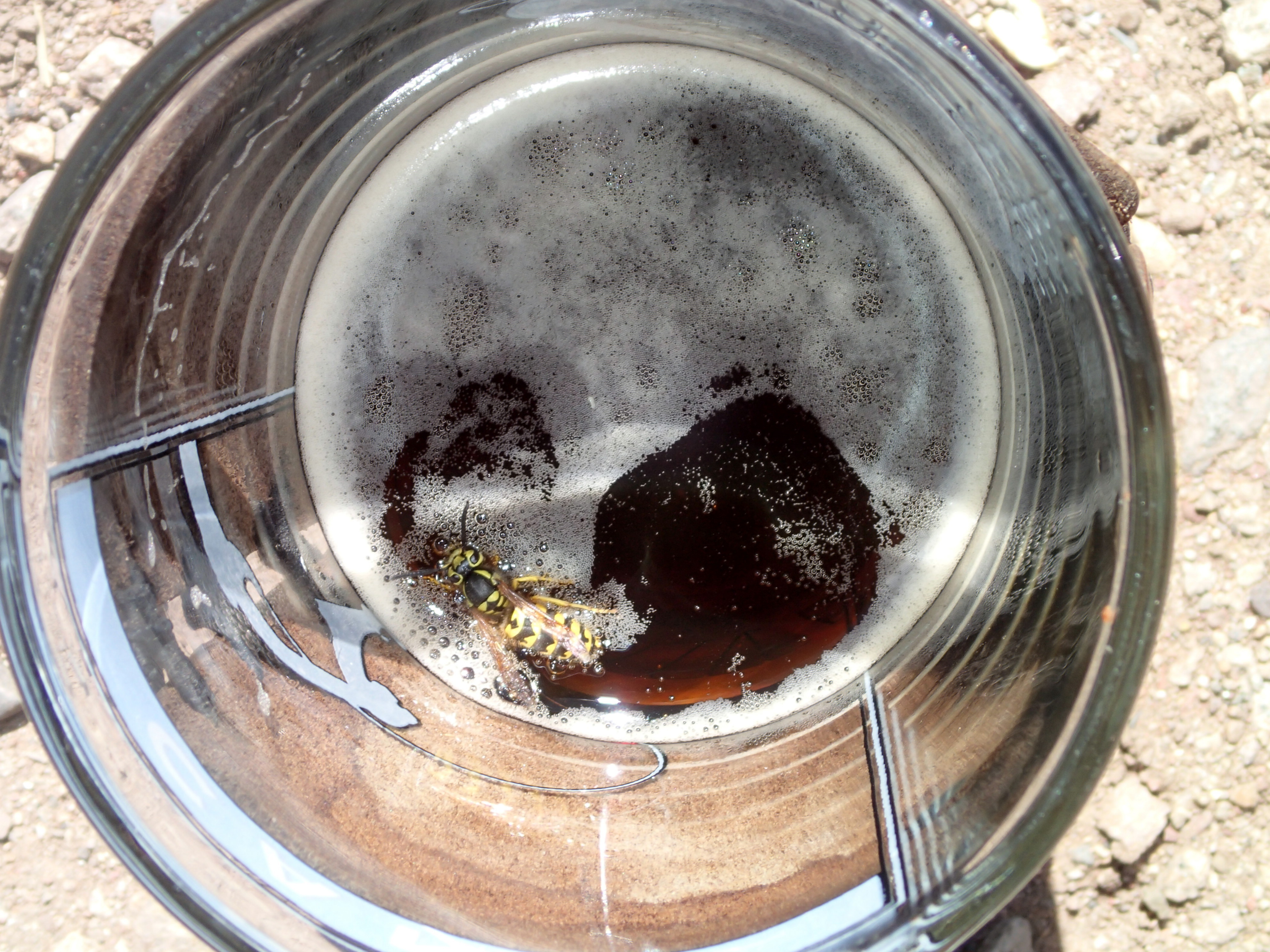
I toured a bit of the historical exhibits in Redstone. I decided to drive over the pass heading towards Gunnison. A rough road left the pass for perhaps a camp spot at the pass. I walked out a ways looking for a spot while assessing the road. Could have gone further looking but driving on this rough road was more than I wanted to beat my van on. I checked out a spur right off the pass. Rig was parked in the best spot. I took the next best spot within BB gun distance. I hung my empty beer can on a branch then shot it full of holes with BBs. Snow is falling up higher.

McClure pass

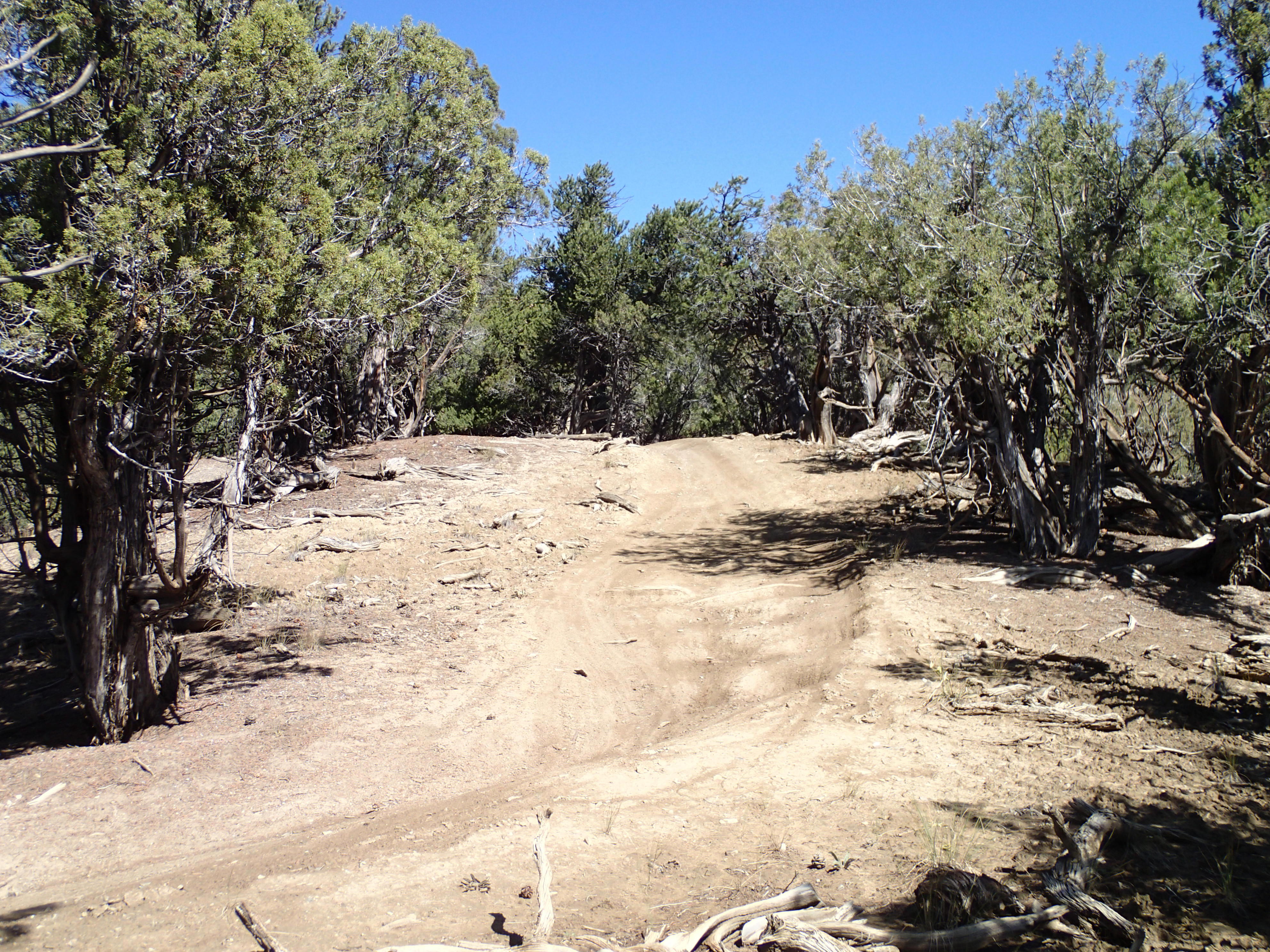
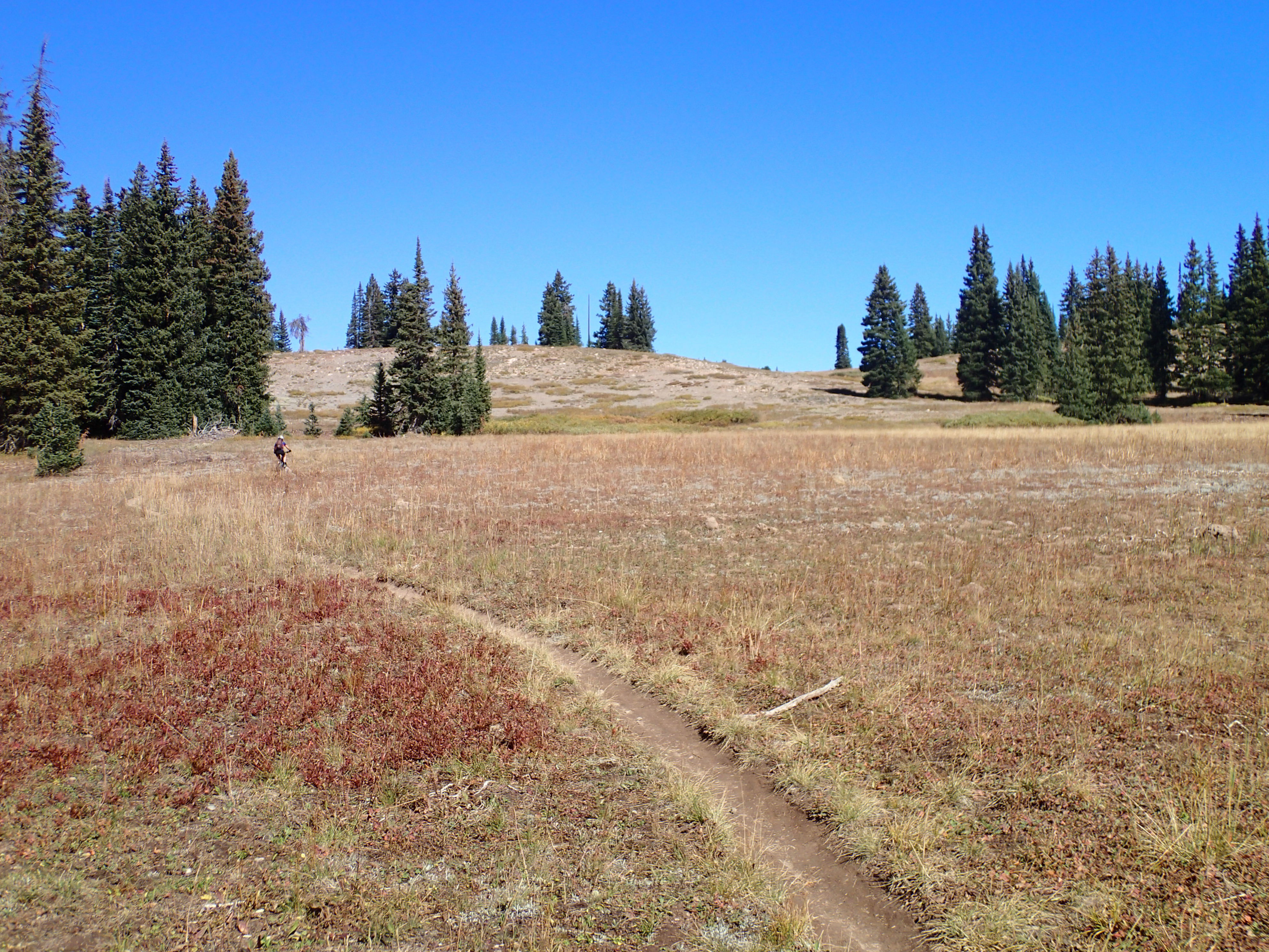
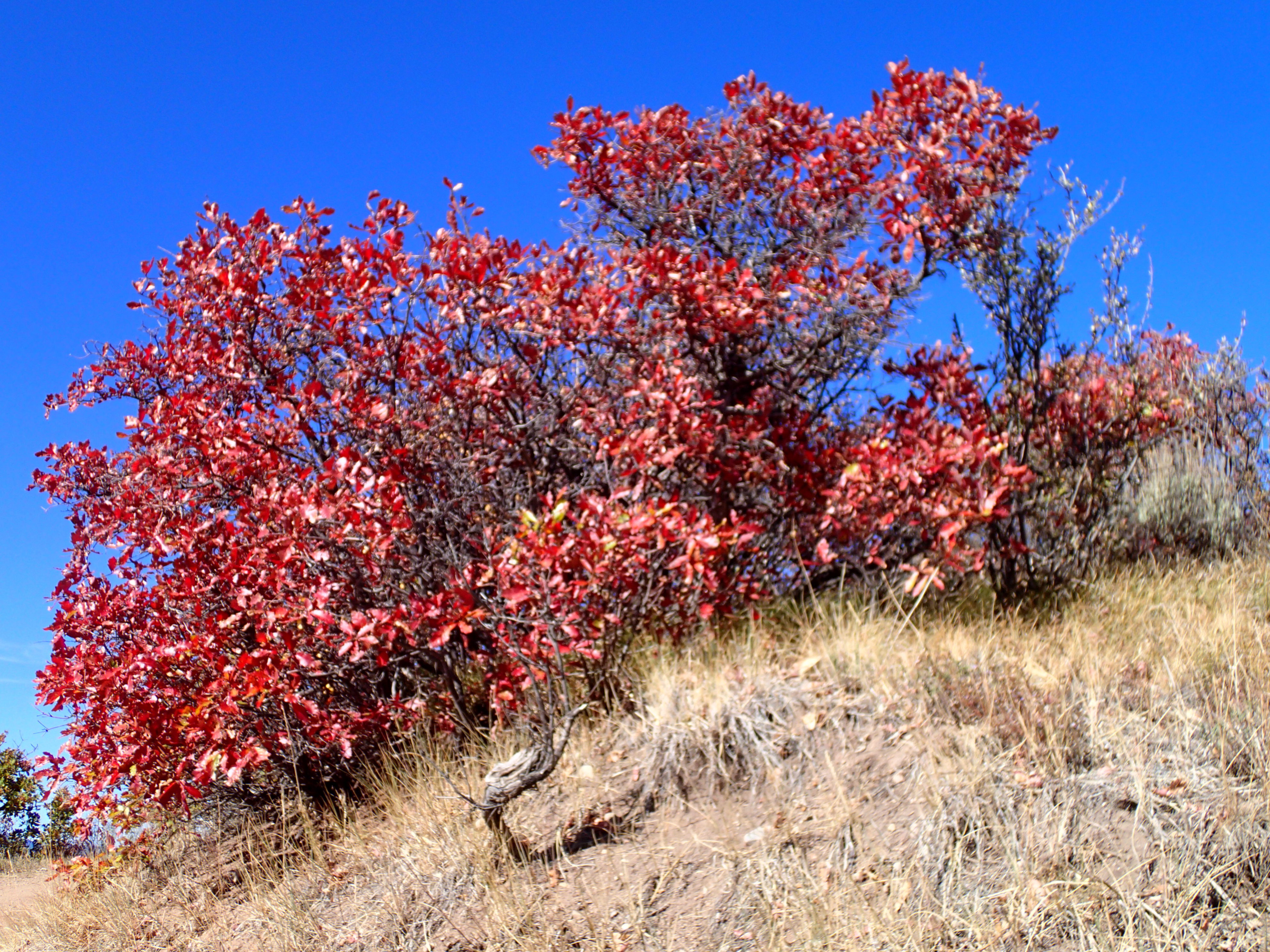
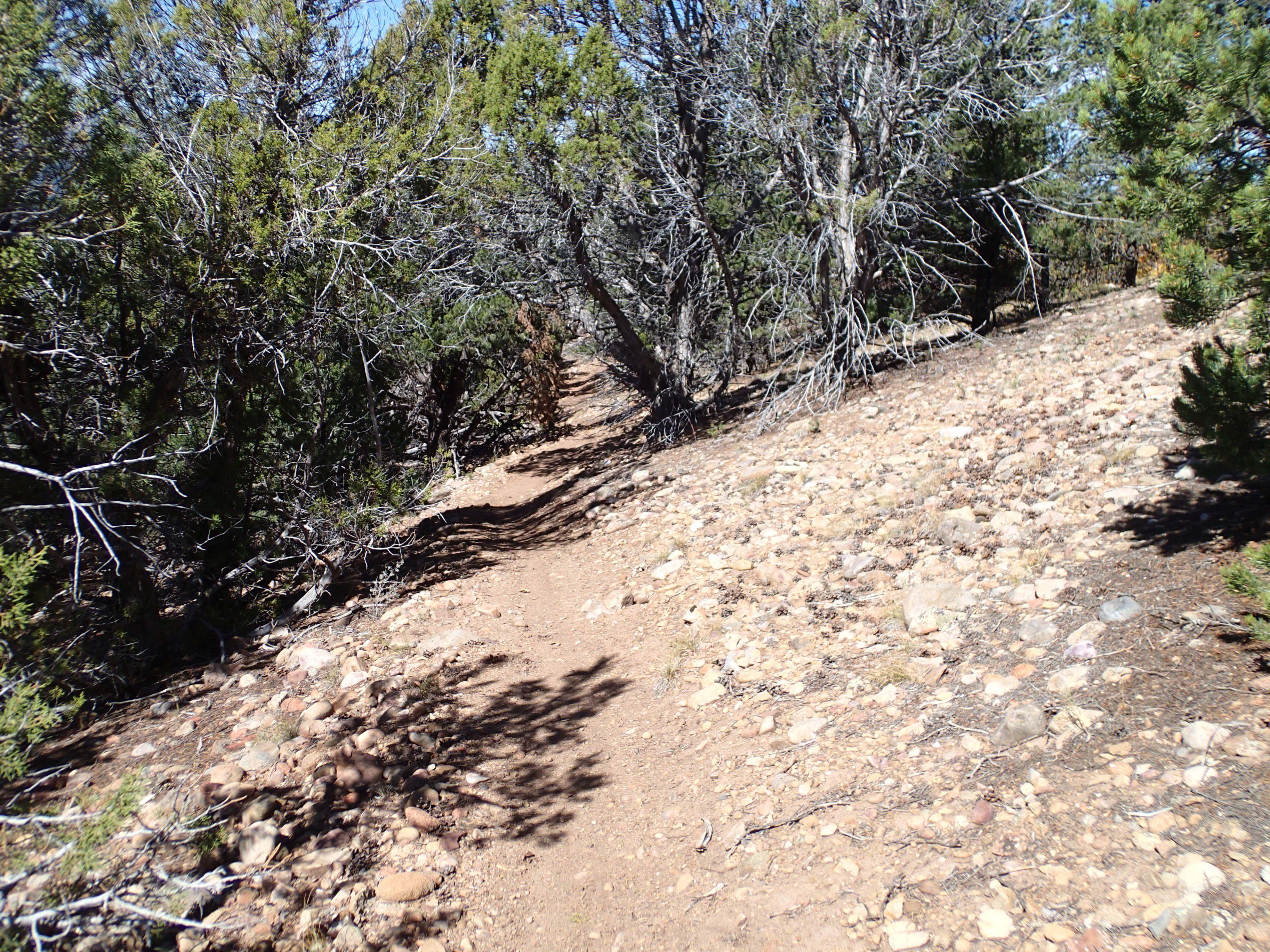
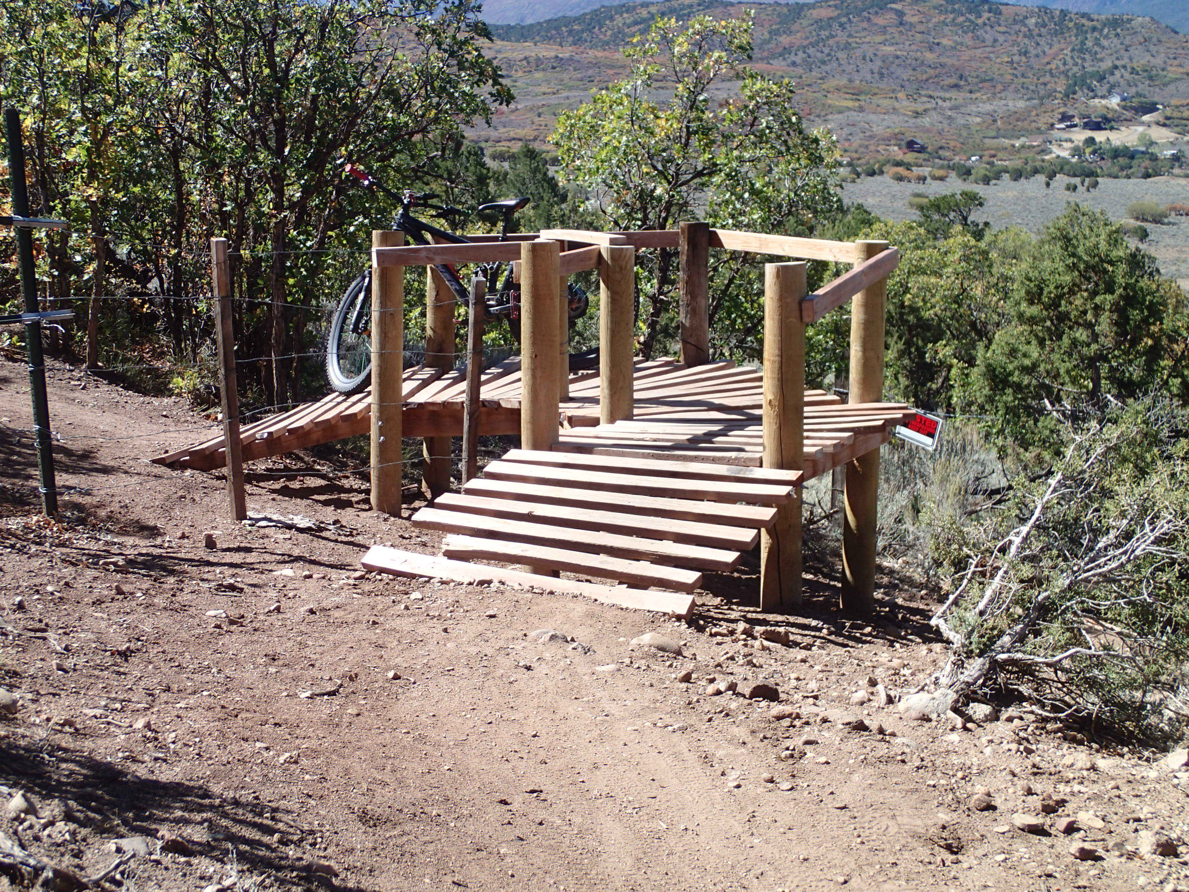
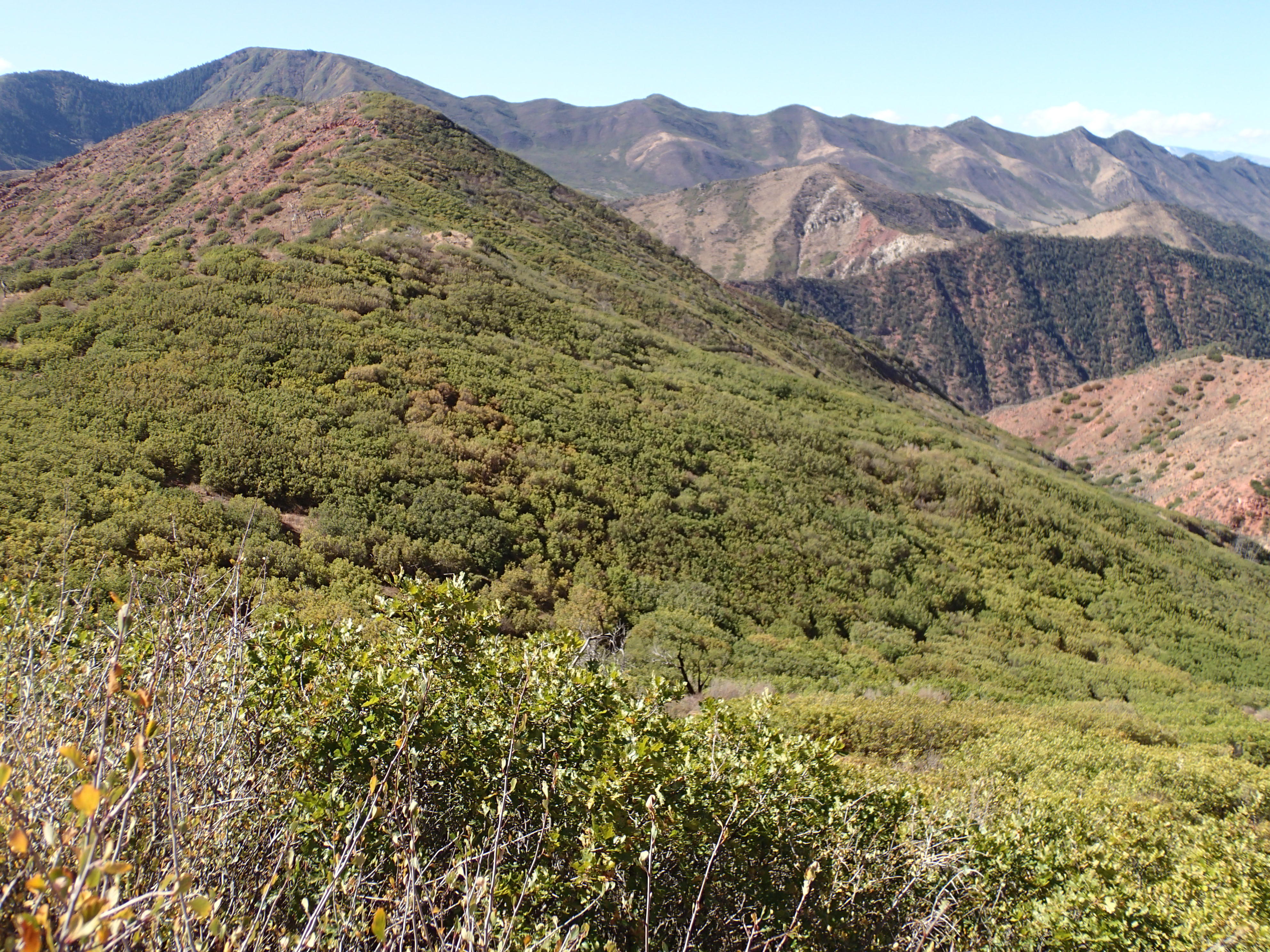
Wed I rode Prince Creek trails from where I was parked. I rode up resource extraction roads to the top of the “Crown”. I planned my ride using MTBProject in the resting position (sitting), it would go. However, with most plans my eyes were bigger than my body’s commitment.  I dropped off the high point. The first lots of elevation drop was on an eroded jeep track over a pavement of loose rolling rocks. Look where I want to go, drop the seat, and squat. Slither and slide. I did walk a steep piece that was like riding on marbles the size of an Idaho baker. Then the single track took off. What a hoot: very tight trees and sage brush, steep outslope, and several g outs in and out of a gulley. I smacked my knuckles several times on branches were hidden. Could have used protective bar ends like I saw the guys from Victor rocking. I left miles unridden for another visit. I enjoyed my solitary ride. I passed some blazing red Gambel oak leaves.  However, I was parked on a major trail that numerous riders rolled by. I greeted them.

MT Sopris
Gambel color
innie or outie trail
fence crossing solution
fall hazard, check b4 sipping

2.5 miles of stutter bump road ended at pavement for the finish back to C-dale. My plan was to camp at city campground outside of town then ride the trail system right near there. I was parked and a young man pedaled up and greeted me saying he read about me and wanted to say hello. I did also. I asked about the trail system. He said it was pretty burley, perhaps more than I wanted. The XG was full. Silver and Fit scored a shower at local rec center. Nice condition downtown. I didn’t dally in town as I wanted to score a spot in heavily used Redstone FS XG. The non electric side was empty and the water was turned off in the showers. $30 a night reduced 50% with my old person’s pass to $15. Still, most expensive FS XG ever.

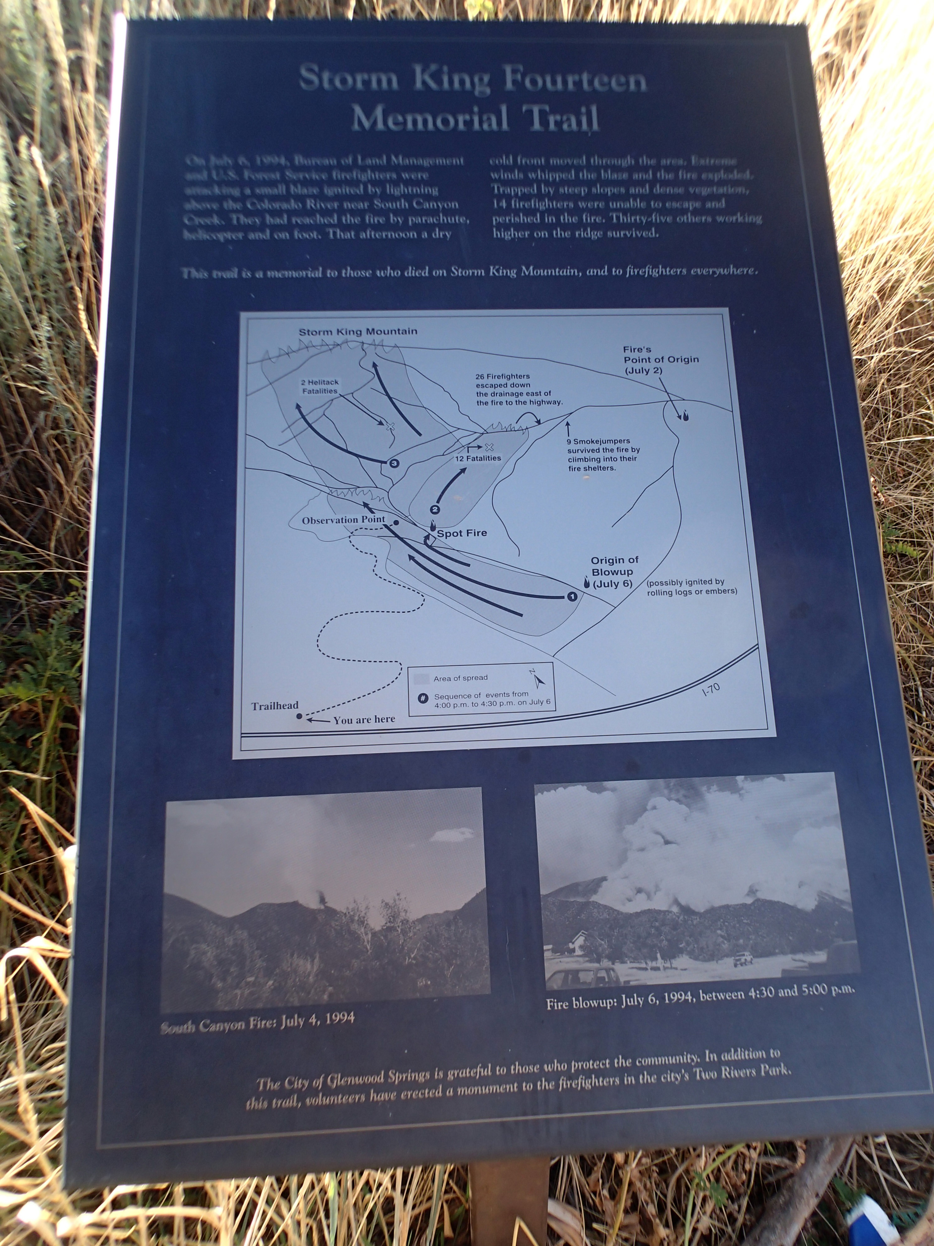
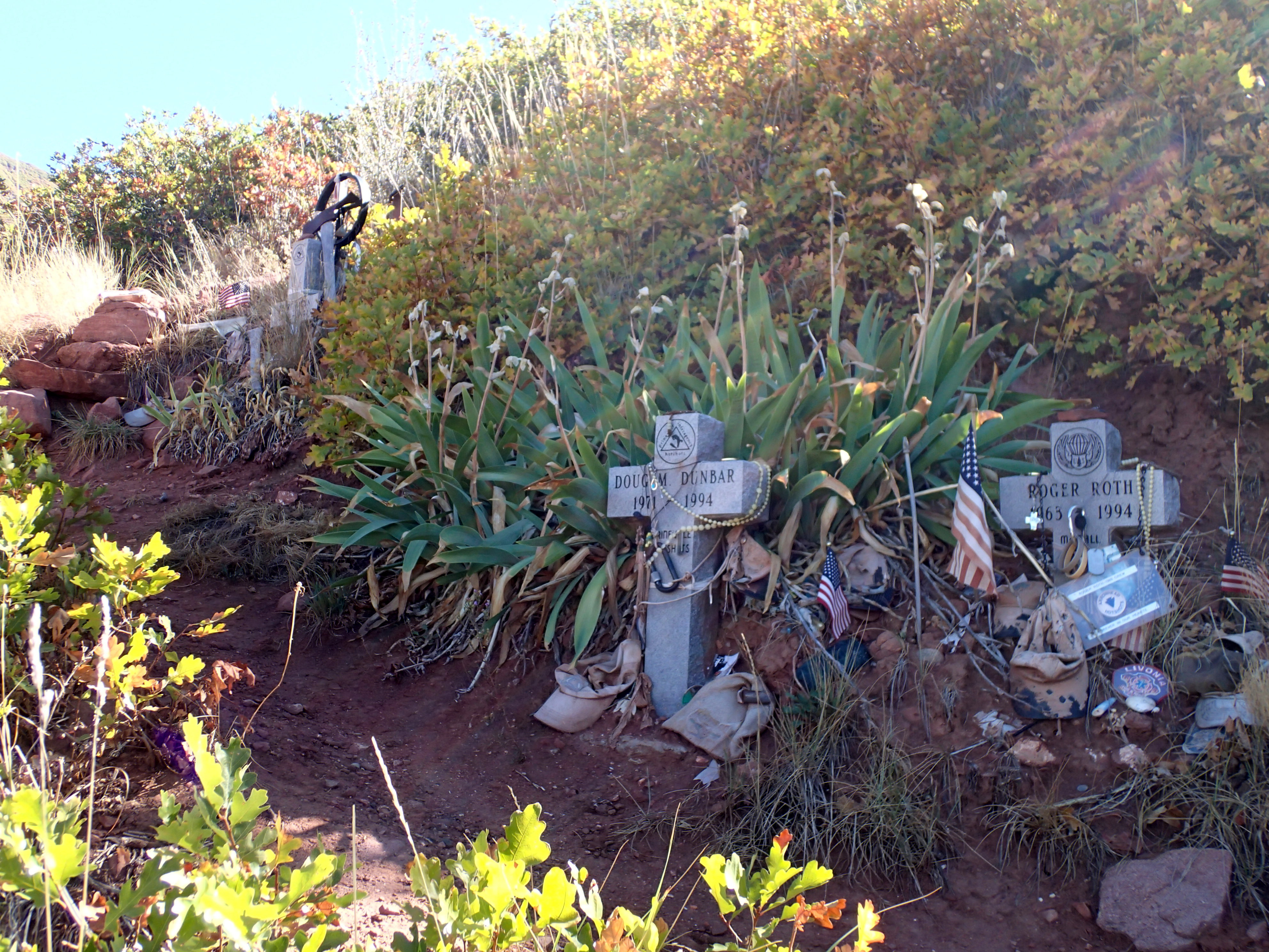
Monday I hiked the Memorial trail for the firefighters that died on Storm King. The fire is actually named South Canyon which is on the mountain. Rough strenuous trail up to the makers where each fighter died. They were almost to the ridge, so close. Down at parking lot plaques tell about each person. There were some really accomplished people. 9 Hot Shots from Prineville, 3 jumpers, and 2 helitack died. Their fire trail is still visible. July 6, 1994.


H1 on peak, they were caught almost at ridge and descent safety, fire trail is there

I checked Bend’s weather forecast which shows sunny skies. Air quality is mostly green, No rain. Extreme fire danger, only stoves that can be shut off with a valve are allowed. I have been in fires allowed wet CO. I still harbor behavior for extreme fire danger.

Next up is prolly Gunnison

Now in Gunnison doing back on schedule Thurs wash.

Rained during the night, temp stayed above freezing but snow fell above. Did bfast thing then scoped out the backup line I had to stick to. Backed thru the tight stuff then came upon 2 LEOs and a fish and game truck and a bunch of private trucks. No one was around to explain the gathering of the law.

RT 133 dropped down off the pass down to Hotchkiss where I took rt 82,  new road to my collection of roads driven. Made Gunnison. Doing my wash then will check out Hartman Rocks. Dave Weins of IMBA etc lives here. I am visiting.

Snow up high, will learn of Crested Butte and Monarch crest trails.

Eagle

Name of a town in Colorado. Rolled into town from Steamboat on twisty, up and down, narrow state highways. I drive a facial tissue box strapped to a roller skate vehicle that requires constant correction to keep between the lines. Drove thru rain showers. Drove to Charlie Browns bike shop to visit. Namesake was off. Visited with Graham. Learned there is a band playing in Eagle Ranch. Didn’t register. I sought a brew pub that was just outside the fence for the band playing for a festival. Instrumental brass and reeds members dressed as marching band. Two women choreographed their gymnastic moves, just amazing athletes. One of about a handfull of cowboy hat wearers. I drank a beer from the brew pub named Charlie Brown, I asked the history, yep, bike shop Charlie. I learned of a sleeping spot out at the fairgrounds which met my criteria for a level quasi legal sleep spot. Chilly.

back outside of Driggs I passed by a perched bald eagle almost every day I drove by. No eagles seen in Eagle

Rain quit late afternoon. I was told dirt dries out pretty quickly and the trails have been dry. I picked Pool and Ice rink ride that new houses butt up against the BLM land. Rode a connector named, yep, you guessed. trail climbed up Boneyard topping out 7697′.  Thin air, climbing, and effects of aging just beat me on the climb. The downhill was less taxing.

ice and pool trail above eagle
east
downhill, juniper, pinon, and sage

I found then loaded a mapping and property ownership app that I have been using to learn of where public land is. Satellite view zoom in.

My next stop was to be Carbondale going thru Glenwood Springs. The interstate exit is undergoing complete reconstruction requiring closure. Next exit is detour. Back into town, I can’t find the bridge across the Colorado to go to Carbondale. I gave up finding the way across the river. Previously using this new app I found BLM land above Glenwood. Steep well smoothed out gravel road brought me to a parking area used by motorized crowd. I am over 2,000′ above the valley floor. Have 4G 4bar service.


Storm King mountain and the namesake fire is next exit west. Firefighters from Prineville, OR Hot Shot crew died on the fire back in 1994. Storm King trail at Bend is named in honor of their deaths. Prolly hike the trail to the memorial.

On Going

Now from rainy Eagle, CO. I drove here from Stagecoach CO state parks XG. I chose a spot well above the lake, on a bluff and pointed my van into the wind. And wind came up hitting me head on. I aimed my wind gauge and saw gusts to 25. Later that early evening more guts, this time way stronger but I chose to remain secure inside. A couple was tent camped nearby where their tent was pitched in the wind shadow of their suv, still their tent whipped around. Then quiet then rain fell. Nice being able to modify my environment.

I have stepped up into my van and hit my head big time maybe 3 times on the lowered cutting board. I have several scabbing cuts on my scalp and my head hurts because of my mashed neck. A chiro adjustment is necessary.

Pick up a bit about Steamboat.

Monday night Cathy and I spent camped above full Dry Lake XG on that steep short nasty uphill to our camp spot. We figured out a ride for the next day. Tuesday we pedaled up the Buffalo Pass road until we caught a cut in to Touch of Gold which is a newly built greener trail going down to Spring Creek TH. Trail is mostly machine built with a hard packed tread. Several places hand built was the method where rocks and roots were skimmed over. In time dirt will erode which appears to “raise” the chunder. Went thru turning aspens. Pretty cool. We studied the trails to make a loop which went around Dry Lake,

bull of the dry lake

Our uphill return was on BTR which from a profile standpoint appeared doable. We learned that it is primarily a downhill trail, we hiked a bike quite a lot. No conflict with the few downhill riders we encountered. We broke out picking up Touch of Gold to ride down to the cut in. Beautiful fall colors. Cathy learned that her rear brake was not doing its job.


We made it back to our camp spot. After changing clothes we sat outside enjoying sun breaks until warmth left. Just before bed time rain started spitting. A bit later it changed to snow which dropped over 2″ of fresh wet snow. By morning most had melted because the ground was above freezing. Still we were faced with what could have been a treacherous descent down the social rough trail. Cathy went first, she was able to lock her brakes and sneak down avoiding a close clearance between 2 aspens. My turn and the misbehaving ABS brakes. The first push on the brake pedal broke the wheels loose causing the ABS to kick in and I lost control of the brakes. I bounced down and missed the same trees. Once on the road the brakes worked.

We created a ride plan. We drove down to Dry Lake XG looking for an empty site. A guy flagged Cathy down telling her he was leaving giving us our empty spot. He cut and stashed a good fires worth of wood under the table. Cathy called Wheels shop and scored an early morning brake bleed and I was hoping for a shifter cable and housing replacement as my shifting was not performing. Cathy’s brake issue was just a bleed. The wrench checked my bike out determining the shifting issue was caused by teh cable and housing which he replaced.

Both bikes in happy mode we drove over to the local trails on the ski hill above town. Cathy did the navigation for a climb up a ways then a descent down NPR which stands for no pedaling required, a blue downhill trail with berms and tabletops.Nice weather and a short fun ride.

Cathy broke out a bottle of Tequila, the same kind that Tom put my pic on the label. A shot a piece at our vans. Our plan was working: bikes fixed, a saved campsite, and a plan for tomorrows big ride. We drove up to our saved spot. Cathy wanted a fire, I avoid smoke. I gathered tinder and laid a fire with my goal of starting it with 1 match. At fire time 1 lit sliver was all required to start. We sat around the fire drinking corn and Tequila.

Plan on Thurs was to drive down to repair garage for brake service on my van then pile into Cathy’s van and drive up to Rabbit Ears Pass for our ride ending back down at Steamboat ski base. Forecast was for gusty winds and chilly. We selected a camp site for her van then pedaled away.

My EDGE crapped out just after the start thus not gathering ride data. I used Backcountry Navigator just to track the ride. The software said we rode 16 miles of wonderful heart propelled trail skirting several lakes and numerous rock gardens until we hit the ski areas boundary and big downhill.

just gorgeous.

For the most part the trees blocked the wind until we left cover then wind added to making moves.

We hit the ski area boundary and a different fun took over. We followed MTBP route which kept us on the cross country downhill trails. What a hoot downhill single track not bermed.

The garage called me while I was huffing up a climb. They found that my brakes were OK and the filters will be installed tomorrow.

We realized that [perhaps more energy would be needed to pedal across town to pick up my van for our shuttle back up to the pass. I called the garage and made a shuttle arrangement. We walked out of the base village and there was Johnny pulling in.

The climb up to the pass is around 2500′ climb. Back at the XG our alcohol consumption was less as I suffered from last nights libations. Nice sitting facing the sun until it went below the trees. Chilly night with van shaking gusts.

Yesterday I drove back down the pass to the garage for the filters install. On the way down the pass the brake light came on. I drove to the shop and showed them what was up. They determined that the front wheel sensors were toasted which was sending hte signal in spite of good pad life.

I did my wash one day late.

Cathy split for her road trip. I drove out to Stagecoach CO state park for the night.

Today I drove down to Eagle to where I am now hunkered down from the rain. Dirt here has clay which will need drying out to ride and even to drive to a camp spot above town.

I am skipping wet Eagle for Carbondale.

Rabbit Ears Pass: back in 1978 I was returning to Ohio after my PCT hike. I gave a ride to my hiking buddy to Steamboat where he had lived. I was driving my 1972 air cooled VW van. I made the top of the pass then on the downhill east side the engine quit. I was nowhere near repair help so I coasted down and down. Coming into a town an uphill grade ran out of helpful gravity. I walked into town stopping at the city hall and asked foe help. A city employee attached a chain to my front in and pulled me to a repair garage up a steep hill. I asked for help. Guy said he would check one thing and if that worked I was gone, if not, big wait. Turns out it was a broken points thing and I was back on the road.

More tree researched revealed that reds here are caused by a scrub oak of which the name applies to many different oaks. Gambel Oak is scrub but usually grows to 15 -20′ and turns red. I saw just a few that had turned red.

Anyway off to deal with wetness.