Herding Cats

Or managing users. You can build the trail but users have say so as they establish lines. Managing users to ride the built trail.

Last night I remained stationary while rigs passed me going further out. Daylight revealed the sprawl. Nobody came to visit me, old codger.

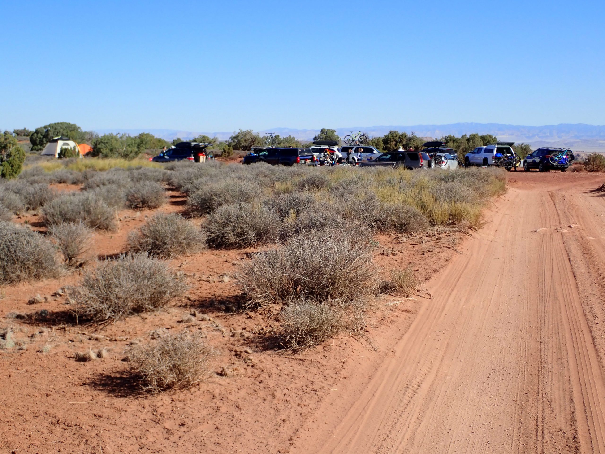
I planned a big ride for today, similar to one Steve set us on once. I rode from camp past the gathering at the flat spot.

Big gathering of young people at flat spot

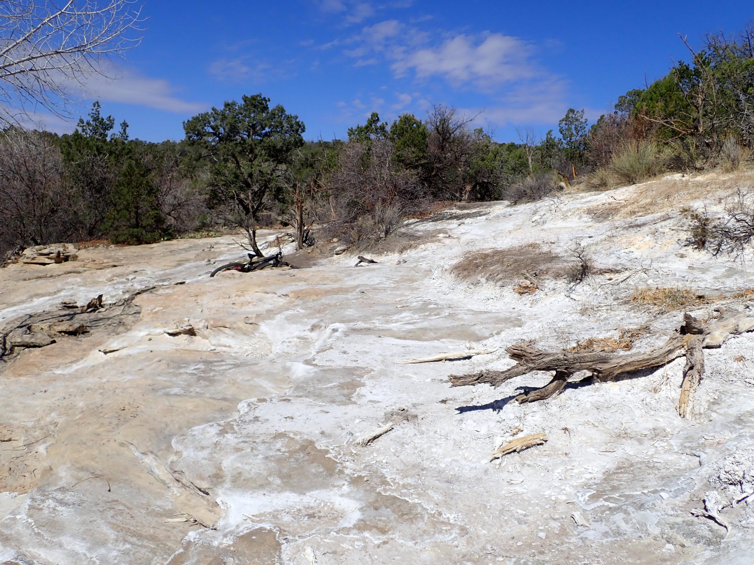
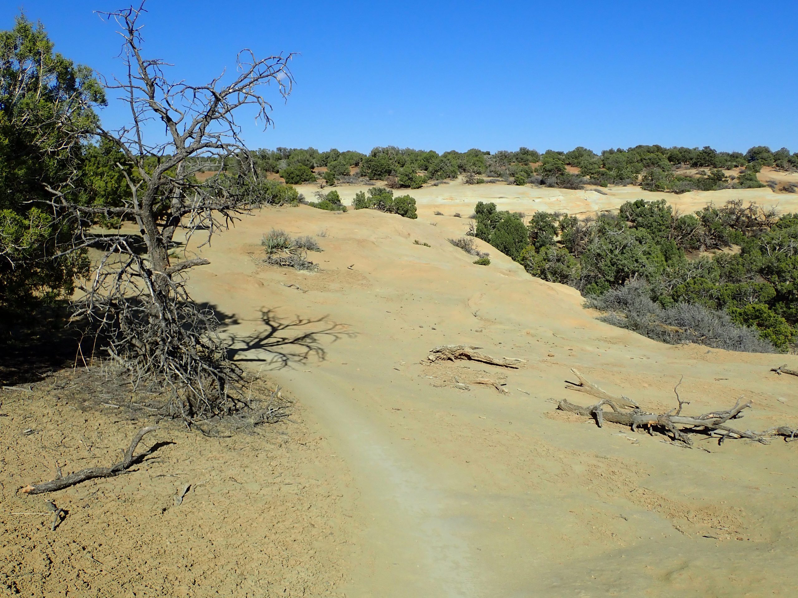
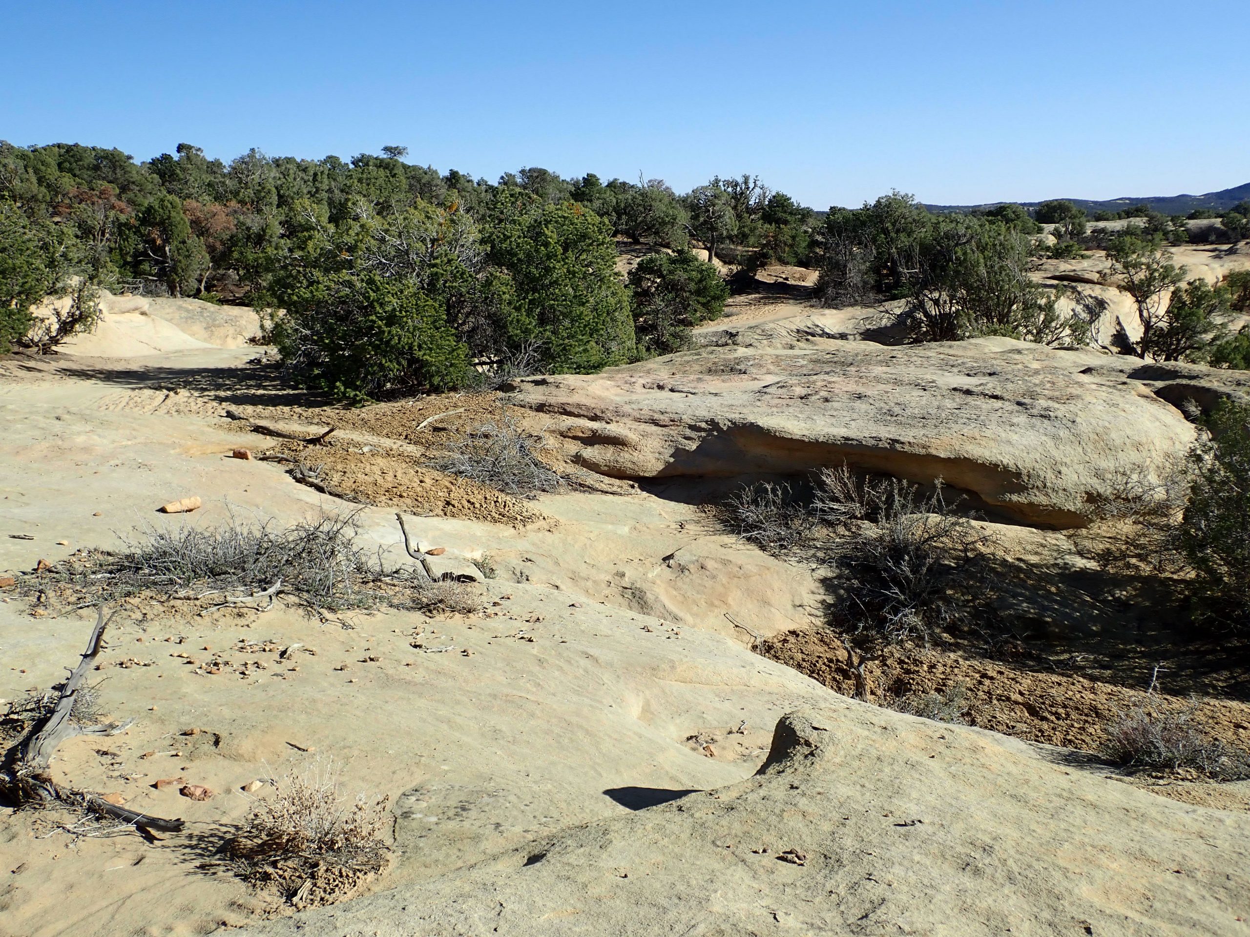
A bit of major traffic dirt road riding to pick up sandy Lasso trail skirting the new group campsites then  Chisholm to end at Big Lonely then turning right which somewhere along the way it changes names to Coney Island. I prefer riding this part of Navajo Rocks system in this direction because it is mostly downhill and present conditions are the sand is loose. Coasting is better than pedaling against gravity and high rolling resistance. Past Middle Earth to junction with 7 Up and start of the climb out. Several ride length choices were presented in the Horsethief system. I vacillated how much work I wanted to undertake. I took the Mama Bear choice and climbed Hidalgo. Lengthier ride choice was made to ride Mustang the longer way around to connect with start of Chisholm back to Lasso then pedal the road back. 20 miles climbing 1437′ pedaling for 2 hrs 43 mins under clear skies and mid 60s. Pleasant conditions. Many riders on Coney Island trail. Average heart rate is below anaerobic threshold. Average speed is still in the 7’s.

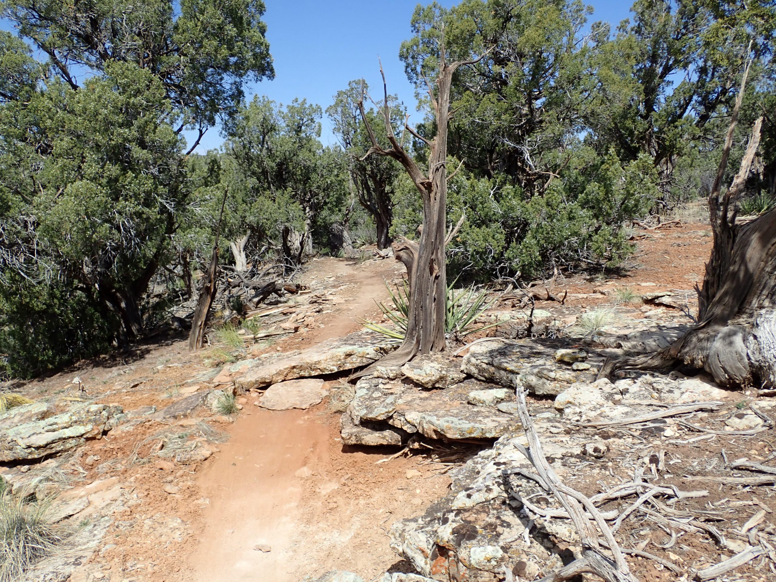
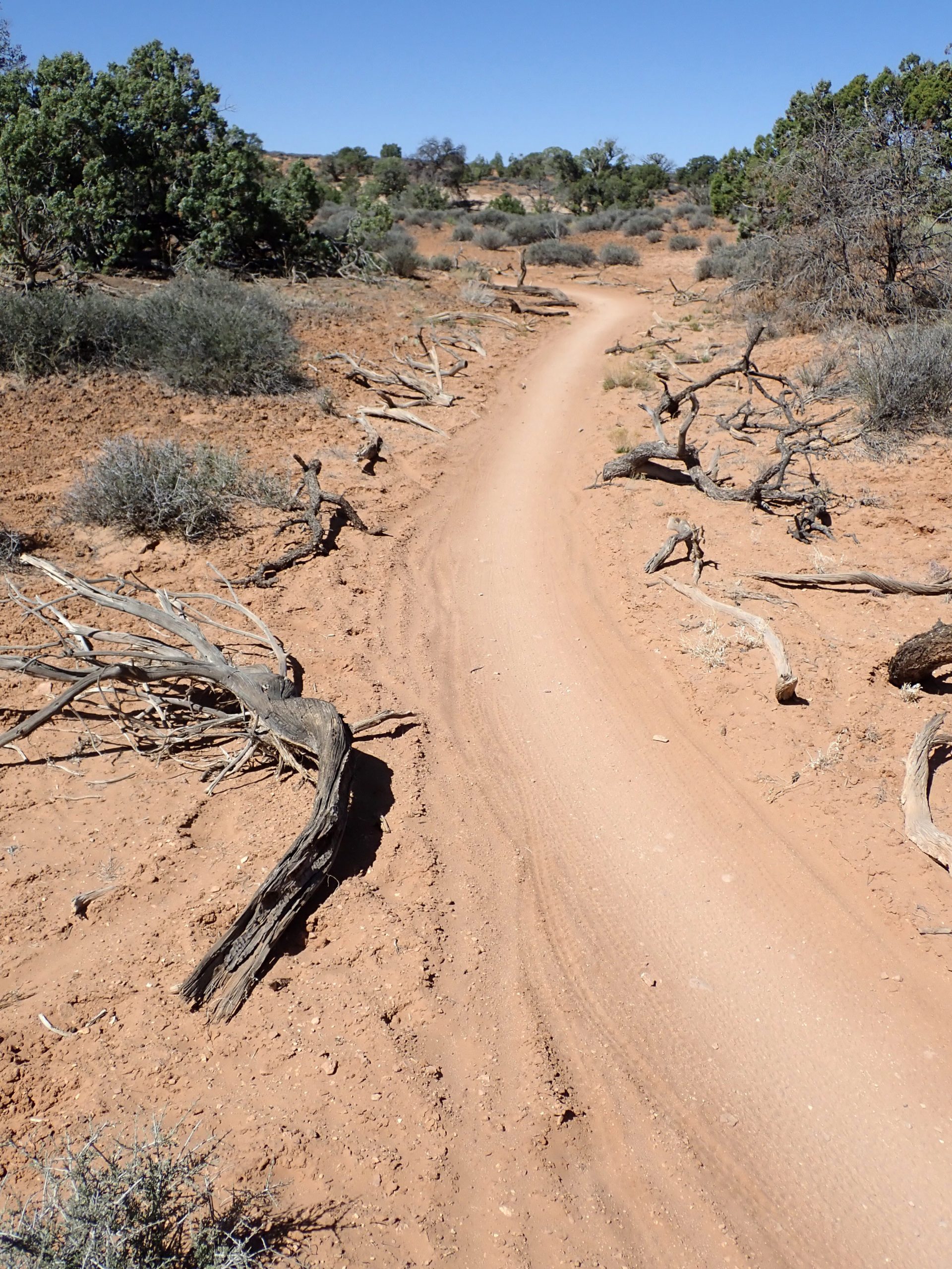
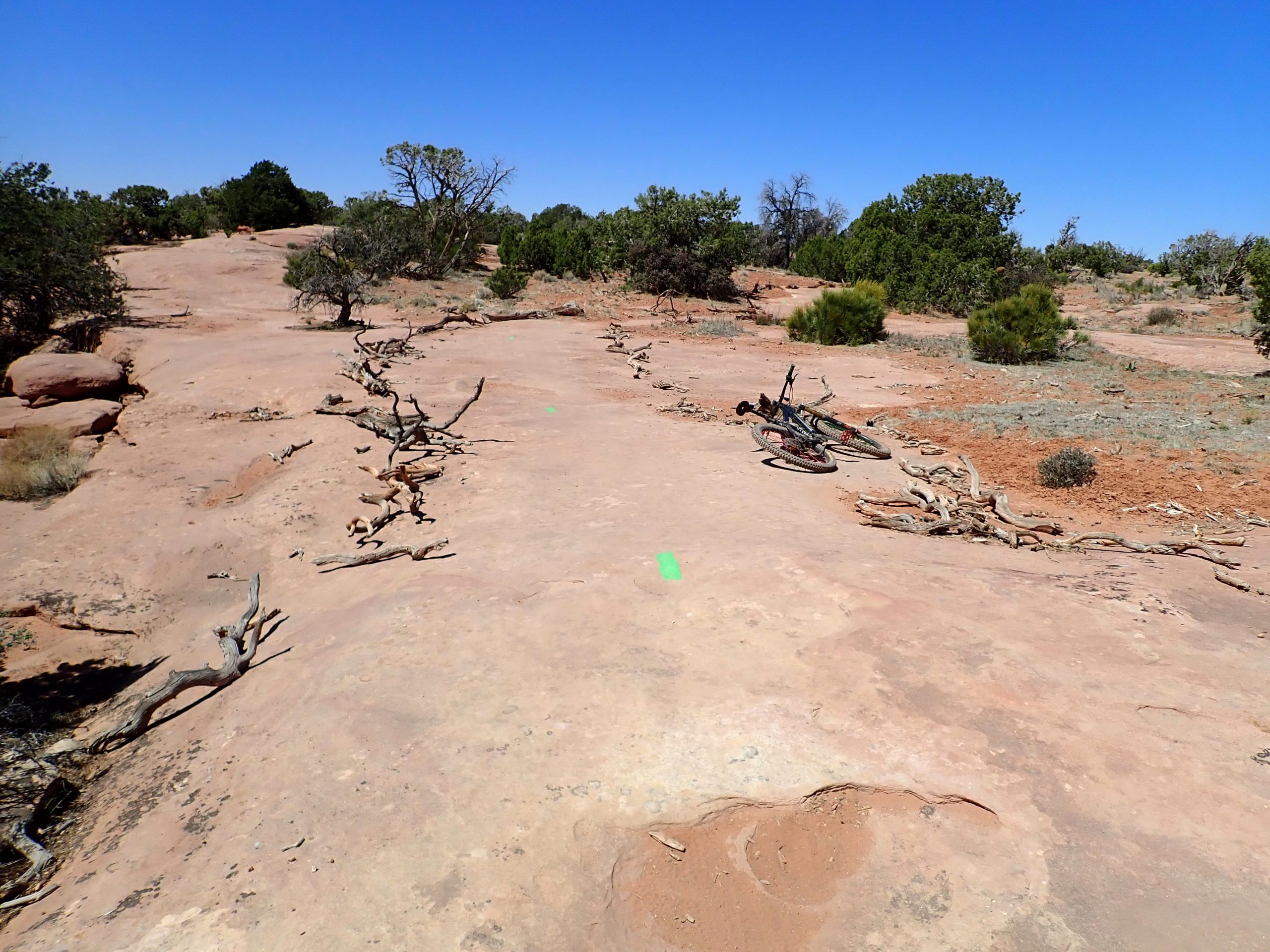
This about that on these trails. SAND and it is loose and grabby, particle sizes are smaller than Sedona which offered better resistance. This loose stuff will suck your steering front wheel, Turning is a mix of steering and carving. I have not dialed my confidence reflexes to push the turns. trail corridor does a good job of routing us on slick rock which is faster. Awareness lights switched on as I paid attention to the placement of dead wood pieces lining both sides of the trails.

portable guide structures

When in doubt: belt and suspenders:

keep it narrow

My table top thru use wore off the protective varnish coating. I put off applying the required new coat. I bought the brush, sanding block, and varnish back in Sedona. I put the stuff in the JOBOX where I could not see it. I made excuses numerous times to not do it. This morning I got after it before I pedaled away and now the table top is shiny. I figured that my ride would be long enough for the varnish to dry which it did. I turned on the exhaust fan to evacuate the curing vapors.

And of vapors. During my ride a large insect landed on the left side of my head below helmet line. I was not concerned that it was a stinging bug. It was tangled in my hair. After a bit I swatted at it blindly. It emitted a nasty smell. Down the way I stopped and took off my helmet and ran my fingers thru my hair expecting to strain out the squashed remains but came away clean. I wiped down those hairs during post ride clean up.

So my van is like a delivery truck with a harsh ride. Because the suspension doesn’t take the jarring out  I drive slowly when off road. Parked where I am I watch like trucks and SUVs drive by me going faster than I choose and creating a dust cloud. No slowing down when they go by other campers. I am courteous by default but they lack courtesy to be concerned of their impact.

Tomorrow I plan on leaving early and dash to town to resupply hoping to not get caught up in backup. But then the construction might not work on Sunday.

Remark: I have ridden 4 rides since leaving Sedona and I have not bled once.

Perhaps a reason for large number of people here is that weather is comfortable now. Temps are forecast lower 70s and upper 60s. Expect as temps rise people will move on.

Left too early

Diaz suspension services reconfigured my fork to add 10mm of travel which required a new RUNT. Back at his shop he explained some things he did to improve fork by loosening up some guts and changing oil out for something better. The result is a much plusher fork. Next ride will reveal the result.

Too early to be here in Durango in that the trails are drying out after winter and campground above town opens next month. No place to stay anyway. My plan then was to drive to Cortez and Phil’s World TH to stay there. Drove to the TH then looked for camping prohibition. Yep, saw the sign. I researched Trailforks online looking for land ownership, This TH is on state land. I selected another TH on Simon something. Drove to it which is on BLM land, again, same info. Next choice is Boggy Draw above Delores, a short drive away. Previously I camped there out past the TH. I arrived at TH, No camping signs at TH which I remember. **** the gate to the road was locked. Elevation was 7600′ and small patches of snow were still melting out. Closed gate protected the off road dirt tracks. I noticed that a wide flat shoulder on the right up against FS fence and adjoining rancher on the other leg of the rectangular beckoned me, it was not on FS land but county land and I was off the road. Met my need for a sleep spot. I decided that the trails would have patches of wet and should not be ridden. Too early here also. Ran the furnace all night, at wake up it was 31 degrees. Switched back to long pants and sleeves but still wearing Bedrock sandals.

Thurs was laundry day. Back to Cortez to a laundromat that I used previously. Clean clothes and wets drying on strung line across the back of my bed. I drove back to the Simon TH. Phil’s system has grown many more trail miles. Out here is new for me which is why I chose it. Nice trailhead. Trails here seem to be directional, turn left at every intersection and you would prolly ride the outer trails and finish back at TH. That’s what I did. Terrain and foliage is like Ridgeway trails of pinion pine and junipers. Trail names are all characters from Edward Abbey’s Monkey Wrench Gang book.

N Phil’s

I encountered a crew of people working on the trail and even the head BLM guy. We chatted about trails. Were we were talking I was standing on top of an armored climb between natural guide structures. I walked the piece as my breathing couldn’t keep up. I told him that this pitch will get slippery from dirt tracked up on the flat rocks used to armor. I told him about mixing in pitches for traction between pavers. He did not know about what I was telling him. He thanked me for sharing. The tread might not have enough dirt deep enough to dig in pitches,but he said he will consider pitches in other places. He does have IMBA’s trail book which has much stuff authored by Woody now in Bend. And the book shows what I talked about. Go Woody now of COTA.

There are spring outflows that are toxic to plant growth, one place the name is stinking springs.

bad water too toxic for tree growth

Enjoyable pedal trails with a few features used. Bike fork is more supple, less jarring after Anthony’s tune, that plus the new I9 front wheel. I pedaled 7.32 miles climbing 748′ in 1 hr. I arrived back at the van. There are more miles to ride between here and the original trails, midafternoon enough time to ride them, but I planned on being at Moab. I put the bike back on the van, cleaned up, then steered the van against stiff gusty winds to Moab.

In Moab I stopped at feed store for propane, clerk welcomed me back. Groceries at small store beside Chili Pepper bike shop where I bought their last pair of bright red Fox gloves replacing the same model I bought there at Thanksgiving. The worn pair had numerous worn thru holes. I held out replacing them in hopes that the store would have a pair. Score.

Driving out of town. Thru town is 4 lane then funnels down to 2 lane which is being modified to 4 lanes. Two lanes heading S into town pinch down to 1 lane and the roadwork. Traffic was backed up  2 lanes deep for miles to Arches entrance. Shit, I will have to negotiate possible long backups when I drive down to town for resupply. I planned my first stay by driving up to Horsethief area. A large BLM campground is located on this road as further back are numerous primitive camp spots. I thought that occupancy in the campground would be an indication of crowded primitive spots. Campground was full. Past the campground, the first left, is an approved off road rd that goes maybe 1/2 mile to a dead end. I have stayed at several spots over the years. I drove down, Occupied, occupied, occupied. “road” became too rough for me to justify driving the van over when another option still needed to be checked out. made a numerous three point maneuvers to turn around. Continued out the main road to the first right which climbed to a small flat spot where I had stayed. Car parked there, drove a little further to a known wide spot on the right. Empty. If it would occupied I would have been in a pickle. After dark several rigs joine the couple on that flat spot. Weekend visitors competing with choices.

This morning I enjoyed laying between 2 freshly laundered long staple egyptian cotton sheets under a down summer blanket and the furnace putting out heat. OK. Just after 6 I went vertical. Today I will ride from the van and spend the night so I do not have to relocate.

I have lost connection with calendar time. Yesterday I thought it was Friday even having done my wash on normal Thursday. I looked for Friday Fails on Pink Bike that did not show a new offering. Something corrected me. But then today, Friday, I think is Sat to explain the crowds. Shit, it’s Friday with a new friday fails and TheA1a  Friday weekly roundup was on. Still lots of visitors.

I rode from camp spot down that left hand road with all the spots, occupied, to connect with Rodeo, an 8 mile loop, blue level. I have ridden this numerous times over the years since it was first built. A good warm up to calibrate reflexes. 57xx’ elevation which is 1,xxx ‘ higher than Sedona. Trail is directional which is cool among other things has minimized braiding. Ran into more riders on this trail than I did ever in Sedona. Not objectionable, just saying more riders.

Navajo Rocks and Monitor rock

15 miles. My average speed was 7.82. My average speed has crept up from 6s. Pedaling harder keeping below anaerobic. Last three rides have had very little time above yet my breathing is what blows up causing me to stop to recover. I push pretty hard recreationally.

Mountain daylight savings time is working its way to my body clock. 6:12 now but body on Sedona time says 1 hour earlier. I should and will stop now and attend to nourishment.

I spent 97 nights down off Beaverhead rd south of Village of Oak Creek.


… Sheesh. Friday night and they are still pulling in. Group up on the flat spot has grown to a small village. Going out past me  a short ways  the jeep track becomes high clearance rig is populated. Daylight will reveal the crowd. Being this crowded here I suspect places like Willow Springs and N Klondike are packed also. I plan on staying here again tomorrow then going into town early Sunday to hopefully beat backup then drive N to N Klondike. I need to make my water last till then.


From Red to Blond

Almost is now most. Unfortunately Gonzaga is runner up as Baylor put a whipping on them. Seems Baylor’s players were more physical, maybe more athletic as they harassed Zags. I watched the game at PJs, it seems every shot Baylor took added points to the score. Very good shooters. Anyway, basketball is in the experience locker and moving on.

Yesterday I drove from Sedona to Aztec, NM to ride Alien Run and sleep in the oil field. Very windy drive from different directions as the highway changed directions. Handful keeping all 4 wheels between the lines.

Made Aztec then drove out washboard dirt BLM road servicing petroleum extraction facilities.

resource extraction

Nicely developed trailhead. Very windy, Aztec recorded wind speed was 30mph wind with 46mph gust. Sunny 60 degrees with wind chill. But no visible blowing dust, maybe microscopic. I was parked at the trail, it was windy, enough daylight to ride at least the Alien Run. I was here, I can cope with wind…. maybe. Wind played havoc lifting my bike off the carrier on the JOBOX. I wore a wind shell over short sleeve jersey. Pedaled away. Rock here is blond, trail is rolled firm same color. Some patches of slick rock, most other tread was small babyhead rocks for a bumpy ride. I was pressed for time so I only rodfe the Run of 9.35 miles climbing 784′ pedaling almost nonstop for 1 hr 12 mins. Elevation is 6100, 2,000′ above Sedona. Heart rate was entirely below anaerobic threshold. Lots of twisty turny trail using trees as guide structures which cutting a corner or drifting wide would result in possible lacerations possibly punctures. Short sight lines. Appears to be a directional trail that I rode in that direction and the fact that I was the only person out there lessened the likelihood of user conflict. Firm tread and slight banked turns made for speedy carving.

Alien run
opportunities

Ian showed me how to make Backcountry navigator give up recorded info. I found a GPS track of a previous ride here, I used his tip to highlight the track which displayed details, of interest was that ride was back in spring of 2017.

So today I have a fork service appointment here at Diaz’s in Durango. Get bike in his shop by 11:30. This morning I got after feeding myself and cleaning up and driving to be able to arrive at his shop just after 9, about 1 hour away. Followed google map until signal lost in town where I needed it to navigate side streets. Memory recall kicked in as I recognized the neighborhood. I arrived just after 9. I walked up the alley to his shop door. Door locked and no lights. Saw his shop hours sign: 11 AM. Being early and waiting gave me time to author this.

Per trailforks Durango has tons of trails crammed into small pieces of nonfederal land. FS Junction Creek XG above town opens in May eliminating close in sleep spot. At present my plan is to resupply while fork being altered than drive to Cortez to ride Phil’s which has really expanded since my last ride there. Maybe on to Delores and Boggy Draw if sufficiently dry. Then up to Moab.