
Tuesday was the last health care visit. On the 27th at an UC clinic I was seen by the same DR for all my previous visits. She has my history. After many tests we agreed that the problem has been with my stomach and I am now on a prescribe proton pump inhibitor. All test results indicate that my body is performing within spec. My getting back to mountain biking the states was predicated on Tuesday’s visit. The DR recommended the PA to me, they have been in contact coordinating my care. Strong evidence points to my presently reported PE as having been seen in previous CT scans. I am asking for the radiologist to compare all scans to learn if this is true. Presently i am still injecting myself 2X to the tune of like $400 / month out of pocket. If existing it is not a coumadin failure which should allow back on pills.
Tuesday after the med visit I sat in the parking lot figuring my escape plan. I have an appointment on Fri at 11 in Spokane. How to manage the time to allow at least a ride on Devil’s Gulch outside Cashmere, WA. Action became provisioning then heading N into WA. US 97 N, cross the Columbia River into WA. Stopped in Yakima for a pint at a local brew pub then off into the night. Climbed up Blewett Pass and camped at a TH I had previously spent nights. Long climb up to the pass. Deserted parking lot within sounds of traffic on the highway.
The van is a handful to drive when buffeted by any wind and ruts in the pavement. Stopped at a gas station to check tire air pressure. Found right front was 4 pounds low which contributed to handling. Have since been chasing correct tire pressure. Handles much better when tires are at their designated pressure.
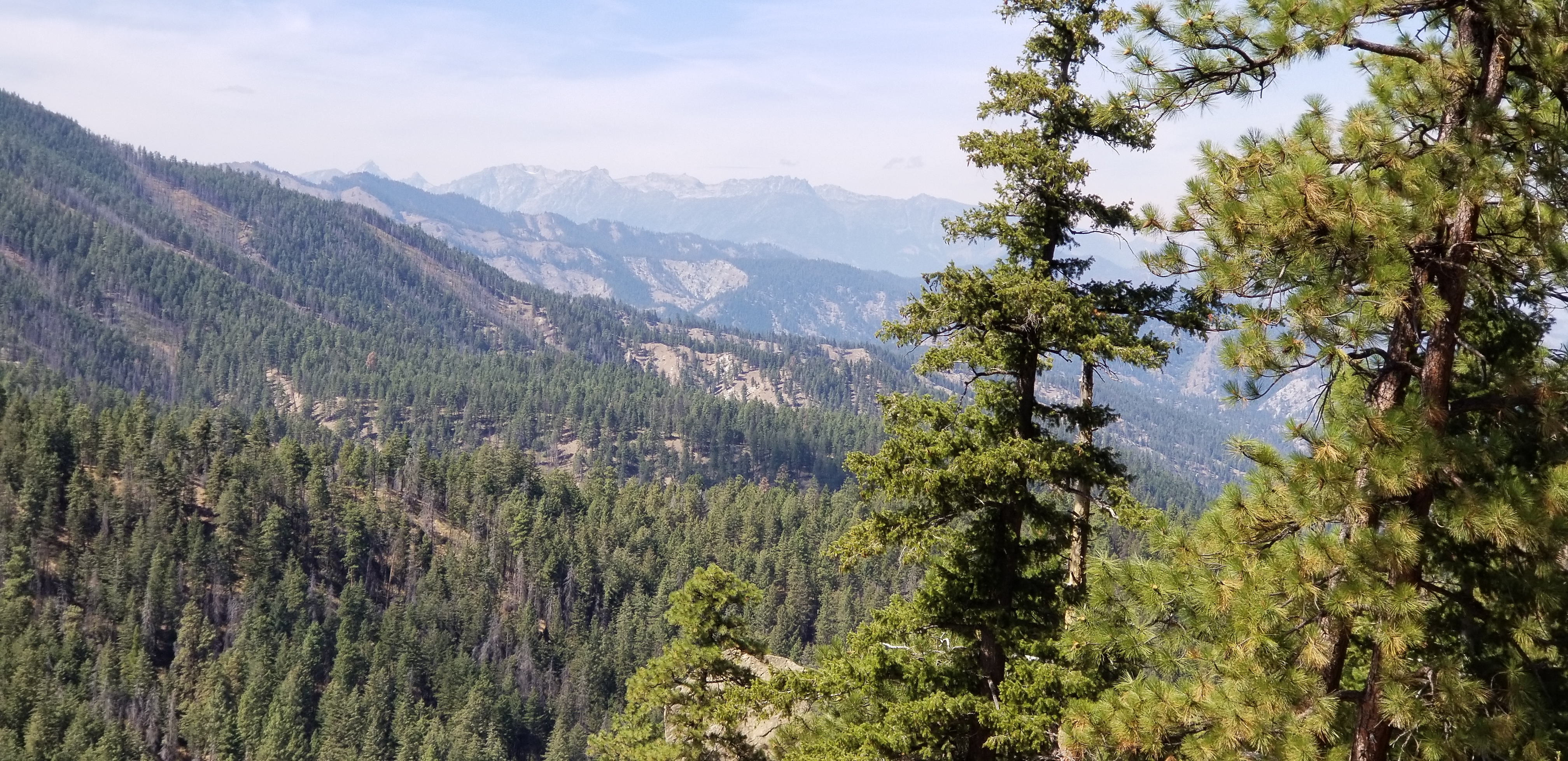
Wed I finished the drive down to Cashmere then drove up Mission Creek to the Devil’s Gulch TH. This trail used to be one of my most favorite trails in spite of the 10 miles 3235′ elevation gain. I pedaled up the open FS road which is in the creek bottom, 2.44 miles still gaining 358′. Pestered by dirt bikes that dusted me. The road at a place left the creek bottom heading over the ridge to drop into Wenatchee. Several years ago I followed that road which went to scary shit once it left FS land. Over the years the creek washed out the road that the FS gave up on maintaining it. Closed to just 2 wheels. Again, same dirt bikes. Road tread deteriorated to loose sand in many places which on a climb just sucks out energy, no need to prove only to myself that I could force my way thru. This piece of abandoned road was 6 miles taking 1 hr 23 mins of solid pedaling gaining a whopping 2214′. It is so easy to quit but so hard to do as to quit means not meeting a set goal. Just a hump. Final pedal up an open all weather road to arrive at upper TH. Then the real fun started, but first a slight uphill. Trail was not beatened up by dirt bikes. I learned why a ways down the trail. Trail dropped 3198′ in 11.5 miles. One time I pedaled up the trail. Several places the trail was washed out across the steep hillside which choked off the dirt bikes. Dirt bike whoops on the tread. Tight narrow single track with many blind bends with exposure. Trail is beat, not as enjoyable as past rides. I first rode this trail back in maybe 1988. Ride was 21.94 miles pedaling 3 hrs 15 mins climbing 3235′. Big hump. I spent way too many minutes anaerobic, just beat my heart in a not planned stress test.
Back at the TH I let fatigue and over use settle in, a beer eased me back to not moving motion followed by a rinse off in the chilly creek. Drove back down the road then up Sand creek to a sketchy FS XG. I had stayed here many nights. Found the level concrete platform vacant as was the rest of the site. No digital reception.
I cancelled a second ride from there today. I added up the ride distance and elevation of 14.9 miles and like 4,xxx’ climbing. way too much for my worked body. I remember the downhill being beat up by dirt bikes loose and steep. I could drive away with my head held high having ridden Devil’s Gulch.
Today was laundry day. Once out of the canyon for cell service I chose Wenatchee’s best laundry. Clean clothes. Parked at Pangborn airport under a shade tree. Back in 1970, while on the Umpqua NF intra regional fire suppression crew, we flew in and out of this airport several times to fight central WA fires. One flight was on a jumper plane with metal seats running along the side of the plane. Seat belt length was determined by smoke jumpers geared up size. I was too small for a snug fit. When we hit ground I slid back to almost into the next seat. Next is the drive to Waterville where I plan on sleeping at their airport.
From Blue Highways: The wander’s danger is to find comfort. I experienced comfort for 2 1/2 months in Bend. I knew where whatever I needed. Back on the road is full of uncertainties. But that is what living on the road is all about. Moving about the country now.
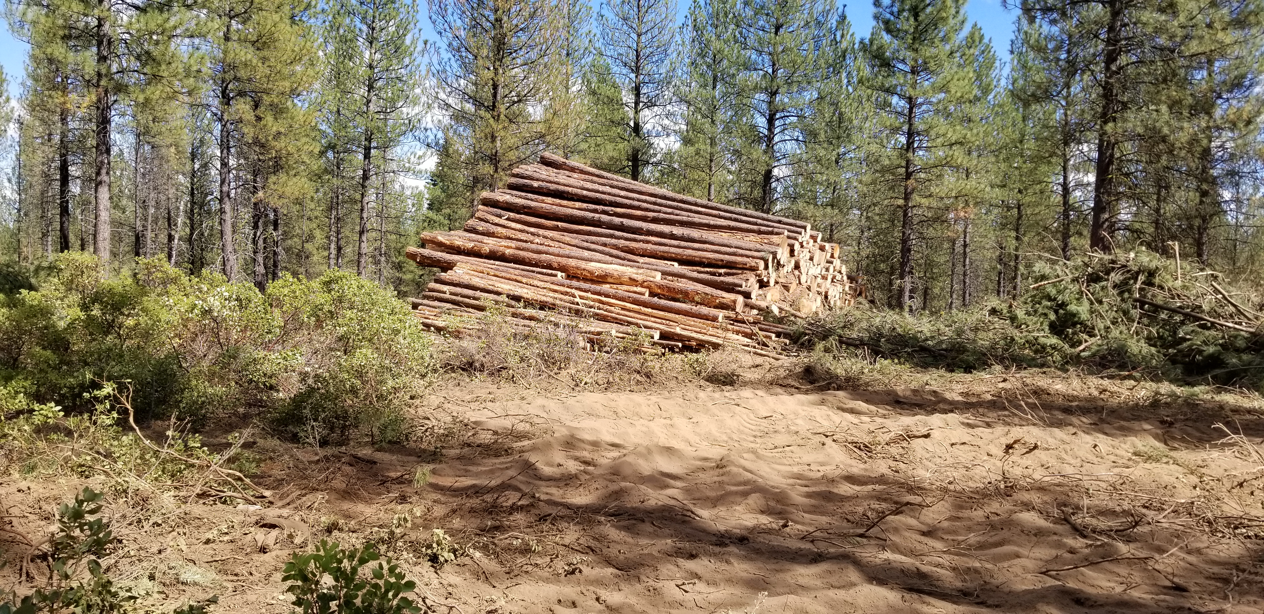
Back at Bend on Monday I rode to check out Storm King closure caused by logging. A sign was placed across the trail at the closure, an arrow pointed right going a ways on FS logging road then to turn left to join Grand Slam. I did not see the reroute sign. I rode thru the logging operation that was shut down because of Class lll fire prevention, known as hoot owl. Very large machines: wonder why loggers complain about not having sufficient timber to harvest: productivity gains and huge capital costs.
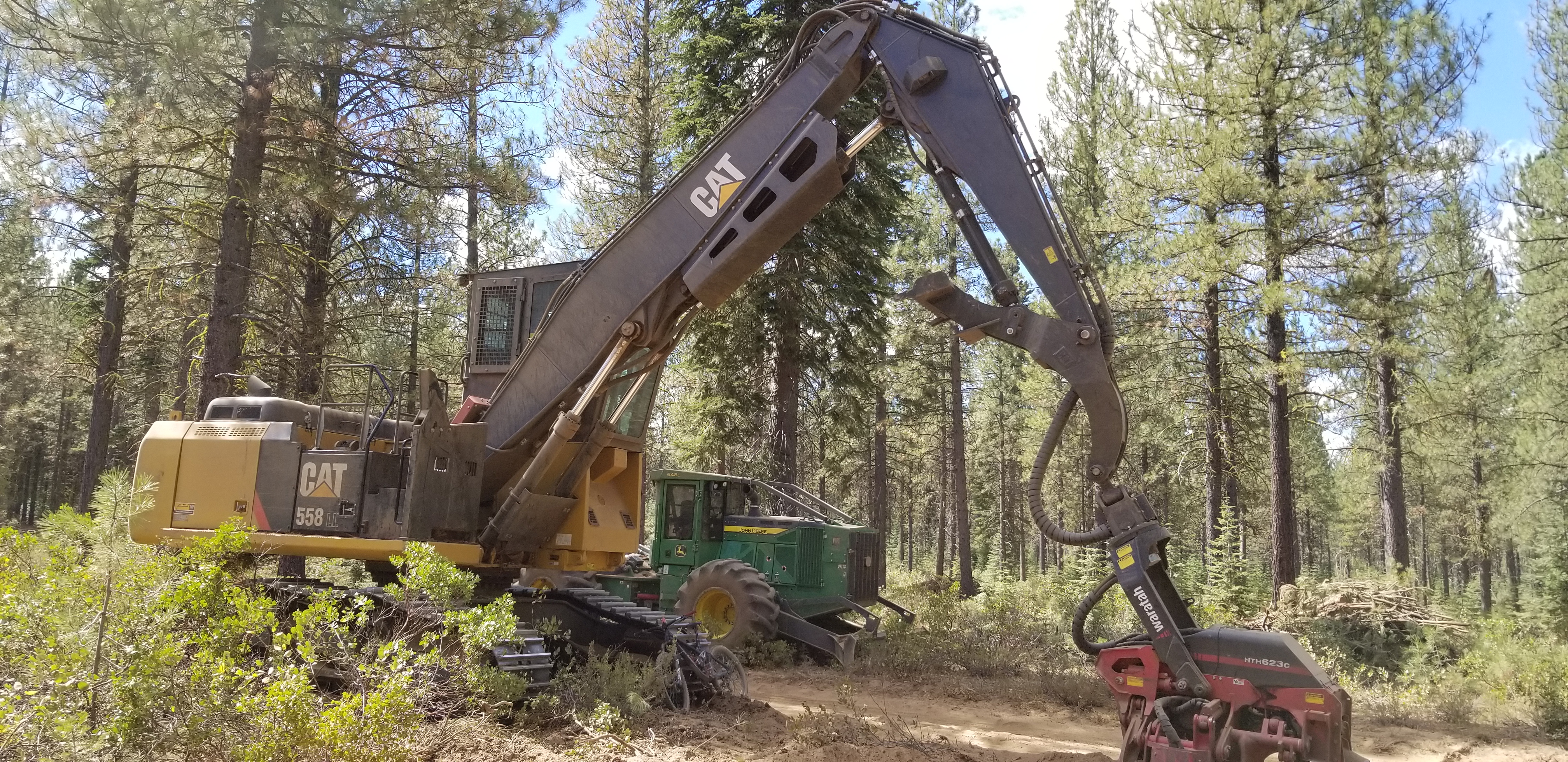
This is what results:
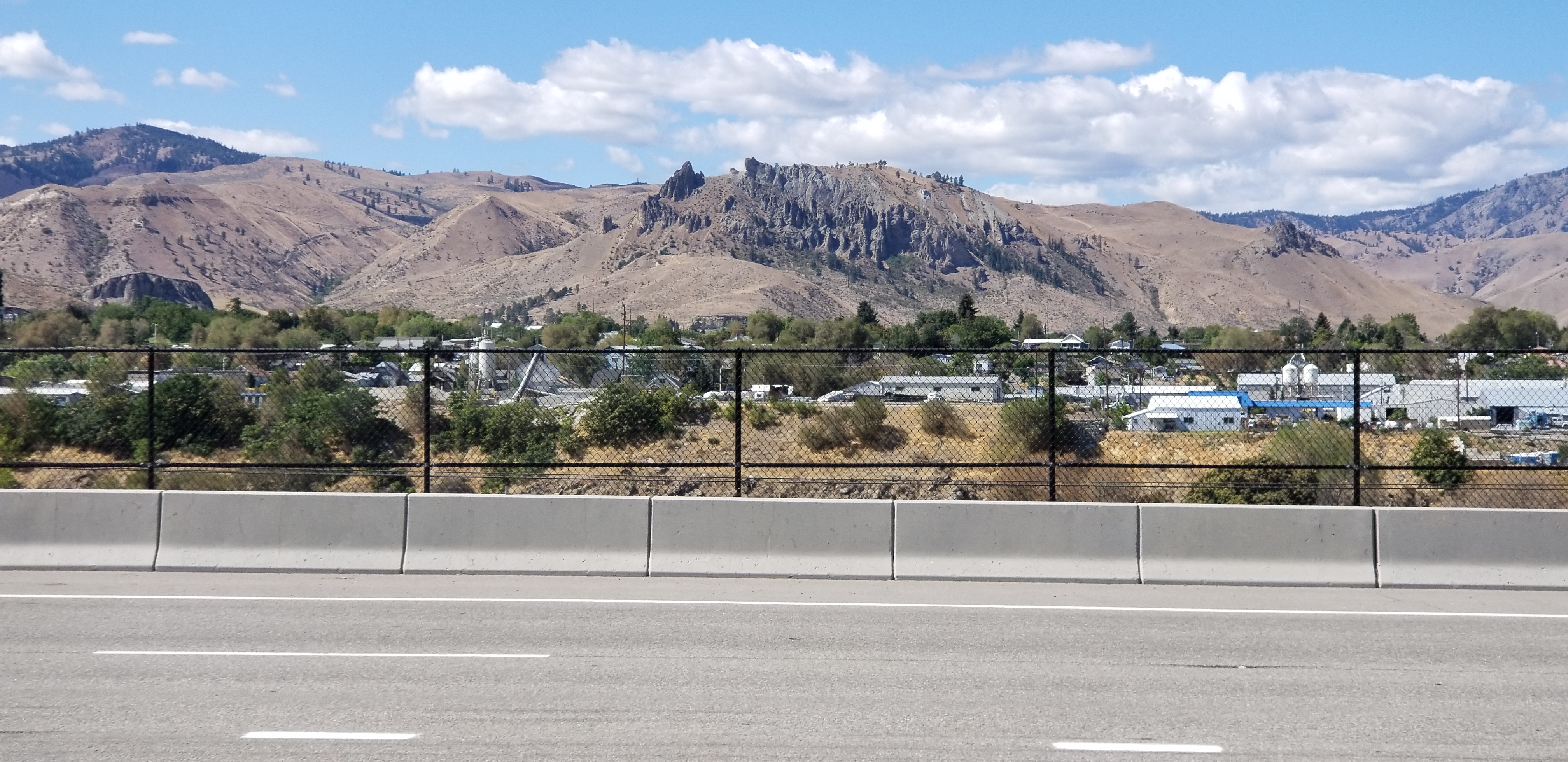
Wenatchee is located on the banks of the Columbia river. Claimed the Apple capital of the world is prolly true.
Off to Labor day weekend in old hometown of Spokane, WA.