
Made the 4th a rest day, Memory is not recalling what all I did from the time I crawled out of bed to crawling back in. I did stay up on Larrison rd. Oh, I remember visiting the annual 4th of July festival at Green Waters park for a few songs. I planned the next day’s ride while talking to myself about completing it.
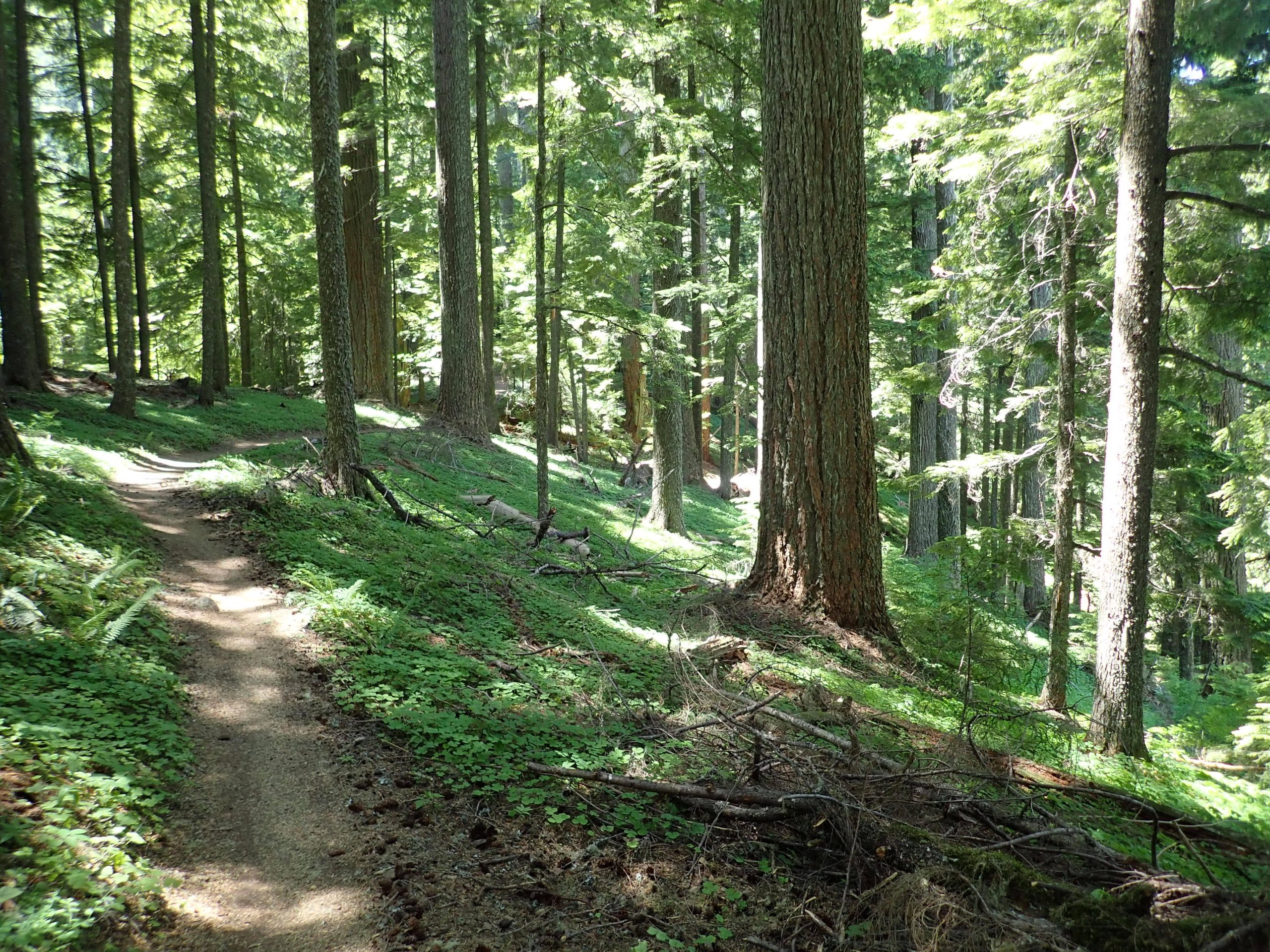
Wed AM I drove to Westfir and parked at bottom of Alpine where I would finish. Ride went like this: I pedaled the N Fork trail which runs just above the NJ Fork of the Willamette River. Past experience and current info was abundance of poison oak bordering a short section of the trail. I saw it and watched myself not brushing any leaves. Trail ended at infamous 1910 rd for my climb up to Windy Pass and start of Lower Alpine. I chose not to spend $ on shuttles. It took me 1 hr 38 mins to pedal 7.54 miles climbing 2267′. I Stopped for a rest at the 1hr time. This is part of the Creampuff race. I turned onto Alpine at the bottom of the Jedi section. I passed the intersectiopn of Tire Mtn which starts the TC of ATCA, I accepted what I climbed as enough challenge. Rode Alpine all by myself as I must have been between shuttle schedules. Ride was 19.3 miles climbing 3091′ pedaling for 3 hr 7 mins. Satisfaction of completing it. My body performs albeit at slower speed and lower heart rate. I spent 1 hr 30 mins in my 80 to 90% max heart rate.
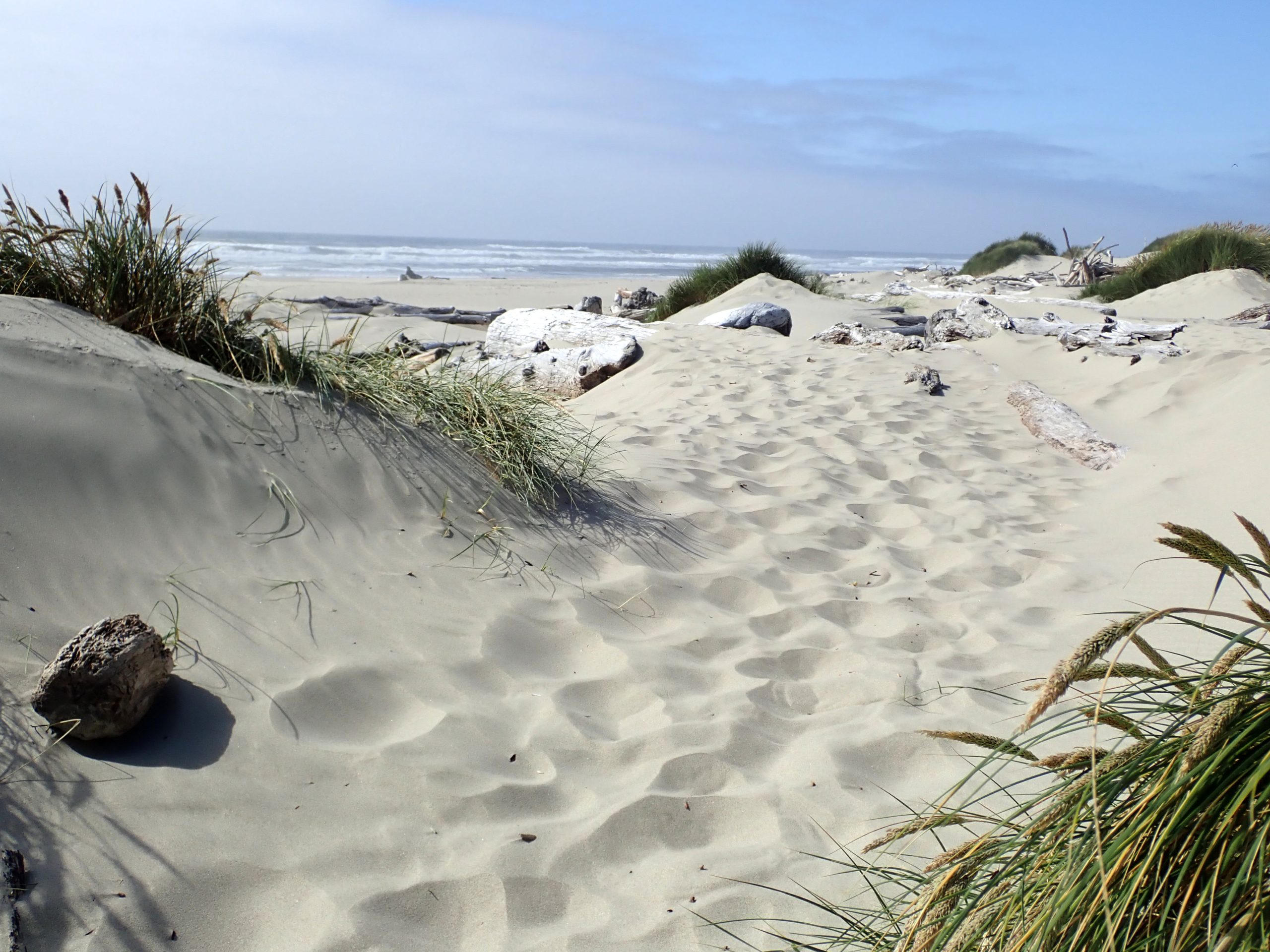
Thursday morn I headed west to the end of land. Laundry in Eugene. Returned the Bobcat glasses I bought from REI for credit. I rode once with them not liking them at all and hoping ride would fisinsh before I made a miscalculation from the glasses. Googled coffee roaster for beans. Google maps guided me thru 191,000 population of Eugene. Headed west going through the coastal range which are hit by the low rain clouds. Rolled into Florence on the coast. I found the tourist info center to inquire of camping as I did not do any planning other than seeking a paid spot for the night. Volunteer was engaged in a long winded conversation with a visitor such that I was to be ignored. I stepped outside to let google research. Saw a county XG, I called, woman said full but she would check on a possible left early spot. Score, she said it was open. I booked it for $30. Next door to center is fresh sea food store. Fresh Dungeness crab cooked fresh every day. $27 cleaned crab was consumed in my van parked behind store. Such a treat for freshly cooked crab. Googled bookstore, Books and Bears on main drag on waterfront. Bought River Runs Through It. Drove out to campground which borders the Suislaw River but off ocean. I drove out to ocean then walked over dunes to sea water. I waded up to my ankles. Chilly and windy.
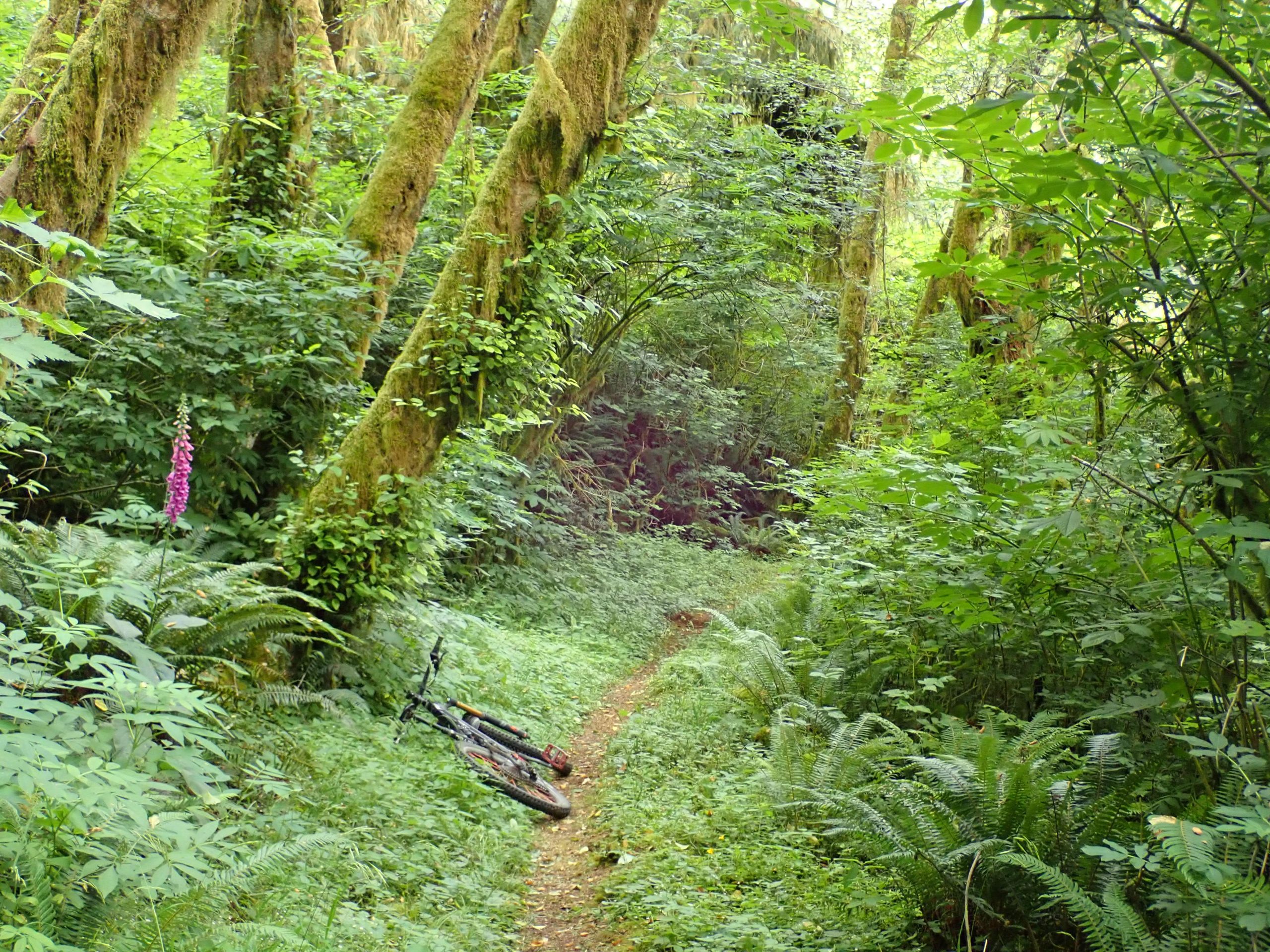
I previously researched possible rides near Florence, I picked Cape Mtn nearby. Drove to trailhead climbing like 1,600′ above highway 101, Climb was steep. System was built for horses. Trails were horse affected in places as below grade, but mostly an enjoyable non technical ride through temperate rain forest.
Side trip to ocean completed I headed back E to Oakridge for the night.
Before my Alpine ride I visited with Trans Cascadia at Westfir. Guy I talked to remembered me from giving he and his a buddy a ride in Sedona as they were tuckered from their ride. Nick. He told about the Old Cascade crest trails, AVENZA software and ability to by on line maps. Man at Oakridge also spoke of riding there and gave me suggestion. I picked the one that required the fewest miles of dirt road. Destination was TH for 2 trails, each climbing up to a peak. I learned that each peak had a fire lookout on it.
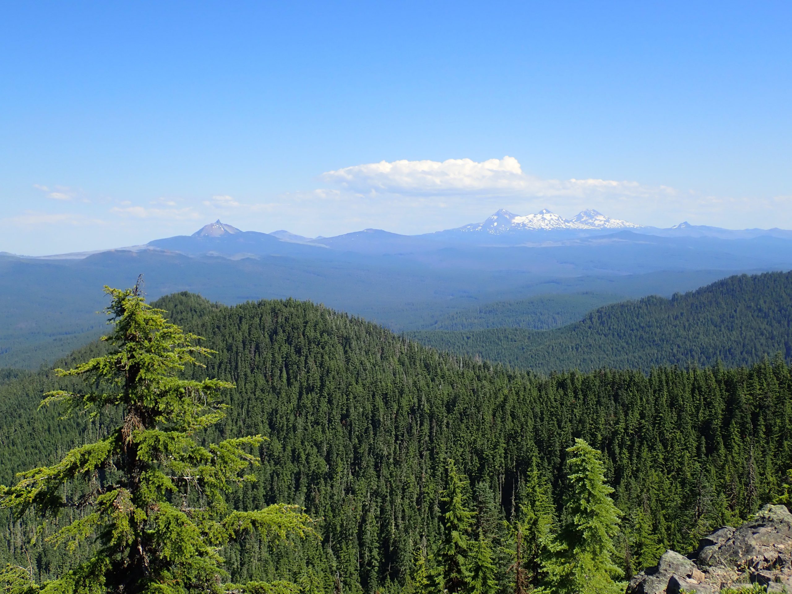
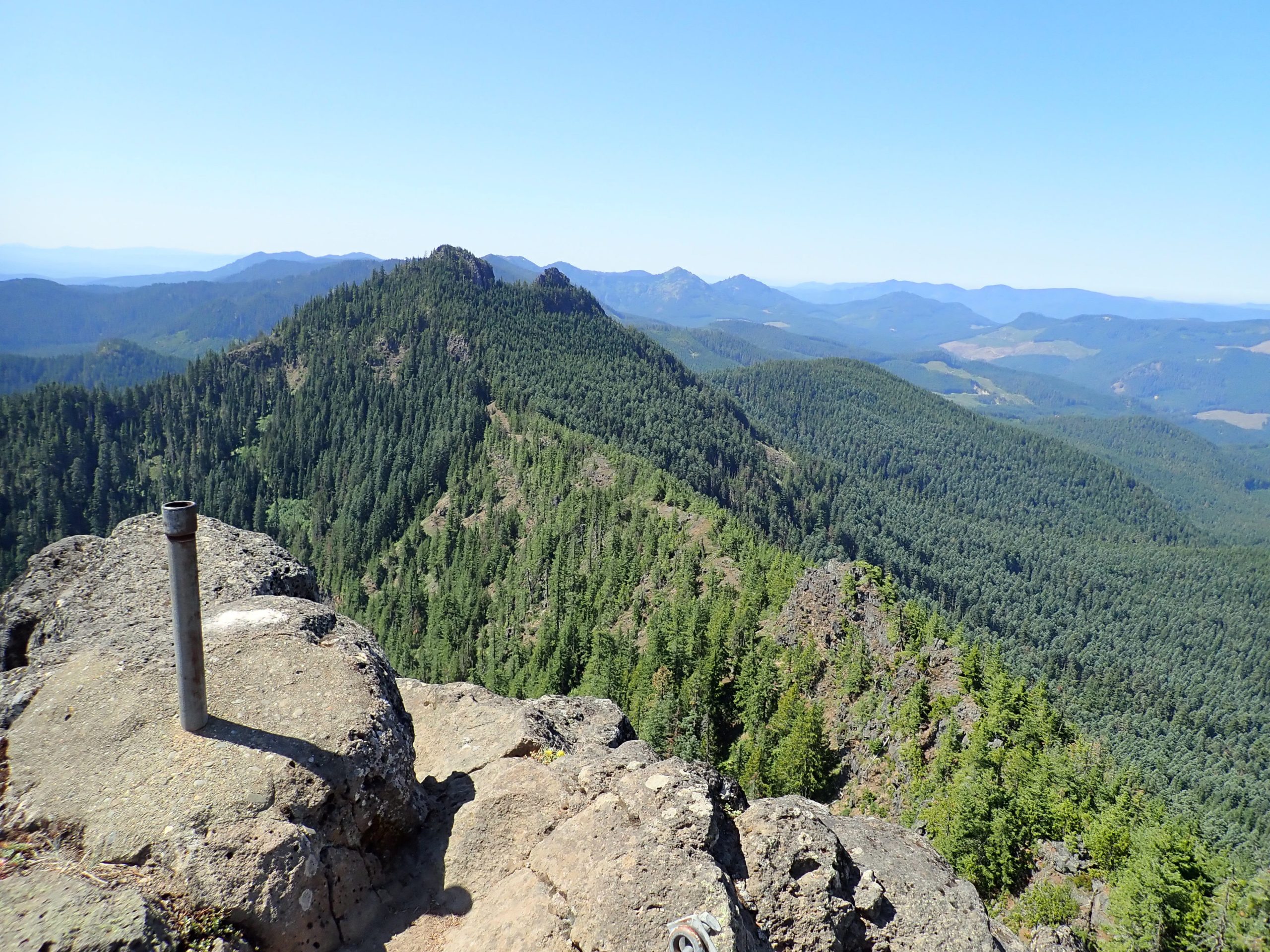
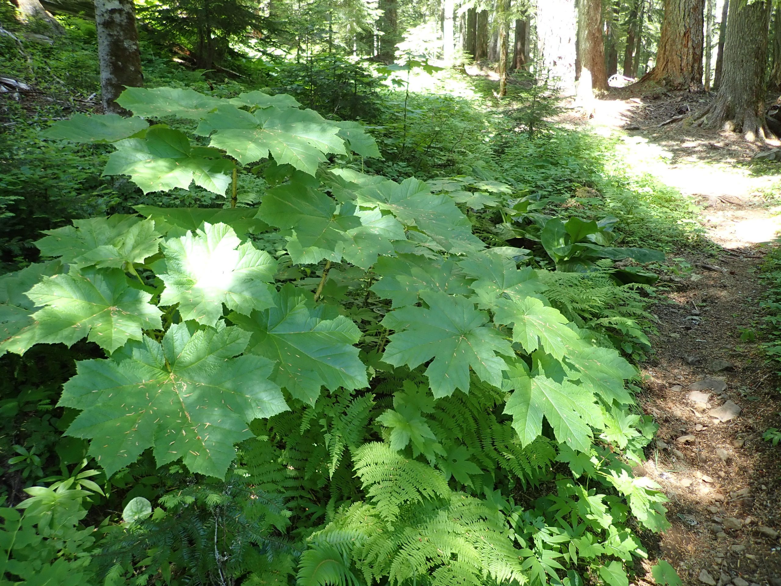
Trailforks showed Crescent Mtn as black difficulty, the other trail is Pyramid rated red which is beyond black in difficulty. I chose Crescent. Mosquitoes abound at chosen camp spot. Trail is in deep old growth tree cover and climbed and climbed. My engine pedaled what I could and walked a whole bunch of distance. Arrived at spur trail to lookout where I parked my bike and walked short distance to former lookout site which was a ground house long since decayed to scattered boards and glass fragments. 3 hikers plus one later joined me. I left first. EDGE does not record all data when hiking which is below sensing speed for data gathering. Distance was 8.6 miles climbing 1037′ but descending 2182′ at speeds high enough for recording. Distance was longer than 8.6 miles. BCN data for just the climb was 5.2 miles climbing 2119′ pedaling and pushing for 1 hr 20 mins.
I was beat. Mosquito night.
Sunday after accepting the trail to Pyramid Peak would be too much for me to ride so I hiked it. 1.9 miles climbing 1,759′. Trail started climbing from get go through old growth forest transitioning to over grown vine maple breaking clear of it for more forest cover. Climbed up peak that wasn’t the lookout site, 3rd class rock climbing should have told me this was not the site. made climbing moves to top then downclimbed. Took the better worn path to the former lookout site.
My legs were really worked climbing then I used them to brake on the descent, I was afraid they might fail to hold me. Lower trail went thru devil’s club patches, things you want to stay out of.
Drove back to Bend over Santiam Pass. Very heavy traffic heading west, not so much in my direction. Just way too many people out doing what I have been doing.
Today I pedaled from anchor spot off rd 41 to enjoy pedal trails. Then drove into crowded city. Post Office line was way too long to wait my turn. Visited Pine Mountain visiting with a woman staff member. She told me she rode the loop including the red trail.
Tomorrow a rest day.
Bed time.
I bought on line a bug buster device like a bug zapper to harvest mosquitoes. So far I seem to be more attractive than the light.