
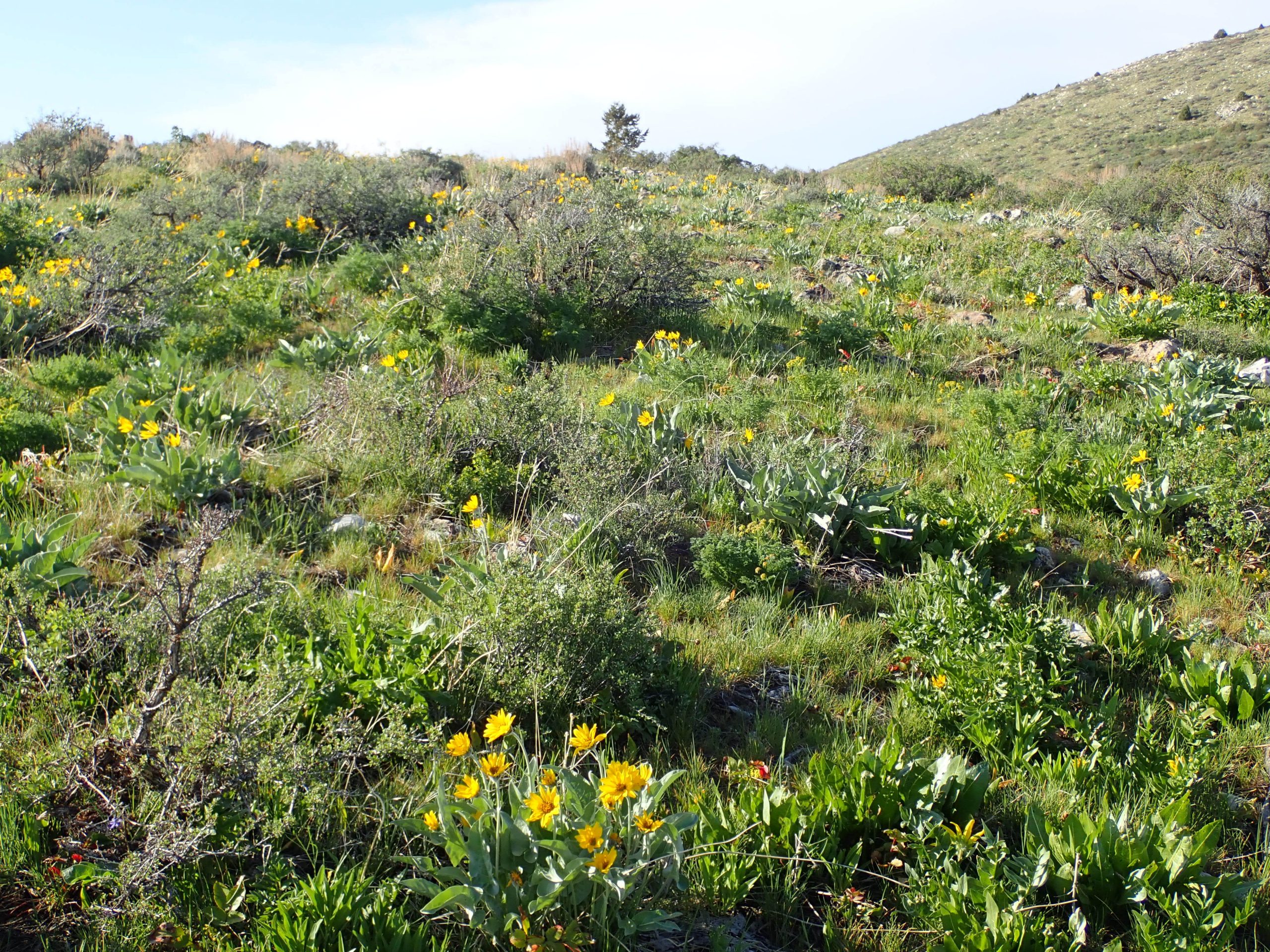
Where it is pretty much either or. Up or down. Mountain range right outside of town. Ride up a drainage, cross ove down cross over back maybe. Or start at the bottom and make a big loop to finish on screamer downhill. I rode here several years ago as current images called from memory same thing. On Sat I drove from Vernal to said city arriving late afternoon. Caribou NF manages those mtns. I researched camp spots in the forest. Scant. I drove up Mink Creek into the forest. Paved road is right in the creek bottom, no camping. Several trailheads right on the rd but did not display no camping signs. I drove further up turning abruptly on rd 006 that was decent condition gravel. Climbed up out of bottom. Memory recall to the fore that I stayed here on that visit. Found same spot as first 1. No internet. Arrobalsamroot flowers are going off.
I did receive Trailforks to plan my rides. I am here as a solo touron, Sunday no bike shops open. Rides always seem doable on the screen. And then actually riding the selected trail. Give me a smart phone with reception and should I put on my readers I can remain found.
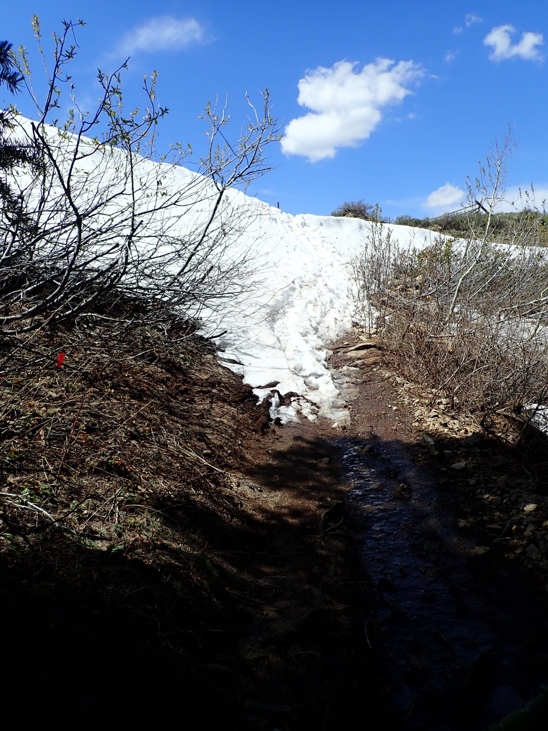
So, Sunday drove down across the bottom then back up Gipson Jack drainage. Plan was to ride up Slate Mtn then ride connecting trails to go down Gipson Jack. I rode maybe this same route last trip, at least that’s how I started. Trail reviews remarked about pedal strikes because of narrow below grade tread. At first the trail was wide for a side by side, old comment? I came to a trail sign for Slate Mtn, the trail I was to take. I was following mountain bike track, he lead me. I stayed on what turned out to be a motorized trail, not built for mountain bikers. loose rock rubble. Steep. I pushed quite a lot as my engine lacks the power to propel me sufficiently. Along the way I did stop and put on my glasses and learned what I did which made my ride shorter, quicker to the return downhill. Dirt bikers descending, me pushing up. Encountered first patch of snow, sure enough still a mountain bike track. All clear. I stopped at a high spot and climbed up onto the ridge line. I am at the top of the climb finally. One last snow patch to kick steps in and drag my bike up.
Short steep climbing turns downhill ended at jeep road. Map check: turn right pedal in meadow short distance
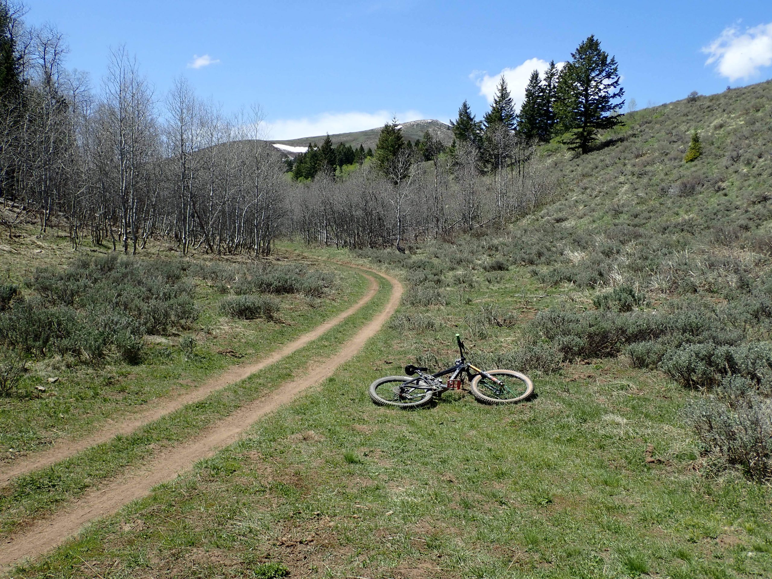
to start of Gipson Jack downhill. Then breathing became less frequent as gravity became my engine. Trail is below grade, is heart propelled only. Riding on woods dirt under tree canopy beside a clear flowing stream. 3.59 miles down dropping 1129′, needed 17 mins to end. Seat dropped, attack position, bell jingling with bumps, and looking. Just 2 hikers entire ride down.
garmin needs some minimum movement value to record. I pushed a lot and stopped for gaspers which garmin won’t acknowledge. I also mapped using backcountry navigator which doesn’t care if I take a nap. garmin said 7.73 miles in 1 hr 3 mins climbing 623′. BCN said 9 miles climbing 1803′ moving time of 1 hr 32 mins. Average heart rate was only 112. I was worked, elevation topped out at 6951′.
Road 006 is seasonally gated, I arrived the day to be open. Woods are getting along with covering up the previous snowpack. Green leaves. I am temporarily out of the desert after 6 months.
Yesterday an intense short lived thunderstorm battered the van up at anchor spot.
Last night again studying Trailforks I came up with a ride starting down the canyon Then climb up, down, up, across, down ride.
Drove down to the other end of Slate mtn trail, my only choice and it was up right after crossing Mink Creek. Not badly beat up by dirtbikes. Loose sharp edged rocks maybe softball size and below. I pedaled from gasp to gasp mixing in hik a biking of steeper sections. My engine is affected by age and wear. Dirt bike coming my way was company. He was packing a small chainsaw. Trail is below grade, pedal strikes, and scraped by encroaching sage brush. Trail is not brushed back. Turned left on Slate downhill that dropped down a small drainage. Smooth dirt tread with squiggles, trail open to heart propelled which made for enjoyable trail condition. Intersected with Birthday creek trail that was also opened to us. Nice single track but surprisingly worn to below grade. Deep forest cover. Over time the brush had been cut back, we hearts can do it, the engine powered people just wear armor I guess. More hiking just because I blow up. Trail ended onto 4X4 road pedaling over to start of Corral creek descent. A dirt biker preceded me putting up engine exhaust and dust until he went faster than me. Screamer downhill, most bends had a berm of sorts. Fast. Pop out of forest then coast down the road to 2nd TH for Valve House short piece then dirt parallel to hard road trail to van.
Garmin said 9.78 miles pedaling for 1 hr 26 mins climbing 879′ and descending 1913, BPM was 116. BCN said 10.7 in 1 hr 39 mins climbing 2027. Again pushing. Definitely rode hard. Elevation is more than 1,000 higher so far this spring.
Today I needed drinking water for rest of the day and start tomorrow, I drink filtered water from water machines which at least lessen the chlorine taste. And internet for this. Long drive to Albertson’s store with an outdoor Glacier vending machine and internet access.
Tomorrow will be another either or ride, spend the night, then on Wed drive to Indian Springs S of Kimberley. Steve said he will drive down to ride with me.
Did ride Friday at McCoy trying to repeat previous ride. festicle is my kind of trail: purpose built by hand using topography for sustainability and enjoyment. Weather moved in with a violent front so strong I was forced to shelter behind a juniper; too strong to remain upright. Spent the night same spot.
Sat I drove up to Red Fleet trails outside the state park. As I drove up canyon I spied to my right numerous downhill lines worn into hard red dirt. There is a loop around that I had ridden two previous visits. Today, blew it off as scene was bike parkish. Spectacular mountain scenery and highways. Flaming Gorge.