
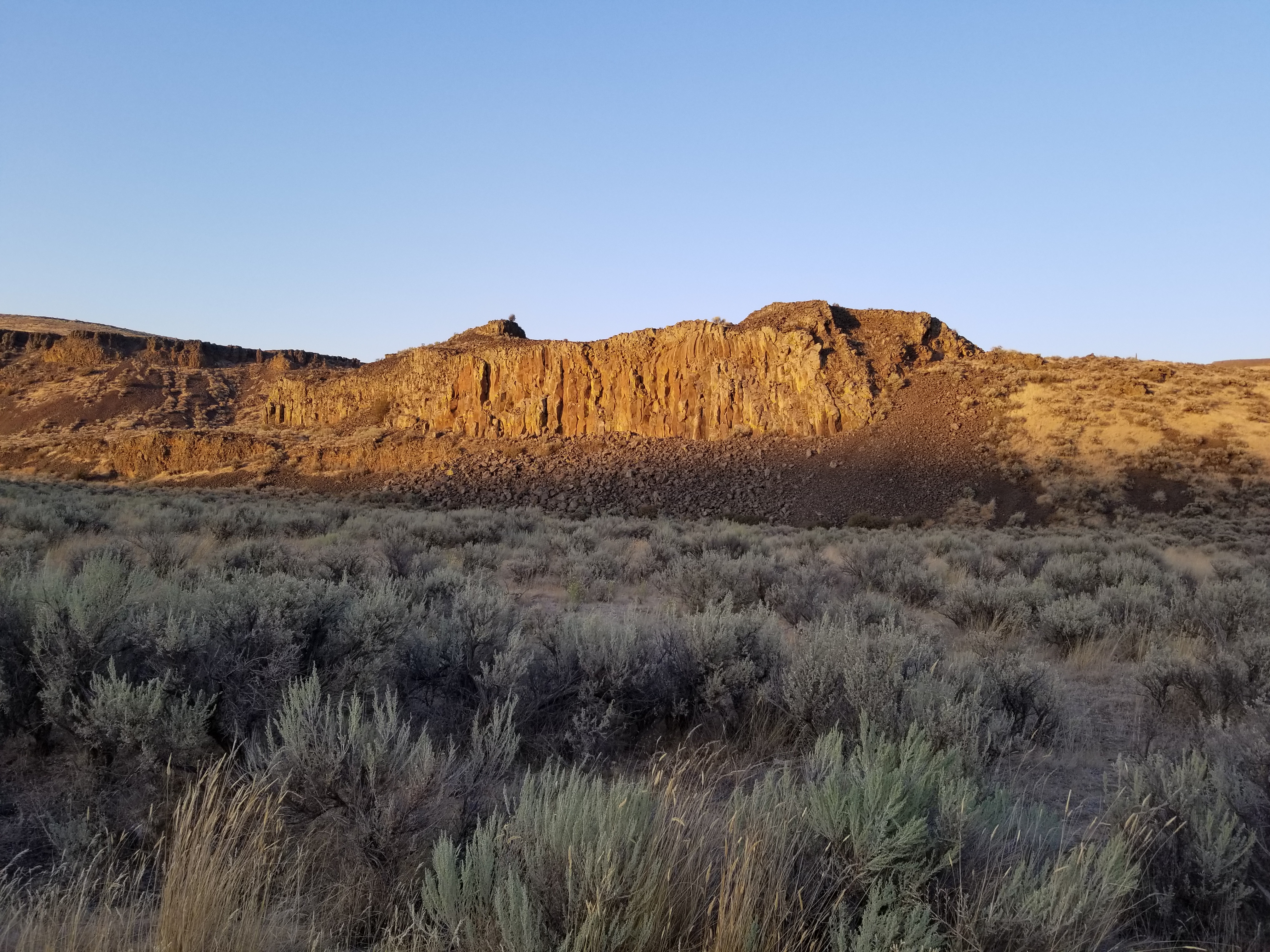
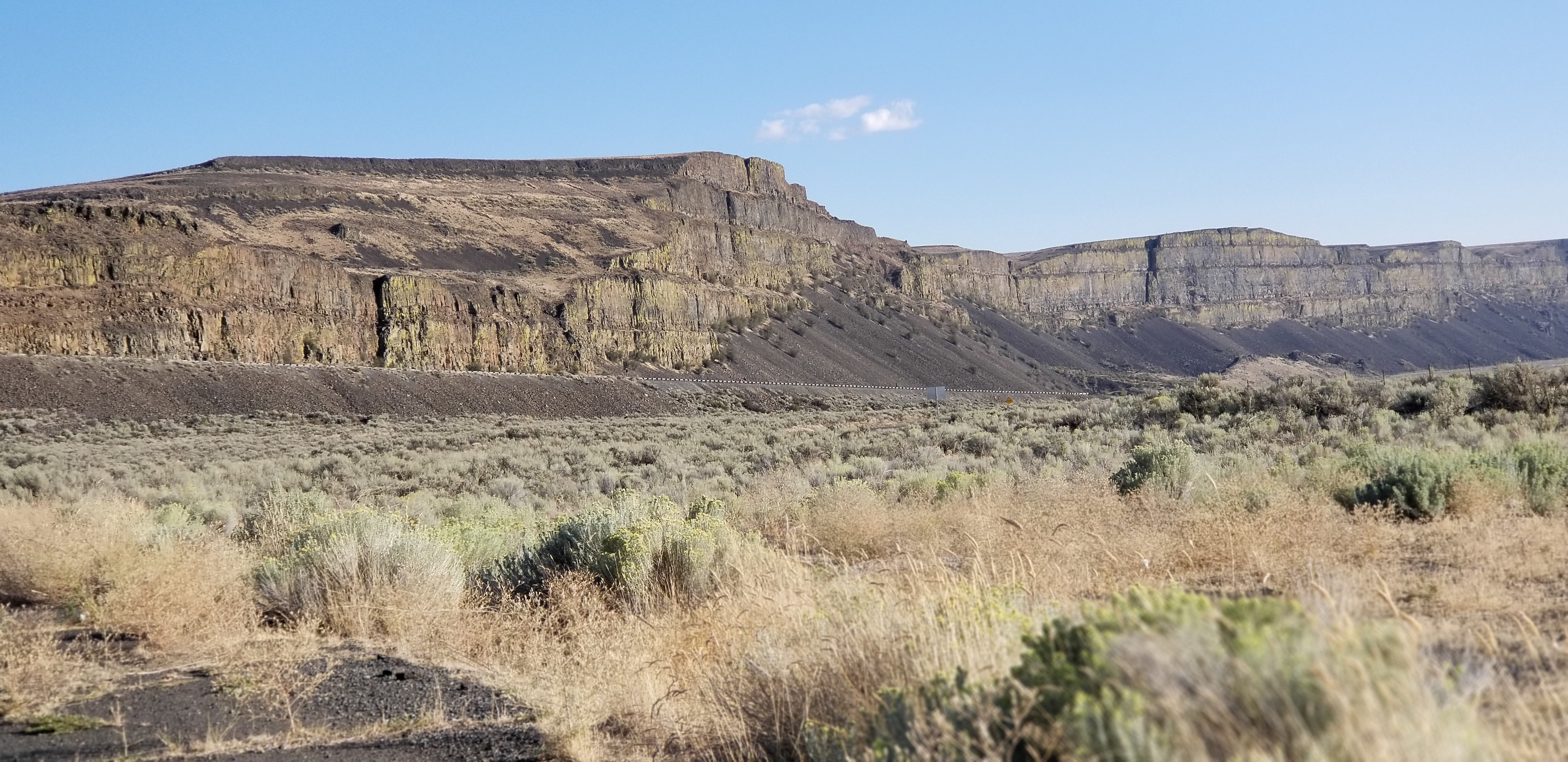
Thursday I drove into Waterville and checked out the airport etc for sleep spot. I found a parking spot at the airport that would work but I would need darkness to work and I wanted a place I could live outside. I moved on to check out a sledding hill which is on private land, I was hoping for a parking lot. Missed the turn which went up a beat up dirt road. I drove up the hillside, sign reported 12.5% grade. Lugged up to the top then chose a gravel road seeking a wide spot or turn out. Didn’t find one. Turned around then descended that steep grade. During the descent I started smelling smoking brake pads. From Me? New brakes , maybe it was from the new brakes and they now have an issue. I pulse my brakes so it wasn’t from dragging them. Once on the flat the smell continued. WTF? Plan became driving further east to a state park at Dry Falls. Labor day weekend would prolly be a zoo. Years ago during a drive I picked a primitive road which dot the very large dry land wheat farms. Picked one. It was dead straight, narrow over dry talc like dirt. I gave up after a ways as I found no turn into a field on either side and concern that dry loose dirt might capture my van. I backed up. A vortex was created at the front of the van which was the rear end causing dust to billow over the windshield beyond big time. I made th hard road then continued east still looking for that to be discovered primitive spot. I spied another state park before Dry Falls. Turned down that road which was paved for a short distance before sign announced pavement ends. I passed a turn out while still on pavement that met my needs. I am in channeled scab lands for the Missoula ice dam flood which is typical of eastern WA. Succinctly over several ice dam bursts which released a massive lake impounded by the ice dam flooded down the normal drainage. The flows were too great for the existing drainage to accept which caused the water to spill over the land which carved away any soil etc leaving only mostly exposed basalt. Something of natural history to see.
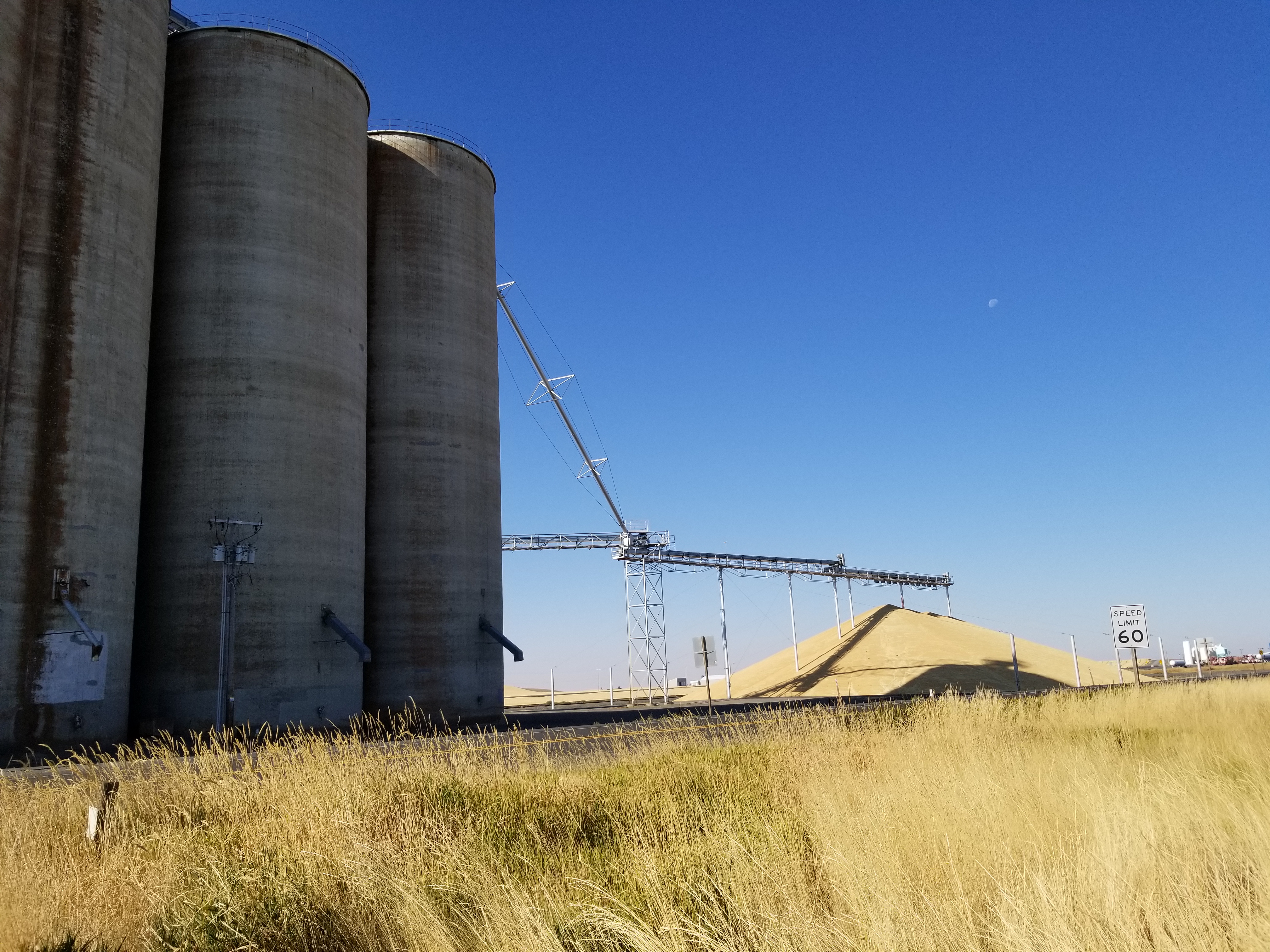
Central WA is huge wheat farming using huge machinery for productivity gains which has driven out the local population that supported the early horse farmers, communities along US 2 have collapsed. Wheat yield exceeds this huge collection of grain elevators at Creston:
Finished my drive into Spokane which is the largest city I have been in a long time. I met with my $ man for a beer and discussion of $ and life. Problem is with dwindling funds.
My brake smell stayed with me to Spokane. I drove to a Schwabs station. I explained what i was experiencing stopping short of condemning them for their work. Van was put on rack, examination revealed the right rear caliper had a firm grip on the rotor. Not a service issue, it was my van. Will have the rear brakes replaced later this week when parts arrive.
I drove out to Riverside Park intending to park at usual spot which is outside the park so it was free avoiding the daily $10 fee. I pulled in only to see official no parking signs. Bummer. A pickup truck pulled in behind me, the driver shut off the engine, then got out and walked over to me. It was Guy, another engineer I had worked with while we were all Boeing. Wonderful friendly conversation.
For dinner and community connection I ate dinner at The Elk in Browns Addition. Swinging Angle my favorite. I left early enough to visit with my former neighbors where I would be staying in their driveway. catch up on road happenings. Bill said that the population continues to change as former residents die and or move away and new people replace. A fact of living.
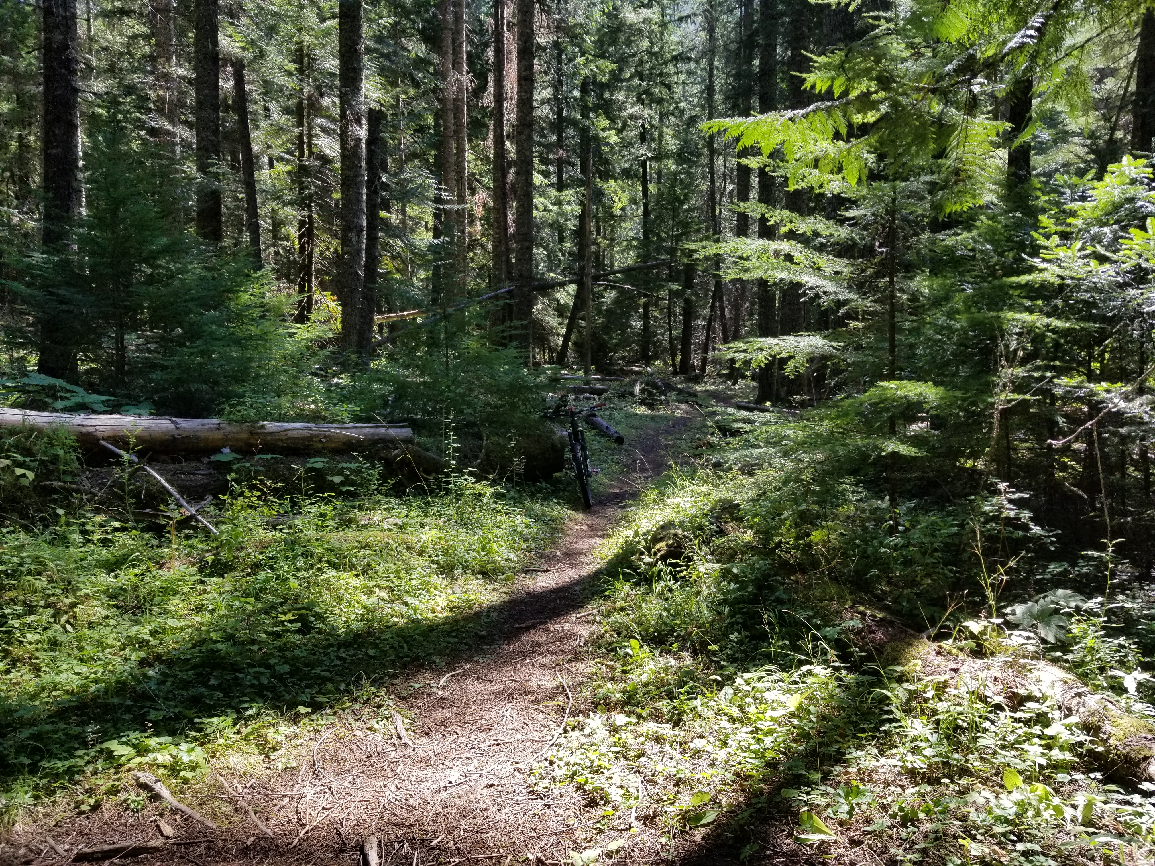
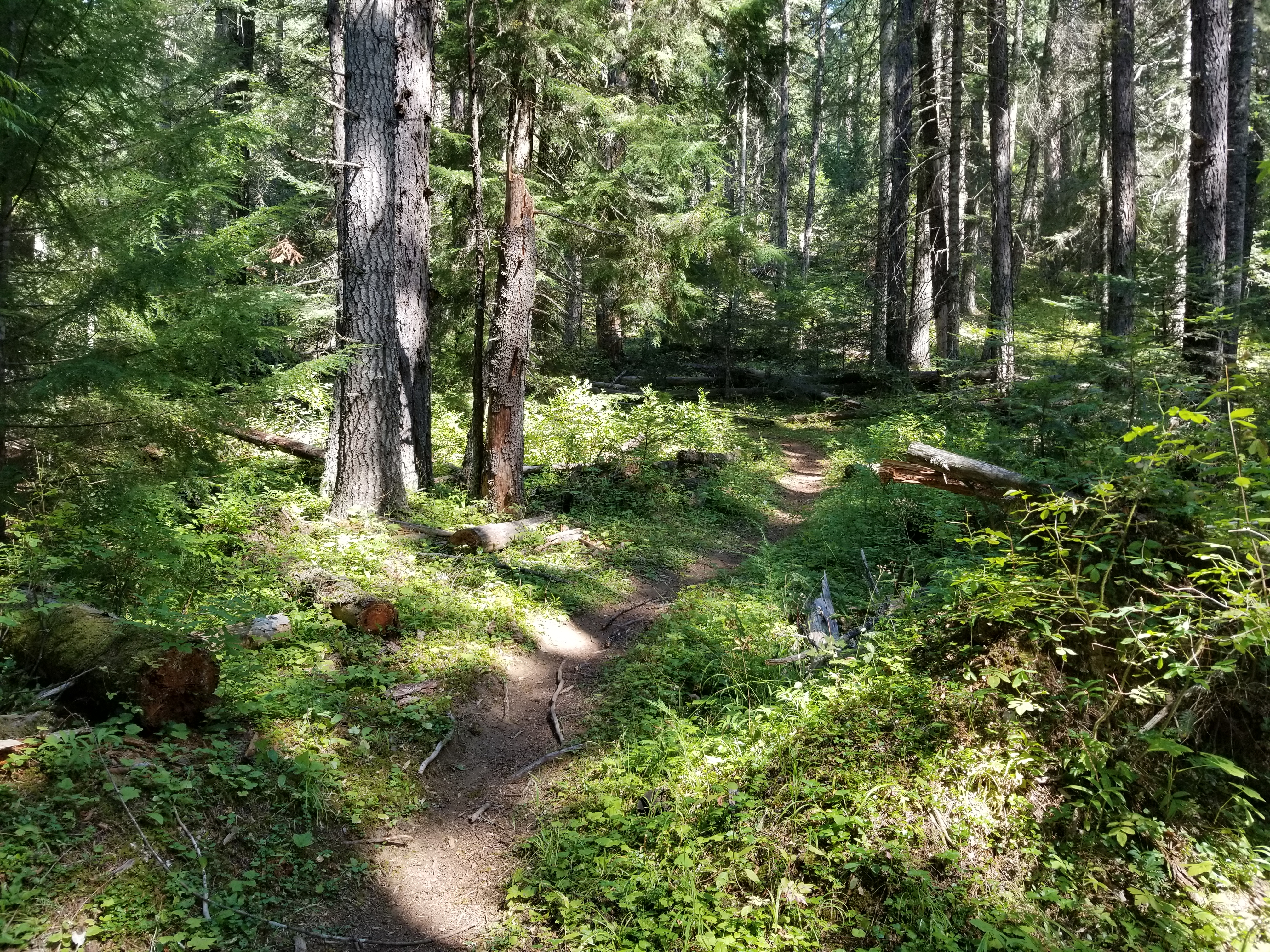
I connected with Tom whom I used to work with and skied with. He has now embraced mtn biking. On Sat we connected for a ride on MT Spokane. A new trail has been built named The Goods which descends the same slope as the infamous Wailer. This new trail is a challenging descent. Deep tree cover creates deep shadows. Trail will rut quickly because of the surface exacerbated by inexperienced riders locking up their rear brake. A heads up trail. I came off my bike on a series of 2 bumps: I came off the first one but stuffed my front wheel in the front side of the next bump. A gentle contact with soft dirt. Short ride climbing up high enough to oast down to the new trail. 7.39 miles climbing 1355′, the new trail is 3 miles, so net that distance yields 4.39 miles up gaining that elevation. Steep.
Sat night I joined Tom and another Boeing engineer for a go at Spokane’s Pig Out at the Park downtown at the site of a previous World’s Fair. Pig out. take away was very few of the attendees have white collar jobs. I stayed for a little while to be filled up then wandered my way thru downtown trying to find the pedestrian bridge over the river. Spent the night back at same spot.
Another favorite ride is a MT Coeur d’Alene loop, this one is a BIG hump. Drove across the sate line into Idaho thru the name sake town out to the eastern edge of namesake lake. Drove up Beauty creek negotiating the enlarging pot holes to park at same spot under a large cedar tree. Ride started with a half mile road climb for a warm up then the hump up the legacy hiking trail. Dirt bikes used to allowed on trail but they were banned several years ago which lessens trail damage. Draw back is dirt bikers would cut out downed trees. Local Tim showed me a route that I rode which is to climb up trail 257 then continue on a downhill to the junction with 227 for the climb out then connect with caribou ridge, ride a recognized social connection trail to connect about midpoint of 257 for downhill back down. It becomes how do you want to pay the piper? Riding down 257 is a nice grade that can be humped up or steeply descend 227 reversing route. I prefer to enjoy down hill and hike a bike out. I passed the spot where a moose had died almost off the trail, this time I did not see any bones. The hump up was just that a BIG hump hike a bike. I discovered that the Edge computer does not collect data at walking speeds. The Edge reported 13.5 miles climbing 3080′ time of 2 hrs 6 mins, backcountry navigator which is also GPS based reported 15.7 miles for 2 hrs 40 mins.Numbers for climbs were 2 miles on 257 gaining 1145′ which I rode all of except for 2 short pieces. 227 climb which was lots of hike a bike was 2 miles gaining 1627′. Both agreed on 3,000′ elevation gain. Deep tree cover, no view sheds.
The descents were a hoot, trails all to myself.
Back at the van I watched several yellow jackets work over an insect prey. At this time of the year the YGs are aggressively seeking animal protein to feed to the larva in the hive, a process named trophallaxis where the adult carries the protein back, feeds it to the larva then eats the excrement of said larva. In the fall a larger nest is built which accounts for the large increase in said YGs. Beer is an attraction also. I rinsed off from Beauty creek and retrieved a chilled watermelon for a juicy finish reward.
Spokane is home to many brew pubs, one of which is in Millwood in the valley which has become my go to establishment for 1 beer.
Today is a rest day.