
Yesterday was a ride drive day. Today was a drive ride day.
Out at N Klondike TH dispersed camping opportunities I picked the first spot which is furthermost away from actual trail. One rig was parked which seemed to be the magnet for a swarm of other rigs joining, appeared to be a big group. My preferred spot back up against the rocks was occupied when I arrived which is why I chose this spot. They started packing up then left, the space was opened. However, wind was blowing straight on to the rocks which would prolly be more wind wind affected than were I chose. My decision turned to be propitious as their gang arrived.
Rode from van to the west side of Little Valley wash on the easier trails for a wonderful pedal warm up.
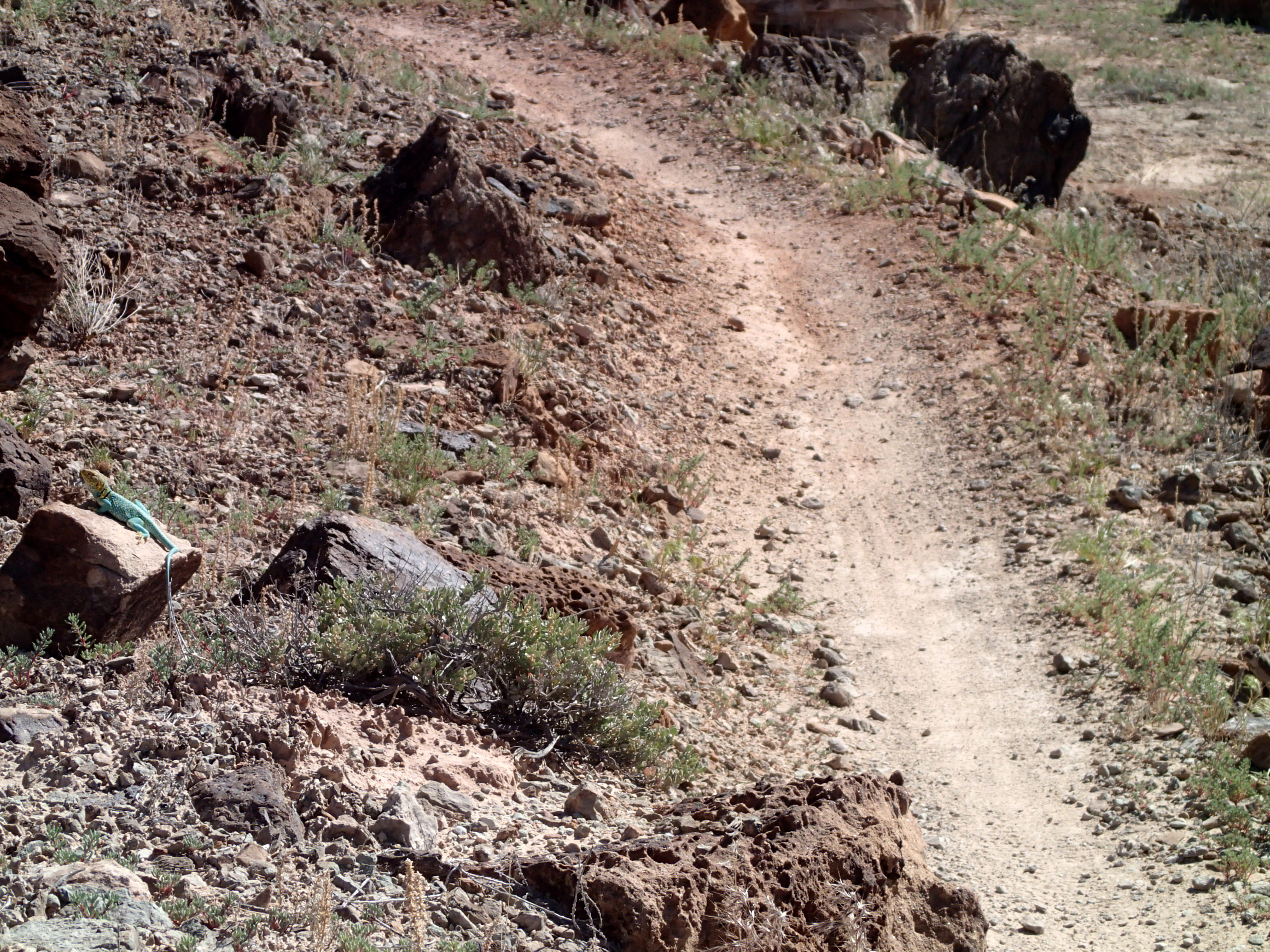
I rode coming towards you. My eyes caught movement of this out of place coloring. Was it somebody’s toy as a prank? I continued past then lowered my bike for a walk back to see up close what caught my eyes. It moved therefor the toy prank was off. It’s coloration protection to human eyes that sees color eliminated its camouflage. How do its predators perceive it?
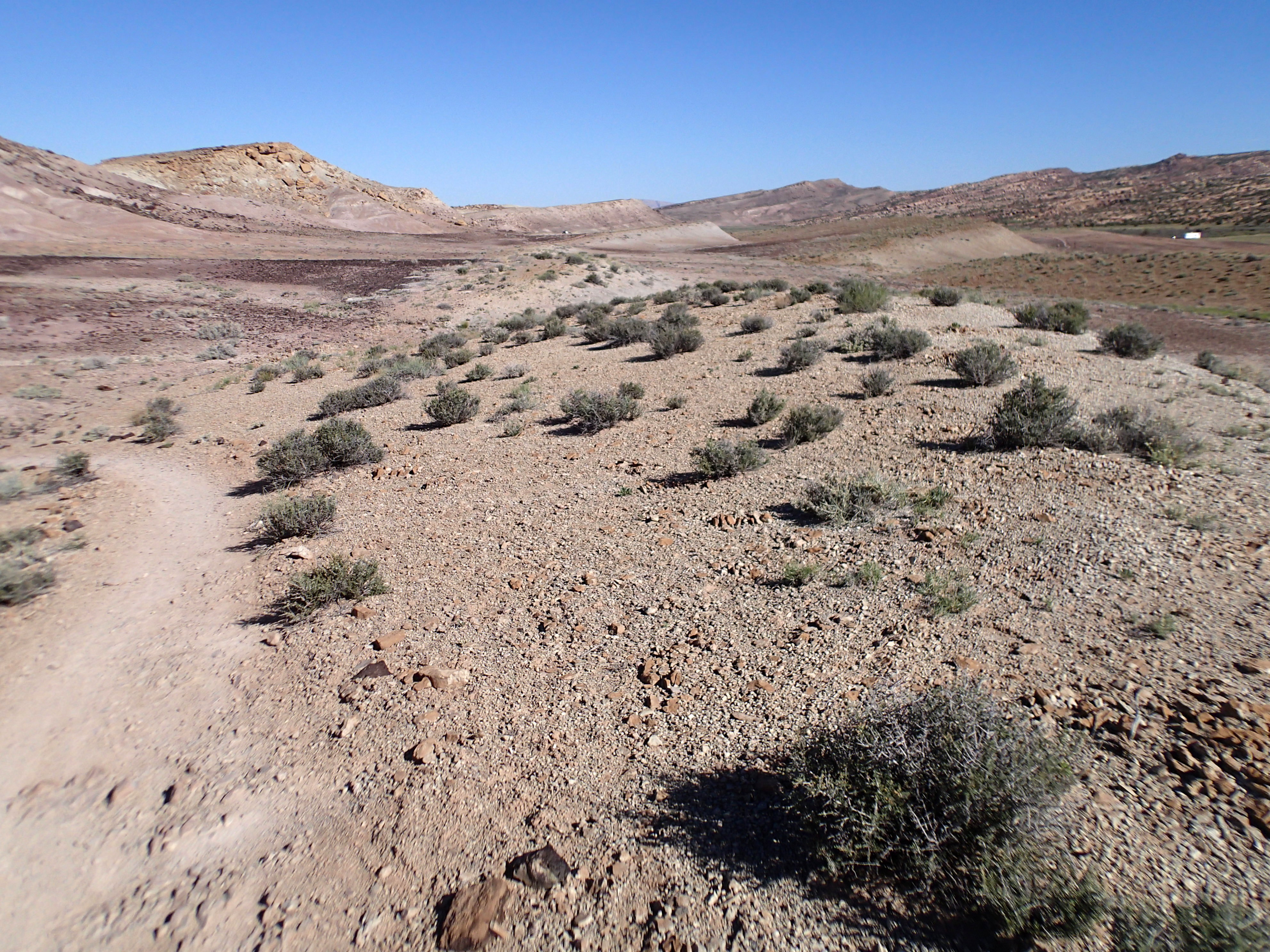
My route went to pick up the start of Dino for my return. This trail is up on slick rock patches, a bluer. Features that required skill but of lesser ability. I said previously I like this trail. I sessioned 2 spots to make each.
Quick route as I planned on driving up to Soldier Summit west of Price for the night. 2 miles of stutter bumped all weather dirt road out to pavement finally onto I-40. 80 mph, not. Then leave 4 lane for 2 lane rt 6 going thru Price on the business loop. I groceried at a Smiths in town. Called up Price bike shop then let google provide navigation to its door. Fuzzy works here. He told me on my first visit years ago that if you walk into a shop and if there is not either or both a long haired guy or dog, walk out. He gave me the sticker which is on my van: Crappy bikes make baby jesus cry.. Walked in. Guy said he was fired months ago. Management disagreement. There was a long haired guy but no dog.
Back on the rt 6 climbing up to Soldier Summit. I researched GS map for possible sleep spots at summit. Only 1 FS road. I saw 4X4 travel rigs parked at what appeared to be a locked gate. I assumed a gate that was locked. I accepted it as the road could be closed for snow melt. I believe I parked there years ago with my Westie, the road blocked by snow. Plan B was to drive all the way to Kimberly, ID and sleep at Indian Springs. Implemented: Driving N on I-15 on a Saturday non work day was 4 lanes bumper to bumper density. I was one of scads of people traveling. Work day rush has to be more white knuckled. I-80 west bound underneath the S shore of the Great Salt Lake. Many, many places rocks in the off road muck spelled messages. Straight line, 80 mph, me going maybe 60. Rain started to fall, at first, just intermittent speed then finally full on hard rain first speed wiper. Drove thru it. Back in Pacific time zone. Afternoon into evening. Not going to make Indian Springs by dark. Stopped in a vacant lot at intersection on rt 93 N and fixed mashed potato pancakes. The map identified an airport on my route. Darkness had fallen needing headlights. I drove the approach road to the airport: bingo, no control tower or security gate. I drove to the far end of a level gravel lot. A house located just outside “official” airport had a fenced in pen for dogs which barked at me. Lights on in the house. Nobody checked me out. Woke about 5:30 which at Delores 2 days before was Pacific time. Time zone changes. Fixed bfast, cleaned up, then turned the engine over for the drive to Indian Springs.
I prefer driving non interstate highways, not the Blue Highways of Heat-Moon. I happen to be reading his book, River Horse, a saga about boating from Atlantic to Pacific oceans. His writing effects this writing.
Finished the drive thru Twin Falls then east to Kimberly, south to BLM Indian Springs. Forecast called for possible heavy rains in the afternoon. I arrived at the TH, lots of motorized rig haulers. Clouds were not friendly, darn right threatening. I geared up. I rode Sweet n’ low towards Dry Gulch. Cow manure on the trail as BLM leases public land for welfare ranchers. Just b4 dropping to Dry Gulch which is a gully climbing with the next exit 4 miles upstream, I heard a clap of thunder and felt big rain splatters. No good. Chicken out even as I packed my new rain coat. I turned around. Short ride. When you ride and out and back the back reveals what you did to get there. The return required less pedaling. I hung at the van looking at the sky. rain had quit which never amounted to anything but upwind skies showed promise for real stuff. Dilly dallied hoping for a sucker hole to ride again. Waited and waited just wanting to put my lips on my pint glass filled with an adult recovery drink. Serious wind picked up announcing bi,g weather arriving. Retreated to van then made my wish happen. Rain storms passed thru to date with the upwind skies saying sunshine is not to be.
rain and time of day cleared out users which were almost all motorized.
Trails here are hand built but not recognized by land manager, BLM. Cows have used sections of the trails which at worst erodes below grade cow leg width which is wide enough to avoid pedal strikes and requires rider attention to remain trail center. Places where the bike trail does not meet the need of cows the rider is treated to narrow single track and no manure. Dirt tread. I experienced a reflex re-calibration.
Steve will be joining me tomorrow morning for a ride here.
Small town airports that do not have a tower and or security fencing make possible sleep spots.
I am back on the road again leaving Sedona where I had figured how to live. I knew where to sleep, shower, grocery, water, etc. Comfortable because it was familiar. Back on the road: obtain permission to take on water. Showers are still per de-riggeur: Silver and Fit membership, campgrounds, solar shower, etc.
Van now has 219,000+ miles.
Cows are grazing almost to my rear bumper.
Other news: Mountain biker killed by a cougar near North Bend, WA. Buddy was mauled but was able to find cell reception to summon authorities who found the cougar standing over its killed person. Killed rider ran “causing” the cougar to run him to earth. Cat was dispatched. Cat is being analyzed to learn if it was the killer.News article linked to a site for wildlife encounters in WA. Quite a few encounters with mountain lions but no attacks. Years ago while living in Spokane I stared down a cougar on a ride up on MT Spokane. I was facing the cat as it looked at me, we were maybe 15′ apart. I could not have stopped b4 hitting it. My thought process said to attack as a defense. Before I could make a powerful pedal stroke it disappeared after doing a 180, just like my former house cats. I was a threat not a treat.