
Rain fell during the night. At wake up I heard no drumming on the roof. Ride might go.
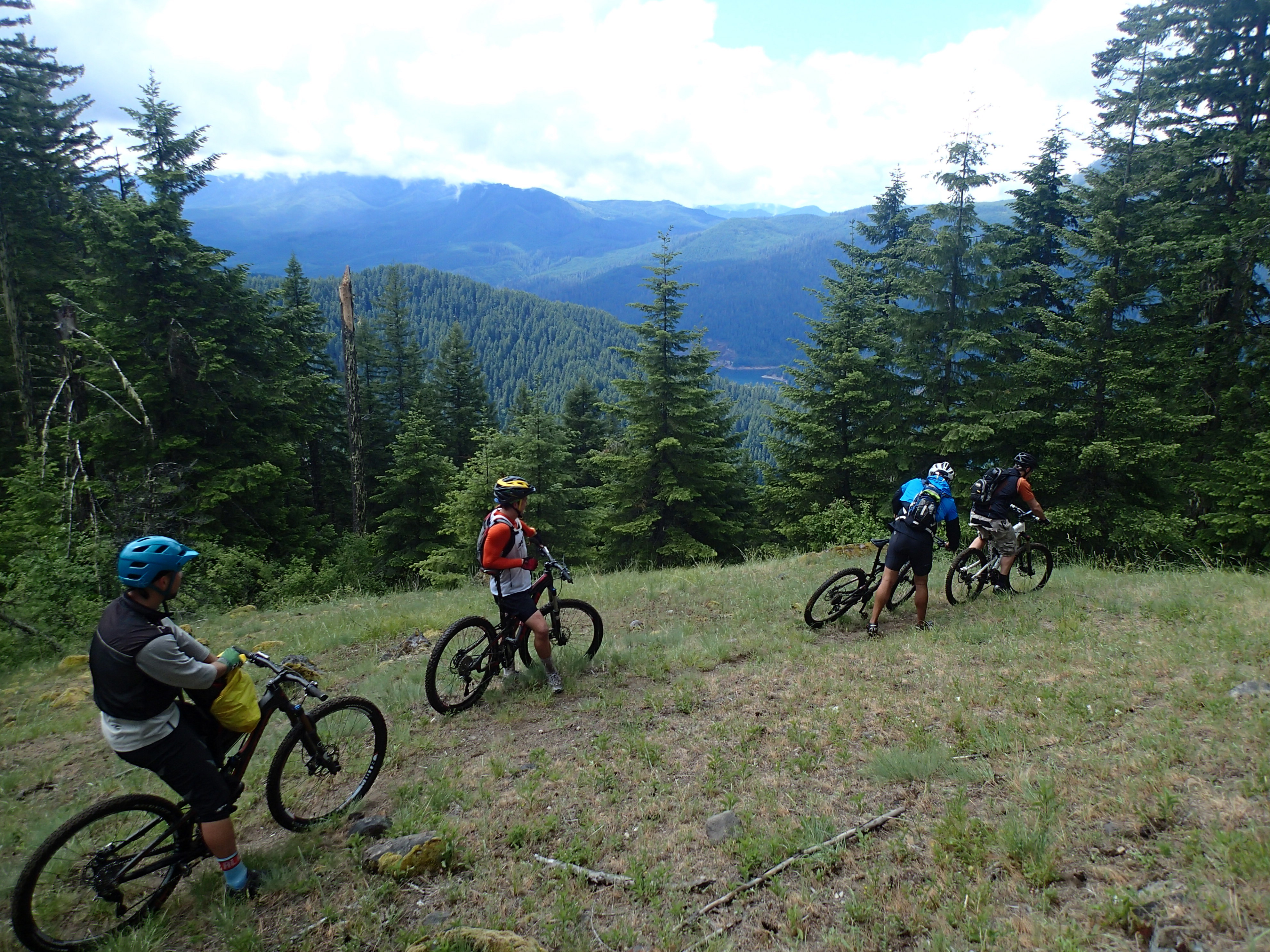
I drove to meet Lev. I turned right on Horse Creek rd and looked for the lodge. I didn’t see it so I kept driving up the road, it entered FS land, pavement ended, then road shrunk to single lane gravel. Didn’t seem right for lodge to be this far back. I turned around. I am marching to the 9:00 start time and I was burning daylight. I saw the lodge sign just a little ways off the main road. Poor sign marking. Met Lev and his gang on time. Overfull van, 2 guys sat in the back on the cooler. The direct road is 1993 which is closed due to slide so we corkscrewed around and climbed to reach TH from other way. Fog. Rain. Wind. Chill. We off loaded the bikes and donned rain jackets.
Our plan was to ride the paved 1993 until a short logging spur climbed to the left, ride that a ways then select the appropriate spot to bush bash down the pick up the trail thus eliminating a nasty single track climb. Plan worked. Last week 6 guys worked brushing and cutting out the trail. Cut out the entire length, brushed a good bit. Nasty old legacy trail.
Catch the view: There is a tiny rider in the fog
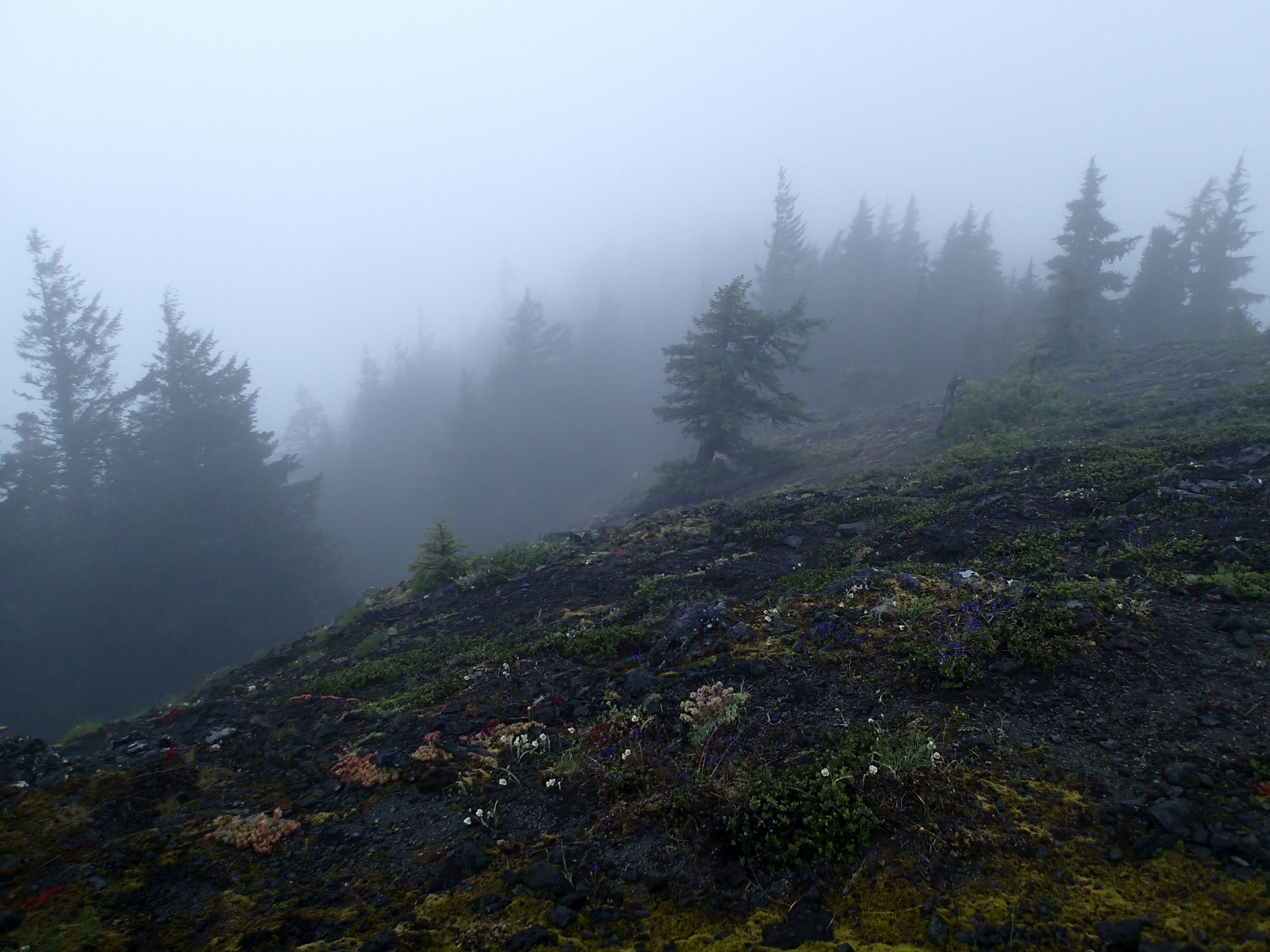
From pic above the trail dropped mostly down. Some incredible rock work to shore up the bench cut trail. Slope was too steep to hold a conventional bench cut. Nasty switchbacks. Then there was some straight down some of the steepest dirt trail I have ever ridden. The Formula T1 brake kept my speed in check. Nasty. Clouds parting later for viewing.
We climbed out on an infrequently used trail, some slithering over wet moss covered rocks. I choked in a rock garden and went down ending w/ a 3″ gash on my right calf. Just let it bleed. Trail joined the Kings Castle from yesterday for the sweet deep woods downhill. I rode off the back because the other guys were stronger and i am more cautious. They never waited for long. Total ride was 22.16 miles taking 3 hours. I climbed 2732 and dropped 6076′. Burned 2492 cals that uses only speed and rider variable to calculate, elevation is ignored.
We rode the road back to the lodge, the same way if I would have ridden it w/o the shuttle.
My brain is responding to the body’s request for comfort and less discomfort (pain). My max HR is 136, theirs are in the 160s where when I was younger mine was.
I hung a little while @ the lodge. I drove up river to the airport to camp. I stayed here years ago. Tomorrow’s forecast is for higher probability of rain. I am passing on riding McKenzie river trail.
Tomorrow I will drive to Eugene to do some city grocery store then up to Fall City for Black Mountain, an IMBA epic. Bike park ride.
Cog Wild is out of Bend, OR. Good operation. They lead an MBA tour of the river that netted them great press in the mag. Local advocates. Check them out: http://cogwild.com/.
My XM receiver is not receiving signal. Bummer.