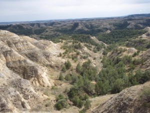
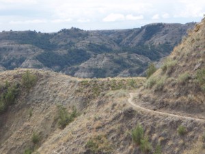
Jamestown Single track & Fargo

My dirtbag campsite selection needs some work: During the night I was awakened by a garbage truck emptying containers behind the strip mall building where I was hunkered down. At least is was quieter than a locomotive and shorter lived.

Bought 5th of Talisker for Bday. ND charges sales tax on top of retail price. Quality Scotch appears to cost the same or more everywhere.

Diesel down to $4.04.

Made Jamestown and searched out Pipestem trail. Took truck route in which distorted directions. Decided author meant Jamestown reservoir and drove to Wildlife bldg to ask trail instructions. I was told, wrong res dude.

Found XG just beyond Wildlife, hot water showers.

Drove to Pipestone Res, meant Bob Martin between his departures. He gave me a trail map and talked about trail. Said he heard it was 1 tough course. Right, I’m here in Flatland USA with no hills or rocks so how could this be tough?

Took off. First thing I mistook the start of the course and rode some of it backwards. Mowed Grass trail tread with some exposed dirt out in the open and some bare dirt in the trees. There is 1 hill side and the course made the most of it traversing up down and across it making the most of maybe a 70′ elevation change. 8 miles generated almost 1000′. Ornery designer stuck several 20% grade climbs. Non tech but way cardio. If you are passing thru and looking to stretch your legs, ride it. I learned that the trail area is about 1/2 mile wide by 1 mile long. Too bad you can’t see the GPS data from the ride.

Hit XG, manager let me play like I was never there for a free shower.

Met Ken Gardner, the care taker of the Pipestone course, and asked him about MN rides. He gave me Island Park Cyclery shop and told of the most fun ride in MN. I called the shop and learned it is Maplelag near Detroit Lakes. Destination for tomorrow and MN ride. Ken and I talked about the course, of course. Complimented him on how well laid out it is, he said tghat guy who designed it moved on. Rick V would appreciate the design.

Drove into Fargo, drove thru town, & found park along perhaps the Red River. Nice dirty brown. Looks like there was a recent flood. Remnants of either a cycle cross or mtn bike race in the park. Somebody designed  what appears to have been a tight twisty course in the grass. Fixed dinner.

Left park after dark looking for a dirtbag spot as this one was right on the tracks again and beleived that it was closed after dark although I never saw a sign to that effect.

Found a spot in a dark office bldg parking lot. See how I sleep.

No pictures today. I wonder which visage is more difficult to get your mind around: A person from the mountains experiencing dead flat land or a flatlander getting up into the mountains? This land is so flat that if you emptied a bath tub of water on the ground, it would stay right there. Lawn billiards. Looking forward to a broken skyline.

Day 2 on Maah Daah Hey to Bismark,ND

From last night:

Found spot W of town on West River Road by a corral but right along side railroad track. Nice spot but trains passed with too much noise. Fixed dinner. Internet speed was way slower than town. Needed to research MN, IA, MI, & IL rides and needed speed. Drove back into Medora, found quiet parking lot but right beside track again. I told myself that it is just a noisy train and because the van shook just meant that I had to dig deeper into my slumber. Didn’t wake up for any trains.

I did wake up to loud whooshing sounds. Looked outside and saw about 8 hot air balloons burning their propane heaters to get airborne.

Fixed Bfast. Walked into town (3 blocks away) to public restrooms, no growler hole dug in asphalt this AM.

Off back W on I-94 to Belfield to go N to Little Missouri Nat Grassland for a section of the MDH Trail at Magpie Camp. About 10 miles of good gravel road driving back among oil wells.

Before I left 2 bike groups visited but they were going S and I am going N.

Take off riding cow pathes and slopping thru cow pies or picking lines around them. MDH trail is just organized cow trail riding. The better riding was yesterday on the Buffalo Gap trail which is a bypass trail aroung teddy’s NP where bikes aren’t allowed.

Rode 9 miles N & turned around after a little more than an hour of riding. No point continuing. After the first several miles the trail idea is the same and the cow shit cumulative. Round trip 18.9 miles with 1800′ vert climbing.

trail kinda of wanders from here to out there, note skyline

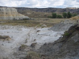
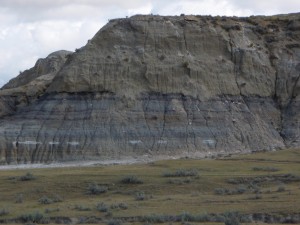
Geology is this was an inland shallow sea that drained away. Strata after strata in soft rock:

stata in "rock"
strata in "rock"

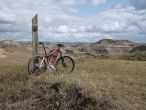
Spot & trail marker and horizon: both keep on going.

More skyline, look @ horizon

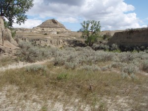
Trail cuts in & out of small drainages. Soil is really unstable & heavy rains created new lines. To the FS credit the trails appear stable.

small creek crossing

Cows. Tom, you want an opinion: America eats too much beef, it will kill people and ultimately destroy our environment from stealing water from the downstream ecosystems, destroying riparian areas, compacting the soil contributing to erosion, and taking the land out of crop growth. Too many business people producing more beef and hay than the market will support so subsidies are spent to keep them in business producing more surplus.

Drove back road E towards Bismark, my resupply point for today. Back roads are less populated and slower but lack towns & grocery stores. Couldn’t find a shower after my ride.

In shopping district of Bismark. Need to find a quieter place for sleep.

Cougs got creamed by Cal.

Tomorrow is Minnesota. Getting harder to find rides along my proposed route.

Medora, SD, Maah Dah Hey trail & CXT

Finish from yesterday:

Drove North from Sturgis looking for public land to dirtbag on. Miles and miles of range land & no shielded spot. Finally I entered a small piece of Nat Forest land. Drove back an slight road & parked right on it. Cloudy at first but @ pee break it was clear and really black. I was miles from any source of light.

Getting colder, no frost yet.

Slept in w/ same intrepidation of poking my nose out of the covers. Used doubled over down blanket. Concern as it gets colder until I get out of it if the blanket will keep me warm w/o heater on.

More miles of desolate road, range land, cows & hay. Lot of unsold hay round bales. Couple of jogs and into ND. At Belfield on I-94 I bought diesel @ $4.09, borrowed a phone book & found bike shop Dakota Cyclery  Mountain Bike Adventures, & called them. Got Jennifer on the horn & learned that she had a shuttle leaving shortly and I bit. Got into downtown Medora, an entry for Theodore Roosevelt Nat Park. She was running John out for a guided trip and I could buy a shuttle ride.

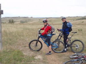
Off West bound on I-94 to Buffalo Gap XG TH. I rode with them for the entire ride. Buffalo Gap is part of the MDH as it skirts the NP. Trail is non technical swooping among cow pies. A bit of rain and slightly chilly. Actually rode with other people, not JRA.

Oh, at the TH was a double CXT outhouse.

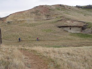
Rode thru some prarie and then into the Badlands:

Jennifer and John, big travel maverick suspension and inverted forks.

Then the trail:

getting into badlands

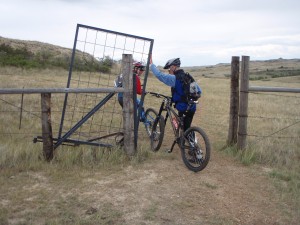
FS has installed a new kind of gate:

gate that can be opened on horseback, spring loaded when let go it is like a sideways head chopper offer

Then into the Badlands:

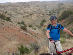
I was there too
I was there too

But then these really are badlands:

Real badlands
Real badlands

Trail section:

trail snakes along terrain

Hit campground right out of town for $3.00 shower and laundry.

Decide to stay here another day and ride some more of the MDH Trail further North.

Off for now,