Test passed

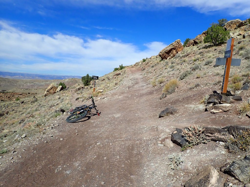
Today I rode shuttle up to start of Olallie Oleary monster ride. The trails are old school possibly built by CCC. No coaster geeks on this ride even with, per Trailforks, 5633′ going downhill. Mixed in was 2113′ climbing over 16.9 miles.

Yesterday I drove from Bend to Santiam Pass area for the night. A large snow park is nearby. I read a hand lettered sign saying closed. ? I drove to the entrance without any sign about closure. I drove in to a sea of 2 man tents pitched off the pavement. I believe I drove int a fire camp. I drove out then continued down the paved road. Big Lake FS XG. I was willing to pay $10 for the night. Drove into filled XG. Sites were on the Big Lake shoreline. Packed tight together. Searched for the night sleep spot switched to dispersed. I found a tract going up a slight rise to a flat open area. Dirt here is finer ash than Bend as grains are hardly seen. Parked over the only patch of wood ships under lodgepole shadow till earth exposed me to full on sun. Was hot.

I saw on my phone mapping that the PCT went nearby. I hiked thru here back in 1978 on my thru hike effort. No memory recall. I do remember bits about my stay at the lodge at the summit.

This morning forecast called for 20% showers. I stuffed my rain jacket into my Wingnut hydration pack. Drove down to Rainbow well down the McKenzie River to shuttle pick up. Just 1 other rider, a young man from Il road tripping. Shuttle ride was an SUV driven by young adventuring woman. A the drop off sprinkles started falling from overcast. Not heavy enough nor chilly to don the rain coat. First part then several scattered sections were encroached by dense vegetation now wetted. Trail not overgrown as the tread was bare but the overhanging vegetation blocks sight. I am a very visual rider I need to see what my wheels will so roll over. Hidden rocks for deflection. Other rider is long gone. During a walk piece I saw a red object on the tread. It was a key fob with a key. I picked it up and put it in my pack. I planned on posting it at the kiosk at the TH. I continued on soon to encounter the other rider walking. I asked what’s up? He said he lost his key and was looking for it. I said I had one which was his. Stars aligned for all that to happen.

The trail is full on old growth forest on the wet side.

Oleary typical

That’s what it is all about.

Numerous places on side hill too steep to cut a bench trail dry rock masonry built up the out slope. It still exists in great shape

out slope rock work

For the second time riding here my bike computer jumbled data differently than I programed in. I only have someone else’s data. I rode straight thru. All by myself. Little rider damage.

Gem of this ride is the descent on King Castle. I didn’t stop to take any pics. Just deep tree cover on woods dirt mixed with conifer needles, lots of cedar. Steve and I rode this same route, we remarked about how long the descent lasted. Good old hiking trail with reroute pieces for sustainability. Several fallen trees blocked the trail, each present its unique problem to overcome. I was able to lift my bike over them me.un Per Trailforks data King Castle is 4.1 miles long dropping 1644′, that’s 400′ / mile. First time I rode here I pedaled up, prolly on my Turner DW 5 Spot 26 wheels and 3X and no dropper.

My brakes squeal when wet. I walked many places that 2 years ago during my pedaling the loop I cleared. I rode this ride because I was afraid I could not. I believe I can close the chapter on this ride. On my own, prolly no. Someone enticed me to join, maybe.

Back at van I put my woods dirt spattered bike on the rack then unlooked the side door, my entrance, and stepped in out of the drizzle. My feet squeak in my shoes. I changed into dry clothes.

I visited with the owner of the shuttle service. He shuttle drove me up one year, we remembered each other.

Drove back up to last night’s spot at Santiam Pass. Hoodoo ski hill here. Strong internet which is reason I published this.

Not really beaten. Earlier my pulse was just 70 which is above morning rate of high 40s, yet showing little effects of the ride. Ate large skillet of my home glob.


It’s ash

Recently at the end of my ride at the Deschutes NF Welcome Center I stated a conversation with a FS person about pumice tread. He shortly corrected me telling me what we ride on is really volcanic ash. I used the opportunity to learn more from him about volcanoes. Ash is fine granular particles composed of rocks, minerals and volcanic glass. How long I went on with duh stupidity to what pumice is, here I assumed the pumice had been ground down. Pumice floats and in rock form it looks like a sponge with openings all over surface. His information took me thru my memory to recall riding Big Bear in CA that was on pumice. Tires crushed it which sucked energy plus your dust plume. OK so I scooped a sample of “dirt” (?) what should it be called? I put water in a clear glass vessel then poured some sample in, went right to the bottom: no floaters. Grain size is tiny. Perhaps the Big Bear pumice dust most closely resembled legendary moon dust.

I take on well water at the same place. Many visits I wet my washcloth with earth temperature pressured plentiful water wipe off my body. The FS station flies the American flag 24X7 both opened and closed. Flag etiquette is to take down….. .

So, first 100 degree heat wave passed followed by hot but bearable temps slowly dropping for below 70 degrees sleeping. My Dad said that the body needs below 70 degrees for full rest.

Now in short lived 100 degree burn. It is what it was. At 8:58 PM at 5,810′ elevation it is 80, down from 98. Temp inside van is 82.

Forest fires on wet side of Cascades. Several are along route 138 which follows the Clearwater then Umpqua rivers downstream. I was a summer FS employee on the Umpqua NF based at Toketee Ranger Station back in 1969 and ’70. Back then local knowledge was the Umpqua never burns. It’s located on west facing divide sucking up too loaded to make the divide clouds rain, Been dry many years. I rode the North Umpqua Trail several times before any of the burns. Fires.

Just been riding. Today’s clean clothes clipped 5 liners on the line. Means I rode 5 out of 7 days. Still here outside Bend. Recent ride data was identical to a previous ride. 15.2 miles climbing 1345′ pedaling for 2 hrs 1 min. Average beats per min was 116. Same results.

Maybe 10 rides ago my chain stretched to .5, time to replace. I put on new same PC1170 chain on existing drive train. First ride I discerned noise indicating wear issue. I removed chain and replaced old chain. No noise. 2 rides ago I replaced the chain ring with same Absolute Black 30T ring and put on the new chain. Success, drive train is happy. 4294 miles on chainring. Cassette remains on the bike.

Sat I booked shuttle ride for O’leary over on the Mckenzie river drainage. Big ride even without shuttle. This will be a mini evaluation of performance without climbing Olallie. Trailforks route shows 16.9 miles climbing 2113 and descending 5633′

Driving part way over tomorrow spending night at Santiam Pass. The PCT is nearby. I hiked thru here on my 1978 thru hike effort.

Installed new handlebar, a PNW Loam carbon bar. I researched bar configurations after learning about sweep and how angles affect shoulder. Revel bikes specs handlebar that has measurements. I picked Loam. This afternoon at Swampy TH I removed old and installed new. Minor difference. Replaced handlebar has been subjected to many years of wear and exposure as my bike is only covered when raining. Expectation is same dependability and longevity. I loosened a bolt on the dropper post lever loosening cable tension which will require professional attention tomorrow on my way out of town.

Ulcer needs more healing time with another unna boot wrap for this week.

So much for this evening. 77 degrees at 9:45 PM. Door and window open to breezes, electric 8″ fan is blowing air towards back of van. Sleeping temp on freshly laundered sheets. I need to make bed first.


Smoke now added to conditions

Fires and more fires. Until this morning Bend smoke remained elsewhere. Earlier I checked air quality which was just yellow, OK to ride. I geared up, outside smoke was becoming more noticeable. I sat down then looked at the web site: air moved to not good, do some less strenuous activity. My breathing should be protected at this level. I rode yesterday, tomorrow has non bike riding events, making Fri next ride day: 2 rest days in a row, Sensibility becoming more the norm. Big area of even worse air is east of here like Burns. Forecasted wind is to become westerly which will blow that smoke away. Perhaps riding later in day.

I have been riding and staying up at Swampy paved parking lot at 5810′. I prefer the trails up here as they are more rugged and certainly less crowded and beat. I am there now with slow internet.

My introduction to the Oregon Cascades was back in 1969 summer employment with the forest service on the Umpqua National Forest, Diamond Lake district at Toketee ranger station on the wet side of the Cascades. I was a tallyman for a timber cruiser in presale. That work was about setting up forest to be harvested, hiking virgin forest seeing big trees that would someday be deprived of life. Bend is on the dry side with less water needing flora, nowhere near as dense.

The Deschutes NF, the local forest, has put out a proposal to allow m-bikes on select trails. I don’t support the proposal. I provided my opinion:

“Prevent adult obesity! Keep present non-motorized trails 100% heart propelled. Pedaling motorized bikes (M-Bikes) burns fewer calories per unit of time spent on bike than pedaling hence increase in unburned fuel which becomes fat: obesity.

The Walton Family Foundation realized childhood obesity is a health problem. Their solution was funding mountain biking and putting kids outside pedaling mountain bikes.

M-bikes are expensive. Riders who ride one are prolly the same golfers who ride golf carts instead of walking. They can afford the luxury as their pant’s size increases.

Obesity adversely affects health care costs.

Prevent obesity and make America thin again.

I am against the Deschutes National Forest proposal to allow motorized bikes on current non-motorized trails.”

Trails up here are not in the proposal.

Tree cover up here is lodgepole and hemlock determined by sun exposure. Trails I ride go through each forest type.

Flag tie, hemlock virgin forest
On Swampy,

You are either a rider or a tourist, mutually exclusive. Tree cover is like blinders on a horse, the trail is a corridor, eyes focused on tread, body responding to commands, attention is rider. The overall quality of the present is enjoyed being in it.

Air quality moved further into unhealthy, further justifying rest decision.

Bend is a repair spot for me to attend to whatever. My departure is affected by completion of last needed event. My ulcer doesn’t seem to be happily recovering so I scored an appointment for tomorrow. The front end of van has an undiagnosed issue that I want further investigation so that is 8/7. Forest fires are burning. Hanging here is comfortable.

Turns out my wireless internet receiver receives strong enough signal to upload above pics. Phone internet is slower.

I was told by a guy who was told by a soil person working for the FS said that the dirt here is hydrophobic which means water doesn’t activate bonding. He said that is because of the origin of the dirt, which is volcanic, is cooked material.

Addiction. Day 6 of no chocolate or Werthers. At first I free ranged consumption. I realized I eating too much. I established a consumption amount which I followed. I decided I wanted to full time kick, today marks 6 days no chocolate. I am spending mental energy to block craving. I need to create my desired acceptance. It’s the chocolate I want.

So. I sit outside in the sun for an hour to change the color of my skin. 60 mins full on sitting reading. I might go for a forest walk for additional accumulation albeit it shade affected. Multiple tan lines.

I will be setting the timer shortly.