<!– /* Font Definitions */ @font-face {font-family:”Cambria Math”; panose-1:2 4 5 3 5 4 6 3 2 4; mso-font-charset:1; mso-generic-font-family:roman; mso-font-format:other; mso-font-pitch:variable; mso-font-signature:0 0 0 0 0 0;} @font-face {font-family:Calibri; panose-1:2 15 5 2 2 2 4 3 2 4; mso-font-charset:0; mso-generic-font-family:swiss; mso-font-pitch:variable; mso-font-signature:-1610611985 1073750139 0 0 159 0;} /* Style Definitions */ p.MsoNormal, li.MsoNormal, div.MsoNormal {mso-style-unhide:no; mso-style-qformat:yes; mso-style-parent:””; margin-top:0in; margin-right:0in; margin-bottom:10.0pt; margin-left:0in; line-height:115%; mso-pagination:widow-orphan; font-size:11.0pt; font-family:”Calibri”,”sans-serif”; mso-ascii-font-family:Calibri; mso-ascii-theme-font:minor-latin; mso-fareast-font-family:Calibri; mso-fareast-theme-font:minor-latin; mso-hansi-font-family:Calibri; mso-hansi-theme-font:minor-latin; mso-bidi-font-family:”Times New Roman”; mso-bidi-theme-font:minor-bidi;} .MsoChpDefault {mso-style-type:export-only; mso-default-props:yes; mso-ascii-font-family:Calibri; mso-ascii-theme-font:minor-latin; mso-fareast-font-family:Calibri; mso-fareast-theme-font:minor-latin; mso-hansi-font-family:Calibri; mso-hansi-theme-font:minor-latin; mso-bidi-font-family:”Times New Roman”; mso-bidi-theme-font:minor-bidi;} .MsoPapDefault {mso-style-type:export-only; margin-bottom:10.0pt; line-height:115%;} @page Section1 {size:8.5in 11.0in; margin:1.0in 1.0in 1.0in 1.0in; mso-header-margin:.5in; mso-footer-margin:.5in; mso-paper-source:0;} div.Section1 {page:Section1;} –>
This post is for 8/31:
Last night Taylor, one of the 3 husbands on the other campers and a mountain biker, filled my notebook pages with ride ideas for the rest of my CO stay and beyond. I reeled him in with the parameter that I have 3 more rides to do in CO, give me 3 good ones. He did.
Said goodbye to the husbands after some sharing of how I am living and plans. Wheels started turning, plans, I’m sure, where cogitating.
Off to Kenosha Pass further S on 285. I drove back into Aspen Park for resupply, found Safeway, super store. Bought h20 etc. Filled my h2o jug and drank. It was tap h2o run thru h2o filter. I anguished a bit & finally turned around & drove back to store. I found the manager & told him of my discovery. He played dumb & no action. He should have tagged the machine as out of order.
Drove up to Kenosha Pass. Getting complacent, I didn’t research the ride. Trail head is back @ 10,000′. The frige quit, and I am riding @ elevation again. Headed S on Colorado Trail towards Georgia Pass. Trail @ first threaded its way over roots, rocks, & aspens. Crossed Jefferson Creek & climb started in earnest as did the roots & rocks. Getting better at making balance moves. I still look down when I get into trouble which throws my balance right off the tire contact patches. At 1 hr 40 min and about 3 miles to go to the pass I stopped for food. I did not replenish my supplies as I again, did not plan this ride. I decided to turn around @ 3:00 because the return trip had climbing in it and I was getting beat. Still took 1 hr 35 min back to TH & that included some fast ST interspersed w/ the climbing.
I have never ridden a trail as rooty & rocky and not beaten by dirt bikes. Add some 20% grade. Real work. Descending was almost as fun except gravity replaced the pedaling.
Taylor laid my route out as ride CO Trail till just before Georgia Pass and drop down JEFFERSON (not Jackson) and intersect with CO Trail @ a road crossing. I turned around before reaching the trail junction. Later when I down loaded the Garmin GPS onto Nat Geo TOPO I learned that I was about .9 mile from reaching the trail. However, not having a map, I was not able to corroborate the FS hike instructions which indicated a 3 mile road ride to connect trails.
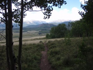
Got rained on several times, neither for very long but the rainfall was intense.
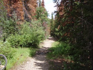
And then the trail got tougher:
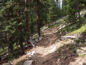
This piece of trail was about the smoothest:
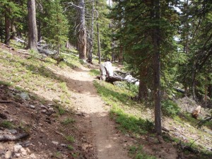
The downhill was fun picking good lines over rocks & roots. Had a few tree brushes as I chose the close to tree line. No flesh or jersey material left behind.
Back @ van, frige still running @ 10,000’.
Fired up computer @ researched TOPO looking for a place to camp. I decided Bailey which is a@ upper end of road 543, Buffalo Creek road. Lower elevation for frige and ice cream. Abandoned that when I saw the first gravel FS road to the N. Turned off on first spur. Parked in a parking lot. This is where the gas people hang.
Washcloth wipe down. Start dinner and then they arrive: Kid pit racers. There is a short step trail from the parking lot down to the road below. 3 bikes, whrom whroom, about 1 hour of it. They are off approved trails, probably weren’t street legal and were wreaking environmental damage. I fumed, I didn’t take action.
Last night high in the mountains, camped @ 9900’. I ate 1 Hagen Daaz ice cream, 1 more to go. Frige needs to work all night.
Tomorrow is Bergan Peak right near Whippletree. Had enough of their food to last. Just the ride.
Shoes bother my feet & knees. Bottoms of feet get tender. Knee pain might be from cleats placed differently or the shoe is either higher or lower than the other Specialized shoe.
Dark @ 8:00 & chilly.


