Back in Bend… again

Thank y’all for your congratulations on my accomplishment. May I be an example, some are already here, others at the other end would never consider this life. But, it’s y’all in the belly of the bell shaped curve that letting their thoughts entertain getting something for themselves. Fourteen years.

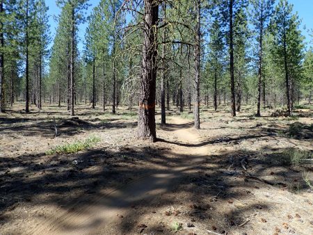
Tuesday I finished the drive to Bend ending at a new preferred spot off rd 41. Early enough to go for a ride later. Dealing with sting of failing ATCA. Riding from here I traversed on Cartch and Release to start of Storm King and a climb. I find that as each climb is completed that the climb is less avoidable, it hurts less. Storm King has several climb pieces mixed in w/ less steep pieces. A safety meeting at the hub intersection of Storm King, Funner, and Tiddlywinks. I climbed a short piece to Tiddly which is dicey avoiding downhill riders who think they rule. No company. Made Larsen’s climbing up to Tyler’s, again all alone. Desended Tylers which from here is still woods trail before it becomes a flow trail with bermed bends. Shade and daylight patches on the ground playing havoc with my learning of what’s on the tread. Bottom out at start of Catch and Release back to van. Rode same ride on 7/12, results are all but identical, still a 1,200′ climb in 14 miles. Bend pedalable trails.

My phone does not flash left messages. I called voice mail on Tues, a message from dentist cancelling my cleaning sent on Mon while I was in Oakridge. I built my schedule for Wed cleaning. I would have stayed in Oakridge longer and put to bed ATCA. No 6 month teeth cleaning.

Next boogie in my mind was climbing up Skyliner, Upper Whoops, and Sector 16 instead of climbing Tumalo ridge. Goal was descent of S Fork for time verification. Skyliner is mix of ups and downs while gaining intersection with Upper Whoops climb. Trailforks shows the climb being on a road. The road is inside a logging operation no longer closed. Heavy vehicle traffic beat the dirt to pumice flour about rim deep. Never again. beat up road stopped at unit boundary, becoming a beat up non maintained logging road. Previous to logging that’s prolly what the road was like. I rode this one to GPS. I know of another way that I will take next time. Riding Sector 16 against primarily coasters with mostly short sight lines caused apprehension of a head on by a rider not looking ahead. The one guy I encountered was tuned out. I caught light flashes of a descending rider well before our 2 objects attempting to be is same space. I pulled over. I said something before I noticed ear buds. Only thing worse could be an ebiker wearing earbuds. Whew, rode SST up to Swampy around then dropped down S Fork. 3.16 miles dropping 905′ took 16 mins, still 1 min slower than last year. Rounding minutes, difference might be seconds. this trail rocks. Then the speedway down a piece of Tumalo creek trail. Max speed was 22 mph, the speed freaked me causing me to check brake 2x, perhaps enough to only hit 22. The bike is dead stable. My nuts are shrinking. Steve said that it’s an aging thing. Afterwards I waded rolled up riding shorts depth in Tumalo creek. Too cold for a full immersion.

Out to past Phil’s hoping for preferred spot under shade. Score. Staged for in town laundry day. The road is a driven in dirt track gone to loose dirt. Numerous rigs went by in their quest for a camp spot. Most drive by in a plume of dust, no slowing in consideration of their dust effect.

Clean clothes, line dried clothes dry by night. I visited w/ a young man in the laundromat. He’s car camping living on the road, now 2 1/2 years tent car camping sleeping on the ground. It’s like riding a single speed, just because you can, do you need to?

I headed up to Swampy. I passed a long haired guy with a full size backpack. I looked at him, he made eye contact as I drove by. I can do better. I turned around then went to offer him a ride up to Swampy. I assumed he was hiking the PCT heading back to trail where Swampy is short of trail access. No. He is from Amsterdam on a see some of America trip. His route was further along. He consulted his map and listened to my advice then headed out on the same route I would shortly ride. I followed his footsteps in the dirt till I caught him. He was on his way as was I.

Yesterday’s ride was 2 hrs 35 mins for 18 miles climbing 1903′. I should be kind to my body on a ride today. Excellent choice Swampy. here is about 2,000′ above Bend making for less hot temp which hit Bend for 90s. Start off with climb up Ridge, Flag Tie

Flag Tie

Then descending Lower Flag to Swampy. Longer sightlines allowed for longer fast sections. More lodgepole cover and open versus S Fork which is fir and hemlock deep cover. Turn left on Swampy heading clockwise around lake. Take catch to other leg of Swampy. Decision time: shorter less climbing straight ahead or right turn for grunt climb up to Ridge for long descent back to Swampy. Ah, learning to embrace the 46T cog to power my way up. Left turn on Ridge coasting back what I climbed on the way out. Nice ride. 9.37 miles climbing 1004′.

This about that: East side versus west side of the cascades. This is East: 4,000′ volcanic desert. Desert because little precip because in rain shadow of Cascades. That is west as in Oakridge, under 2,000′, bathed from rain laden clouds lightening their load so to speak. Wet, dense tree cover, mud, organic material on ground, slugs. This: volcanic pumice, no organic, dust. The county road my property is on is unpaved. I watched dust clouds stirred from passing rigs. The road dead ends into the forest 4 properties to the west meaning no thru traffic. My land is pumice with duff from Ppine and lodgepole trees. Desert. Dry skin. No mosquitoes. That is mostly about downhill, is about 90 mins away. Oakridge is a town that needs an economic engine, a resource to be exploited including labor force. Ray’s grocery. I remember years ago there was a Ray’s in part of town I frequent. Later a safeway was built across the street. Ray’s went away. Small towns, bigger towns.

Last night I slept with the door open, tonight at 5810′ the door will be shut, chilly 59 degrees and dropping.

Here for another day to avoid heat.

$12 piece of King salmon for dinner. Steamed.

Visited a Little Library today in the Safeway grocery store lot. Picked Scott Turow book and gave 2: Waters’ Liarmouth and Walter’s short stories.


Cause for Celebration

Today starts the 15th year of my vagabond life. Just so many of so many.

2,870 rides covering 41,485 miles traveling in my 15 years old Sprinter  , 281,xxx miles, body is 72 years old, 4 bikes, and more. Been there, ridden,  moved on. I learned about recording data back at work, I record in 2 spreadsheets, mountain biking and living. Data.

Yesterday I paid for shuttle up to Alpine with ATCA on my mind. However, my body was not sending positive vibes. This ride was the 7th in a row, previous 2 days rides were hard. Alpine starts climbing right away that I worked hard on a cold body, the first evaluation point.

Foggy up high

Sourgrass mtn

Bare stalks are dead bear grass from previous bloom 2 years before. That bloom was something to see as I did that year.

Continues mostly down.

Jedi section is through old growth trees


Alpine Jedi section, old trees
big ‘en
East looking, Mills lake back

Above is the only open vista on entire trail which is under deep verdant tree cover.

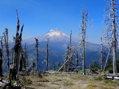
Just through the above opening the intersection of Tire mtn, the T in ATCA. Put up or shut up. I did not want to make the big climb out of C in ATCA, Cloverpatch. I rationalized my abandonment of big ride was planning on a return trip in Aug to ride it and be in better recovery state. Yeah. I could make a loop ride trip first riding O’Leary Ollie loop as warmup. (?).

Oakridge is on the wet side of the Cascades. The trails are under deep tree cover, moist. Tread is mostly loose dirt tread. Narrow tread because of build and also no uphill riders to cause tread not in the tread. I spent last night on Larison rock road to enjoy the wet side.

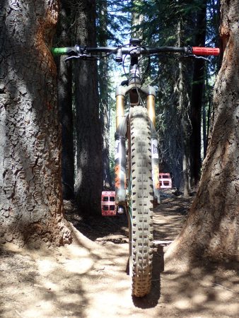
Alpine, well established notoriety on bucket lists. Edge seems to not record when speed is low so its ride data is understated. It showed 12.7 miles, climbing 931′ and descending 4318′.  Pay attention, all the challenges requiring skill execution to remain upright and some degree of control. I have become more comfortable on this Revel Rail bike. That elevation drop. Shuttle costs $30. 99% of ride I was alone.

This Wed I have a teeth cleaning appointment which means back in Bend. I anguished over how to spend the next 2 days. I needed to rest today then ride on Tues etc. I could hang in Oakridge today then ride ATCA on Tues then drive back towards Bend. I could have made a loop to McKenzie river to ride O’Leary. I chose driving over to La Pine for the night then on Tues back to Bend riding. I wanted to cruise La Pine for what I could see and sense. Ray’s grocery store ain’t Newport Market in Bend, even Safeway. La Pine is a wide spot on US 97 bordered by US land. It is what it is. Is that because lower income pinching pennies for food, or is it the store’s policy to not carry more expensive choices reflective of better quality of product? Yesterday I bought chicken thighs in Oakridge, the label read something grown in America, not organic or other healthful claims. Today at Ray’s in La Pine I found the better chicken I prefer. More $ here in La Pine. Still no aged Gouda cheese.

Celebration is time at my dream house location. And empty mouse traps.

Oakridge

Change. Happiness is having the I9 rear wheel back on after Thurs ride. Thank you I9 for 1 day turn around rebuilding my wheel, UPS put the wheel on their doc on Thurs, Friday they ask for a ship to address, I gave TJ at The Hub Cyclery address. Thurs afternoon I parked under a shade tree at TJ’s then did shade tree mechanics to swap wheels. I cleaned up the loaner then returned it to shop. 12 rides covering 165 miles of no quick hub engagement.

Now I will head over to Oakridge. I spent Thurs night on my piece of physical ownership. Quiet and dark.

Friday morn I drove to Oakridge, elevation 1333′, the lowest prolly since last year here. Drove by Randy’s shuttle shop that is now an empty building. Gone is local comp shuttle. Visited at Merchantile then drove to Greenwaters city park which is at bottom of Larison Rock trail. Larison is a shorter  downhill of 3.21 miles dropping1936′ taking just 20 mins after 4.0 miles of pavement climbing1670′ in 1 hr 3 mins non stop pedaling that’s 417’/mile. Rode in granny gear for most of distance which is really a friendly gear. Change: Oakridge is on the wet side of the Cascades meaning verdant big trees and no pumice. Shade dappled sunlight plays havoc with me reading shadows. The trail dropped 603’/mile. Handful of a descent. Part way down a threatening cramp said hello, I stopped to let my leg relax. Trail is old narrow single track, bench cut on steep mountainside, heavy tree cover hides the exposure. Smoked my body on the climb.

Salmon creek is way too clod to immerse more than my lower legs. Cleaned up then drove up to old town, the original location. I booked a shuttle for Alpine on Sunday. Visited brew pub formerly Brewers’ Union, now Three legged Crane. Salad for dinner while sitting at the empty bar. A woman arrived walking behind the bar in front of me. We looked at each other, it was Katrina, such a warm sight to greet and she called me by name then we greeted each other with warm hugs.

Spent night at bottom of Dead Mountain trail, end of today’s ride. Warm night.

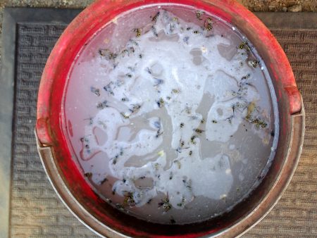
Damn, still hearing mouse skritches. Set 3 traps out, this morning 1 did not get away. I use 3 different traps, all by Victor from Lititz, PA, the next town over from Manheim where I lived for 6 years back in the 70s. The oldest trap has a metal trigger, the newer one same config but has a plastic paddle, and the newest which Steve gave to me. So far the middle age trap leads the capture. I will change locations tonight.

they did not go home

Today was Dead mtn loop from anchor spot. 16.5 miles climbing 2546′, pedaled mostly non stop for 2 hrs 49 mins. Again 46T granny was my friend. I needed 1 hr 10 min to cover 8 miles of pavement then the grunt took over for 2.57 miles climbing 1138′ gravel for 39 mins average speed was 3.9 mph. Solid effort.

Dammed Middle Fork of Willamette from Dead mtn
closer is last year’s fire that closed Heckletooth, patchy burn

Then the descent: the upper part is machine built flow trail down to became old hand built trail, legacy hiking trail that has been modified for bikes. 5.77 miles dropped 2369′ in 39 mins. I came upon a gaggle of adults and young kids. I visited with them at the bottom, 7, 8, and 11 year old boys, wheel sizes smaller than 26″.  Poison oak.

Wiped down clean. Writing this in the park.

Wet side: Doug Fir, tall trees. Logging.  Trails are more difficult than Phils. Trails are road climb up then single track dirt down.

I will be here till Tues eve as I will return to Bend for a scored teeth cleaning session.

3 shuttle services here. Riding here is downhill. Larison and Dead are shuttled, some paid $ I paid in calories. I will pay for ATCA tomorrow.

Off to social evening in old town. There is a local distillery that hosts open air music and drinks made with their spirits. Cool small town happening.