S,S,S

(3) letter S.

Sucker hole

Strange bedfellows

Stupid

Suckerhole happens when there is a break in shitty weather and you just need to be on your way. The weather break closed down with a vey heavy downpour. Forecast said like 40% prob. I parked at rd 41 spot where  Catch and Release is maybe 50′ away. I wave at riders going by, so far nobody has stopped to visit. Sprinkles started during my ride, thunder said serious. I shortened my ride to stay dry. Not long after Being inside rain fell. Thunderstorm gentle pour for short while then stopped. That rain would turn these trails to hero. I thought about a short spin, that was all. More thunder then drenching downpour. Watched weather thru the windshield. Early riders tomorrow will be in pig heaven.

Strange bedfellows.

Maybe 100 yards down the way is that freshly dug badger hole. I wanted to see of any activity. A ground squirrel stood up in the mouth of the hole. It flinched then ran down into the hole. Summation: the meat eater not at home or disposed.

I rode rest of Catch and Release where a newer trail, Afternoon Delight takes off. I rode that to junction of Roundabout going to my left. I helped build some feet of that trail. Loop around turning right at start of Afternoon Delight then Catch and Release. At that junction

Stupid

In general area of the above intersection riders are riding fall line dragging brakes. Rainfall carried lots of loosened dirt onto the road.

fall line erosion

Rain washed the smoke down to clear up the skies

Beautiful weather after yesterday’s heavy rain cleanse

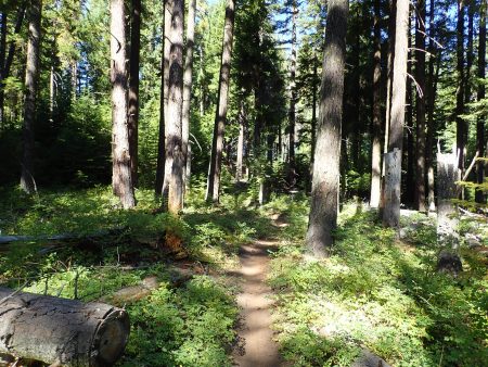
Trails are well executed. I like riding these Bend trails because only heart propelled allowed and no horses. Primo tread.

Was no cake walk, 20.5 miles climbing 1516′, 2 1/2 pedal. Hot but not scorching.

C&R trail day after heavy rain. The lighter dirt as fines, see next pic
Fines

Current resident on my property:


aaaassssssddttt

ATCA: check

Sunday 9AM met with Cog Wild shuttle at West Fir for shuttle ride to Kate’s cut in for start of Alpine trail. ATCA initials stand for Alpine, Tire, Cloverpatch, Alpine. Today I will punch thru reservations of confidence and see thru it to the end. Kate’s cut in was a social trail, FS laid the trail out, Thurs, 2 days before Cream Puff Derick Bell and I built the official trail replacing social while fulfilling need to cut in to Alpine at a favorable spot from the logging road. Two shuttle vans preceded us as we shared the road in opposite direction. There were just 3 other riders in my van. Small number of riders. Today I concentrated on being nice to my body, I used granny and plug away pedal stroke. A 1,xxx acre forest fire near Waldo Lake is putting up smoke that we encountered far up the way. Air quality was yellow in Oakridge. Smoke visible at drop off. I pedaled away. Trail breaks out of timber at top of Sourgrass mtn, some years into full on Beargrass bloom. Today dried stalks remain in the leaves of the plant. Today, well,

Sourgrass mtn top, smoke

Forecast called for winds to blow smoke away. I harshed my lungs breathing the solids. As I dropped down trail the smoke cleared. I arrived at decision junction in fine spirits so I committed to the big effort.

Alpine, green gone to brown, smoke

Tire Mtn is thru old growth forest, such and experience to spend moments in old nature. Trail drops and drops never steeply to junction with CloverPatch which starts pay back. Old growth here also. Lower elevation enters poison oak zone. Trail ends at logging road, turn right then descend steeply good shape gravel logging road. Numerous limited sight line bends precludes letting it fly in case of vehicle uphill traffic. Concern this time was for naught as maybe a 3′ fallen tree spanned the road being too low as to block all but  smallest traffic. Turn left uphill on little used FS rd 130 for the climb back to Alpine. Hot sunny, I steered thru patches of shade on the road part. Trail leaves rd for handcut tie that works its way upwards with numerous climbing turns and small coast sections. This piece ties in with recently completed hand built singletrack bypassing Buckhead shelter and more road riding. Trail ends on Alpine. This climb was 3.83 miles climbing1293′, took me 56 mins of nonstop pedaling. Well, no stops longer than 1 minute blow. Hot. Finished on Alpine down. I passed riders up high stopped then I was all alone. 23.7 miles, climbing 2943 and descending 6161′ the most since Whole Enchilada. Hot.

Last year I was shown a path down to the river under Red Bridge. I found it overgrown with blackberry canes mixed in. I cautiously placed my feet avoiding grasping thorny canes for balance. Made the river, I was told this is the warmest water of all the area. Wonderful no bite chill to lower body temp and rinse off residue of effort.

I drove the river road back to rt 58, several places there were many pickups parked at turnouts for river access.

I decided to stay overnight. I drove to Greenwaters park scoring some shade. Park is a bottom of Larison rock trail. As I was preparing to leave for Mexican dinner I watched a white pickup with a mtn bike hung on the tailgate. I followed him all the way to my chosen restaurant. I exited my rig first, I invited him to share a table. I only knew him as a mountain biker so we had that in common. We connected: I visited with him during previous visit to TransCascadia shuttle site. He told me about Chucksney mtn loop. We shared a booth for dinner. Nick, 29 years old doing what I would have liked to live if I had known.

Visited at Pub for glass of wine. Drove out to Dead Mtn TH for the night. Hot, side door open and small fan blowing. Temp dropped below 70 before I slid into bed. I was so wasted from the ride I was too tired to fall asleep.

Cedar Creek fire is burning west of Waldo lake with access up Salmon Creek road where I was. Many many fire rigs headed up to fire. Oakridge has several fire camps. Sat night I noticed firefighters in town. Firefighter safety rules limit number of hours worked per day and in a stretch. Seems like the wildland fighters put in a days work then drive into town for dinner and a bed. I spent my summer between junior and senior year of college on a fire crew when stopping the fire was what we did. We lived at a spike camp within walking distance of the fire line, from can’t see to can’t see. Scoring a paper sleeping bag was cool, scoring a second one was like a 1 star motel bed. Anyway, they do not know of those old days, they are living by today’s rules.

My sink water pump had issues such that I wired in a switch to turn it off when acting up. Sat afternoon it failed to pump. I checked over my wiring assuring myself that wiring was not the cause. Pump died, I wanted running water. I googled RV stores, found one at Eugene, straight down highway 58. I called, guy had last one. Could I make the store before closing. Maps said I could. I drove at the upper speed limits to make my purchase then returned to Greenwaters shade to install, this time without switch. degrees,

I’m parked inside the envisioned house perimeter on my land. I envision sun exposure to my house. Midafternoon exposure. At 7 temp was 85 degrees. Now at 9 PM it is dark and 75 degrees. Sunset tonight was thru smoke to the west. No screens covering van openings.

I succeeded in making today a complete rest day and worked at rehydrating.

on July 22, 2020 I first rode the Olallie O’Leary loop, first ride time was 4 hrs 21 mins, this time it was 6 mins slower. Age.

So, I have completed two of my Whys. I am warm and fuzzy inside. But Why? My observation of aging is the older one becomes the less active they are, stasis is life’s reward. WHY do I not sit out? What I do is physical effort, most times past comfort zone. Just keep doing it.

5270 feet up

Yesterday I pedaled the Olallie O’Leary loop above McKenzie River, settlement of Rainbow. Why? The ride is a monster, it’s out there, all by myself, exposure, brutal amount of hike a bike, fast descents, vegetation over growing hiding what’s on ground or sticking into the trail, hot, for starters. To me it was testing my mettle. I worked myself stress wise leading up to start of ride that I did not talk myself down until minutes and miles on the pavement passed under my wheels. The ride is within my capability for fitness, skill, ability. I exposed myself to testing and I PASSED. 72 years old.

Over the years I have paid for shuttle which eliminates all of Olallie climb and once I pedaled the loop several years ago. Took an hour of pavement and logging road climb to arrive at start of Olallie. All by myself. Trail does nothing but climb on steep mountainside thru varying patches of green and burn. Narrow hand built bench cut trail. Well laid out, the trail had to climb to the ridge which it did. I struggled climbing stopping for blows and pushing my bike in between. Hard to walk bike on skinny trail.

Olallie
Olallie scattered live and burnt
ground fire burn

Darn EDGE either doesn’t record data at walking speed and numerous stops or just fails. It did not record almost 3 miles of Olallie. It shorted my effort, Backcountry Navigator gathered it all less HR etc. BCN recorded 26.5 miles climbing 5270 feet, almost a mile up, pedaling for 4 hrs 27 mins for ride. Tops the list for most climbing.

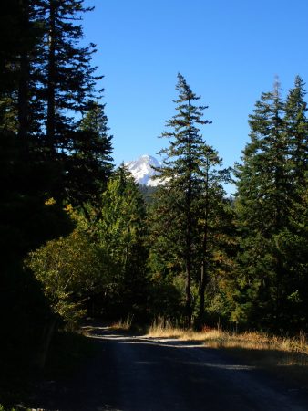
summit of MacDuff mtn, looking N, Hood out there

Reward was descent of King Castle, 4.1 miles dropping 1,644′. Last year Steve and I shuttled this ride. I remember saying that this piece never seemed to end and was so much fun. Today I looked forward to its end as I wanted to return to my comfort zone. Deep tree cover with patches of old growth. Dark and shadows.

Day went by, almost 7 hours on ride. Plan was to drive towards Oakridge on FS rd 19, Auderheide. Twisty, narrow, smooth pavement climbed up a tributary of McKenzie River, crested at Box Canyon then descended fork of the Willamette. I needed a sleep spot. Numerous pullouts seemed to be for river fishing access. I picked one for the night. Big trees and lost of them.

sleep spot on S Fork McKenzie river, big trees.

This morning I finished the drive to Oakridge.

Several forest fires are burning. One is near Waldo Lake above Oakridge. Air quality here is still green.

I booked a 9 AM shuttle with Cog for ATCA. EDGE calculated 4 days recovery before next hard effort, I will be inside that time fence.

Towards the end of yesterday’s ride my left knee started talking, seems to be bone on bone issue.

Thurs was a jumble of things to attend to before I left. Laundry day. I pulled the bottom sheet off my bed, it tore in many places, worn out. I drove out of the way to Bath etc to buy a sheet. Smallest size is a twin which is way larger than my 36″ wide bunk. Washed it with rest of clothes. Made the bed up tucking up feet of over stock between the frame and foam mattress. Nice feel. Lots of extra should make for tautly made bed. Groceries and water. Headed out.

Spent afternoon in Sisters waiting a 5 PM telecom with DR in Flag about clotting condition. Learned my body produces different blood clots known only in my left leg.

Spent night up at Santiam Pass Benson Snow park.

Benson snowpark Santiam Pass

PCT is nearby. Back during my 1978 thru hike I stayed at this historic CCC built lodge, at that time operated as a camp of some kind. A bunk cost 50 cents and meals were about the same. Stories.

I spent 2 nights here back when on PCT 1978

Now in Oakridge for Sat entertainment. Elevation is 961′, maybe blood will flow back inside. Humidity, big green trees and water: Salt Creek. Over the years I heard osprey talking from nearby nests, this year quiet.