Out of the red into the green

Last year about the first of November I entered the desert to the land of slickrock mostly colored red w/ layers of gray and junipers and sagebrush. Exclude Black Canyon trail in the Sonoran desert. Open skies.

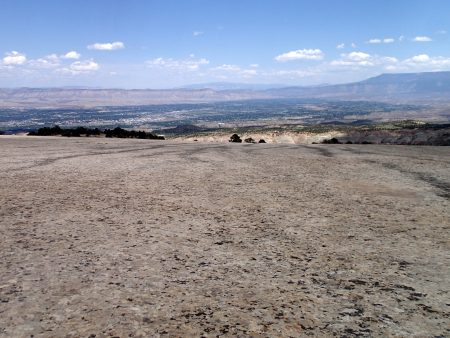
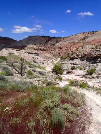
Today I rode from my parking spot on Donkey Flats road to ride the Red Fleet loop, another IMBA / BLM backyard to backcountry rides. I rode the trail last year as I worked my way south ahead of the snow. Today all was green from wet spring. Lots of red rock.
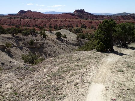
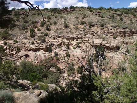
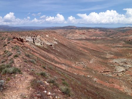
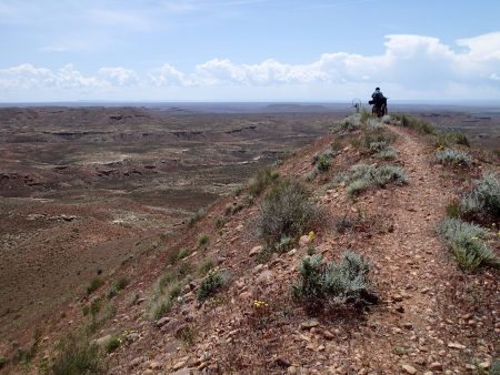
Red Fleet red
Red Fleet red

I used Trailforks on my phone for route following. Short loop of 8.55 miles climbing 1331′ which exceeds the mostly normal of 100′ climb per trail mile. I sweated a bit today.

I headed north going from Utah crossing into Wyoming then entered Idaho. I’m camped on east fork of Georgetown canyon at 6312′ and the vegetation is green, not a spec of red. Amazing what water will do. Today I left the red till when? Now it is green and less viewsheds.
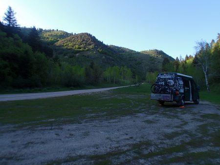
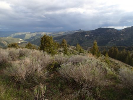
Left hand fork georgetown canyon

And I am getting 4G 2 bars back in this canyon. Found the big spring as noted on the GS map.

Tomorrow is perhaps a ride above Pocatello then off to Indian Springs south of Kimberly. Need to do weekly Thurs wash, prolly make it a rest day after riding 6 days in a row. Woods River Valley later this week.

This AM I checked my bank accounts. I found that my card was used to purchase airplane tickets in Oklahoma. I started the fraud reporting process. Card is cancelled which is used to pay all my monthly recurring bills. I have to cover the $1,800 charges that will be reimbursed when the claim is settled. I have another card on another checking account to be able to pay bills and spend money. Now comes the planning of where to have the new card sent to.

Don’t you know you want to make me shout

Thursday’s plan got blown away by high winds. Last night my preferred camp spot was taken so I moved further up the mesa and winds that came up. For me too windy and I don’t have to ride every day.

I drove into Fruita 18 miles to the east on I-70, I did my laundry. Machines work off like a money card. Clean clothes I drove to Junction and up to Little park TH for the night. Very windy and dusty, stayed inside.

Friday’s plan was to ride Gunny Loop at the Lunch loops, drive back to Fruita, take a shower, one last Sedona salad at Hot Tomato and hope of visiting w/ either Jen or Ann, then drive towards Vernal spending the night up on Douglas Pass.

Friday I was able to ride directly from my van a short distance on a double track to pick up Gunny Loop. Then the chunk and navigation challenges started. Again, the Lunch Loop trails are some of the most challenging trails I have ridden. Today perhaps I rode better on the RFX than I did on the 5 Spot on the pieces I could ride and I did ride more on the RFX but there are pieces that I say noway nohow. I kept my big Samsung cell phone in my right side pocket of my Wingnut pack. I pulled it out at trail intersections to keep on track. It seemed that every time I pulled it out I had to reload the trails. I was pretty frustrated at my navigation. There are numerous trail intersections. I was not a happy rider when I finally made it back to the van. One was the chicken confidence to ride what I should be able to and second was the phone. And I had the phone solution at hand but had not implemented it. I bought a cell phone handlebar mount carrier at Junction REI but did put it on. At the van I installed it and rode a piece to see what I could not see. I mounted the phone of center from the stem allowing me to still see the front wheel. Good to go.

rider about dead center Pre Nup
rider about dead center
Pre Nup

I drove into Junction to the jewelry repair shop to pick up my bracelet. Shop was closed. WTF? I called the shop and listened to the answer stating the guy had family issues requiring his out of town attendance and should be back on Friday. He missed. I left a message to start the proceedings of exchanging $ for merchandise.

Shower back in Fruita. I ordered dinner just after 5 before the normal evening rush arrived. No Ann or Jen. They know Charlie and Theresa whom I know also. Thanksgiving of 2014 we palled around at Moab till Charlie smashed his head in a canyoneering accident. I hoped to learn about him from the women.

I drove out of Fruita heading North climbing over the Book Cliffs cresting at Douglas Pass at 8268′, the highest I have been in a long time. I drove up the FS gravel road on the east side of the pass till I found a wide mostly flat spot at a left hand turn. Long time ago prolly my first Fruita visit back when I drove the Westie I rode a ride named Flight of Icarus which dropped down the spine of a ridge dumping onto private land to be crossed before hitting the highway for the 10 mile grunt climb back to the pass. Back when I was younger.

from Douglas Pass looking S.

slept at 8478′. 37 degrees at 7:00. I ran the furnace all night on low. I reached out from under the coves in the morning to turn the thermostat up higher then waited for warmth.

After B-fast and clean up I continued my drive to Vernal, UT. 25 mph is the posted speed limit on both sides of the pass until the road straightens out. Dropped down to petroleum extraction basin. I learned to the east of Vernal the extract is natural gas and to the west of town it is oil. Back into barren desert. Crossed into Utah on US40. Locale used to be a hopping extraction activity. Not so anymore, it is a real bust as vacant newer build buildings sit dark and lots of oil equipment parked in fenced lots.

I stopped at Altitude Cycles finally on an open day hoping to visit w/ Troy the owner. I learned that a mountain bike festival sort of was going on out at McCoy flats where I was going to ride. I drove out after grocery shopping. On the west end of town business is retail not capital on the east side. A 3 mile broken pavement side road drive took me to the corral. Lots of riders, maybe 150, were in attendance. I geared up and pedaled off to ride jack a lop which is the steepest climb here. Weather was threatening T storms and I rode the top of an exposed mesa. Just a few drops fell

Trails here the tread is loose round river rock Purpose built. Big climb the descent.
I dropped my bike off at the van then walked over to the pavilion where festival center was. I found Troy. It took him about 2 seconds to remember me then warmly greeted me. Earlier this year an article about Vernal was in Bike Mag. I learned that the biggest bust in 60 years has hit the locale. Oil prices are down, fields not pumping, no new drilling. many people leaving at end of school which is this weekend. I talked to several BLM people who are the primary land manager for these trails. I learned that per the man from MT that the BLM nationally considers electric assist bikes motorized. I met Ryan who is the recreational director for the Ashley NF. I asked him about accessibility using whatever vehicle you can ride on trails.He said they use the Mall test which means that if what you plan on riding in / on the trails is acceptable for a shopping mall. I asked about knobby tires and his answer was if they don’t mar the floors. If the rig passes then it can be used on the trails.

Spokane friends Les and Gloria are in Vernal. We made arrangements for dinner in town. I stopped at Anytime for a cleanup shower then met them at Vernal Brewery. Earlier today at the festival Skyler who is the operations manager of the place gave me their sticky. Good food, beer, and visit. Our server is from Ohio. Rain shower fell. I bid adieu just after sunset as I wanted to be back at McCoy while still light to find a camp spot.

Back out at McCoy the day traffic had left leaving lots of space.

This AM I made my scratch pancakes w/ store bought small blueberries. Recipe uses 1/2 cup of buttermilk and finding the 1/2 pint carton doesn’t occur very often. Put Smiths on the grocery store list.

Today is riding fine weather. I installed the phone in the carrier then selected the first trail I would ride. MTBProject is GPS based which will show your location, which kept me found as I always knew where I was relative to the trail I wanted to ride. I chose More Hoes. I had never ridden this one before. Monster climb up onto a mesa. I was caught up by 2 younger men, locals. Round river rock rubble. Exit off More Hoes so named because of the 50 hoes that were broken cutting in the trail was along a knife edge

More Hoes knife edge ride

Ridge had exposure on both sides, tread was loose round rock. I applied serious concentration which started out laser focused but started to fade the further along I got. Fortunately we came to the end then dropped down rear brake dragging skid control descent. I chose to walk those pieces to lessen damage.

bike parts indicate nasty ahead

Purpose built trails. Very few hard tech problems. Good pedaling. Hard and enjoyable. Ride was 14.58 miles climbing 1379′. Good ride. MTBProject on the phone in the carrier worked and will be used again when travel complexion necessitates.

I hung out at the pavilion to a sparse crowd. Late afternoon a wind event blew in. The weather station at Vernal airport recorded 41 mph gust, steady 23. Van was really rocking.

Going to ride here again tomorrow. Haven’t decided to stay here again overnight or drive up to Red Fleet, my next ride.

I bought the new MBA issue at Smiths here in Vernal. I found my letter in the Trailgram section it was the first one. It is verbatim to our emails.

Mosquitoes are emerging. I learned that Memorial day weekend is about the last weekend before mosquitoes take over until fall. That’s why the festival is on this weekend in spite of potential slightly unsettled weather.

Butterknife and the Ribbon

Yesterday I drove down from Little Park to Mac Daddy for van service. Request was for parking brake service and check over the van for state of health. Parking brake needs a new cable that will take longer delivery time than I will stay here. Exam discovered the radiator has a small leak between the expansion chamber and the radiator. Just a matter of time before the crack blows up. I decided to let them replace the radiator. It was delivered mid morning. The front end of the van was disassembled to get at the radiator. I spent the day at the shop. This shop has Sprinter knowledge. Payden serviced the air conditioning which now works.

I drove back up to Little Park for the night setting myself for today’s ride.

The ride today started w/ a 1.2 mile climb on pavement to the dirt. Twist and shout leads to Butter knife which was built by motorcyclists to sustainable standards. It’s tight and twisty and rocky. Last weekend the bike race used the trail. It’s a tough tech trail that I poked along on and walked stuff. I just can’t imagine racers racing this trail. I looked forward to this trail riding my better bike and with improved skills. I lack confidence to ride what the bike can do and I have the ability to ride. It’s almost as if the better the bike I have the more I walk. 8.17 miles dropping 1582′ that will be climbed back up. The 4X4 road climb was a crusher climbing 966′ in 3.89 miles back to the pavement.

I chose the parking spot as it is just a short pedal up the pavement from the end of the Ribbon. At the pavement I decided to give the Ribbon a go which meant a big road climb to the top. 2.52 miles climbing 797′ took 27 mins. I stayed with it. Finally the TH at top. Then the descent. The first part of the Ribbon is a big slab of slick rock w/ no trail markers.

Ribbon
Ribbon

Don’t touch your brake rotors which heat up from keeping speed under control.

I wandered down until I came to a drop off. I switched my phone to MTBProject that had the ride on line. I used the data to find the correct exit, and it solved several other route confusion. There is a definite tire wear line on the big slab that can be seen from where I camped. Lower down the trail became a definitive track. There is a nasty steep slick rock problem that required me to lower my bike below me and used it as a climbing aid. NASTY. I could have used another rider to help lowering and down climbing. Sort of scary. Further down another nasty down climb. All the while I could see what I would climb to get out of the canyon.

in canyon at bottom of ribbon

Climbed out to pavement and a short tiring pedal back to the van. 2 hrs 59 mins covering 19.47 miles climbing 3212′.

I drank a beer and ate a sandwich then drove back to Fruita for a shower and dinner at Hot Tomato. I washed my bike at the other bike shop in town that allows anybody to use contrary to OTE. I drove back to camp spot above Rabbit valley at last west exit in CO.

Tomorrow I plan on riding Kokopelli trails w/ little wind then drive back to town to do my weekly laundry.

Friday my bracelet is to be repaired for pick up and check on and hopefully pick up my INR testing supplies at the post office.

Very pleasant night camped here. Sun has set, whisp of a breeze, window down and door opened. Listening to Mariners crush the As.

Friend Steve said that MBA mag printed my letter to the editor. New issue hasn’t hit the grocery store racks.