3 of a kind, rest up.
Tonight I am out near Plain, WA on Lake Wenatchee. I worked on the previous post and left no time for lore here.

3 of a kind, rest up.
Tonight I am out near Plain, WA on Lake Wenatchee. I worked on the previous post and left no time for lore here.
Or vice versa.
Crossed the Columbia into WA last week. Why do all the license plates look like mine?
Brief catch then I am back out in the woods. I drove north from Carson up into the mtns and into the volcanic activity area from the erupted MT ST Helens. I was inside the 20 mile red zone created to keep people sort of away from the shaking mtn b4 it blew its literal top.
Last week I rode Old Man’s Pass and Falls creek trails uphill from Carson, WA. Old Man’s trails were mellow deep woods riding w/ no vistas except when on the logging road.
The developed gravel roads throughout the USFS lands are resource extraction roads paid for by US tax payers to access the public timber. To call them fire roads is to somehow sanction the destruction of the natural resource. We drive on logging roads, fireroads are bulldozer scraped firebreaks.Read More
How time flies when it is mine to spend. It’s late afternoon and I am parked in the shade on a residential street in Hood River after spending the weekend up on Surveyor’s Ridge, almost 4000′ above the river where it is also considerably less than the 92 degrees recorded here. There is also no cell or internet coverage out there.
So my next move is across the Columbia river to WA and up to Old Mans pass and Falls Creek then up to Lewis river trail. Perhaps buddy Les from Spokane might come down to the river this weekend giving me a reason to stay down here another week.
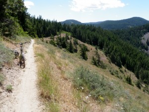
I believe that the number 1 reason a person picks their most favorite trail is if they can ride it from home. I felt the same rating as I spent 2 days parked up @ Surveyor’s ridge for 2 rides. Sat was the crunch up Cook’s meadow to High prairie then down 8 mile, then a piece of Knebal Springs to rd 1720 to a short piece of Surveyors back to my sun baked van and solar heated shower shower. 19.75 miles and 3006′ climbed in just under 3 hours. Cook’s meadow trail is a continuing relocation effort that will climbing turn up the steep climbs. Then Sun I rode Surveyor’s ridge out to Oak Creek crossing then back. I liked this trail as it was a mix of climbing and descending w/ only 1 hill on the return that was too demanding of my scarce resources to ride up. Deep forest riding. Again I rode to and from my parked van.

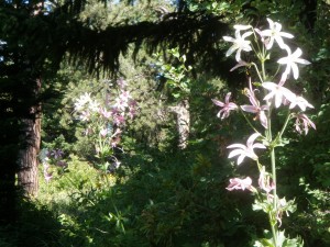
What is this flower? Lilium washingtonianum, thanks to Stacey.
 Today I spent several more hours @ Dirty Fingers bike shop. Fun place to hang. A counter on wheels separates the work area from the stools on the customer side. Mitchell. Someone there has designed a bike powered rotisserie w/’ 9′ of chain to roast a pig on. Some guess is 9 hours of spinning time. This cooking will be @ the super D race in Oakridge this weekend.
Surveyor ridge area trails are great as they are little damaged by dirt bikes or aren’t allowed on. I have been identifying rides in WA east of Cascade crest but except for around Spokane the trails have been dirtbiked which drastically affect the mtn bike experience. Devil’s Gulch S of Cashmere used to be a favorite trail but the dirt bikes have chewed it up. I will prolly ride it anyway because I am a sucker for past favorites.
I made my 6 month dental visit w/ my Spokane dentist for 8/29 hence establishing my Spokane visit time.
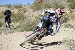
Oh, I feel that the Better Ride instruction was very beneficial as I am definitely enjoying myself more riding. The 28″wide bars have helped put the skills to application. Catch the turning:

I still ride in mostly bare skin and slower speeds but I am learning this powerful technique.
From a few views up high one can see MT Hood, Adams, Rainier and ST Helens. I can trace my ski route down MT Adams from the false summit @ 10,000′. False Summit to Lunch counter is almost 2000′ on constant low level black diamond steep. Back in my day….. .
Off to drink a brew pub beer and dinner than scoot up high.

