
Monday I bid adieu to Spokane heading west to Wenatchee. My plan was to ride the Sage Hills trails above town. Years ago I rode here after an IMBA trail care crew session of Steve and Morgan in Leavenworth. The TH is 3 climbing torturous miles of steep gravel road. I remembered, I hoped the road would be in better shape but was same ol same ol. I made it. Late afternoon. Rain threatening clouds. The system is an out and back unless you want to connect to another canyon for a huge loop. I chose the O & B. Great smooth purpose built trail with a sustainable climbing angle, lots of bermed turns to facilitate the turn. Climb climb, climb, turn turn turn. The last trail, Apricot Crisp, ended on an old logging road that kept climbing. I stayed w/ it till almost the top. I could see the rain falling from the clouds over the Stewart Range moving closer, I chose to point back downhill. Swoopy ride. My Turner 5 Spot w/ Industry 9 Enduro wheel set, Pike fork, and 32″ wide carbon handle bar just gives me so much control and confidence. I beat the rain back which later dumped a few paltry drops enough to make mud splatters of the dust on the van.
Central WA is in the rain shadow of the Cascades.
Ride was 12.60 miles climbing 1989′, took 1 hr 12 mins up and 35 down.
Back @ the TH 4 riders were getting ready to take off. Shop ride from local store. They would be riding in the dark. The least prepared rider bailed before dead dark. One rider w/ a light arrived I chatted w/ him. The other 2 riders, one had a flat, and the other keeping him company as he walked his bike down. Seems that he used Slime as his tubeless sealant and could not break the bead loose to install a tube. We stood around in the chilly wind drinking beer before I bailed for the warmth of my van. I spent the night. Wind blew which rocked me to sleep.
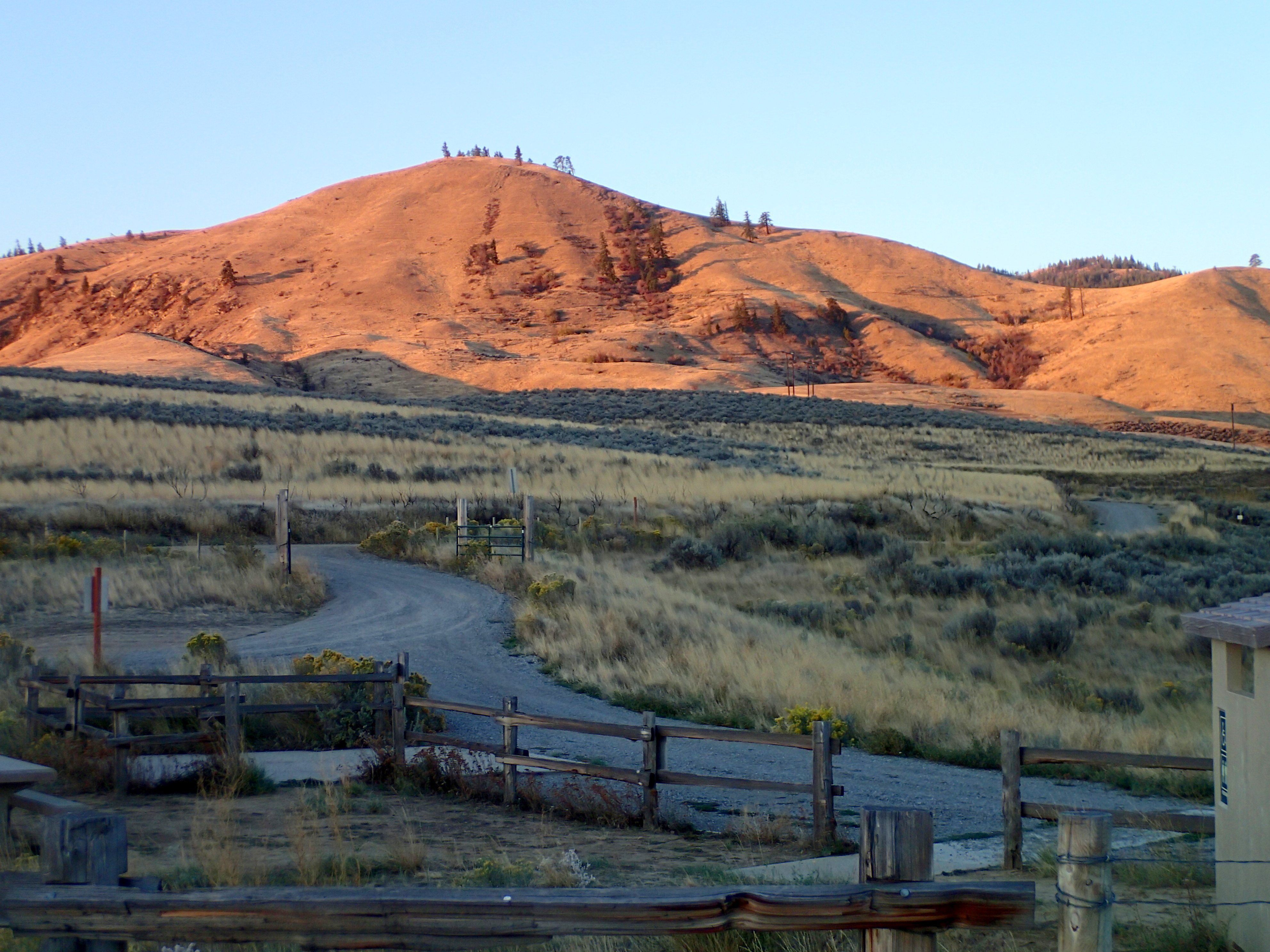
Yesterday I woke b4 the sunrise then watched it light up the hillsides.
I shifted the transmission into 2nd and crept down hill back to Wenatchee. I drove to Central Bike in town, they were the shop ride. I was looking for a wash station for the bike. No such facility. A salesman educated me on more bike suspension designs about brake jack and pedal bob and Dave Weagle and his DW link. Lots of solutions, each has some trade off.
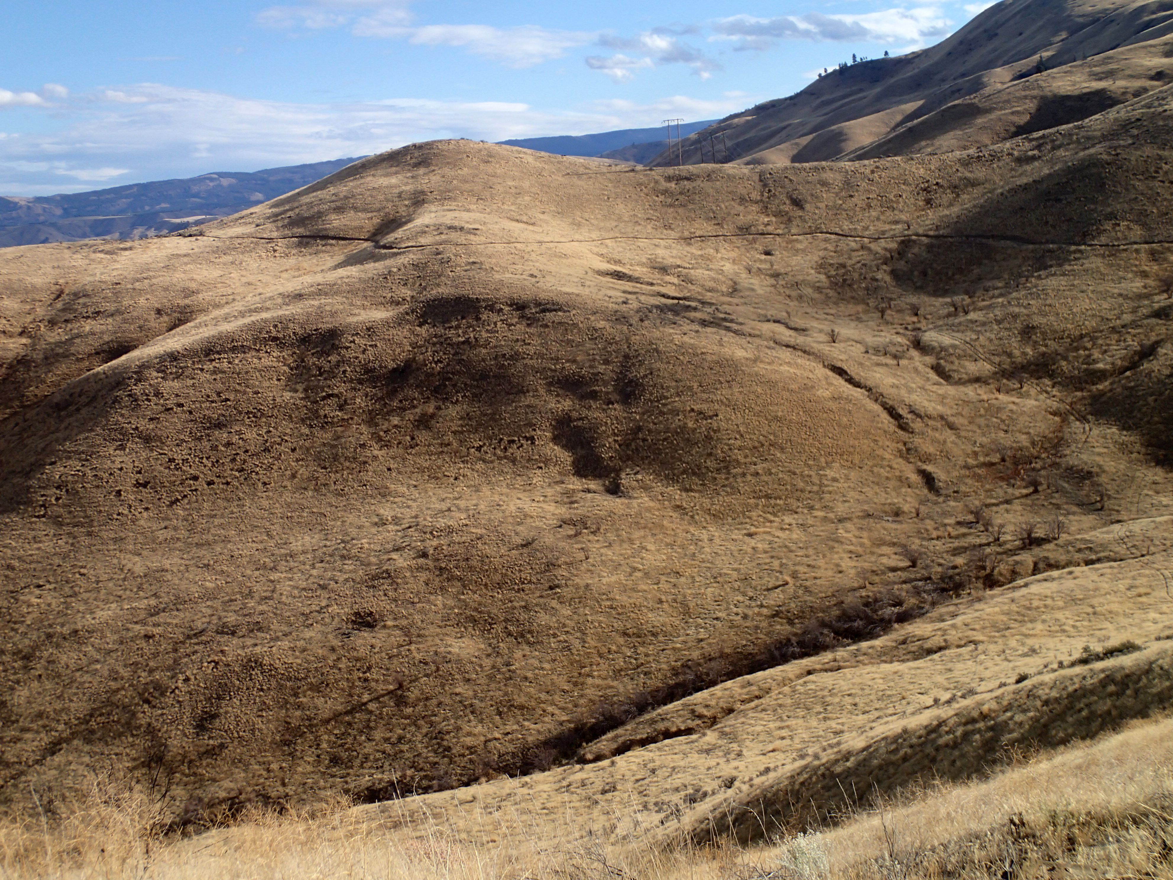
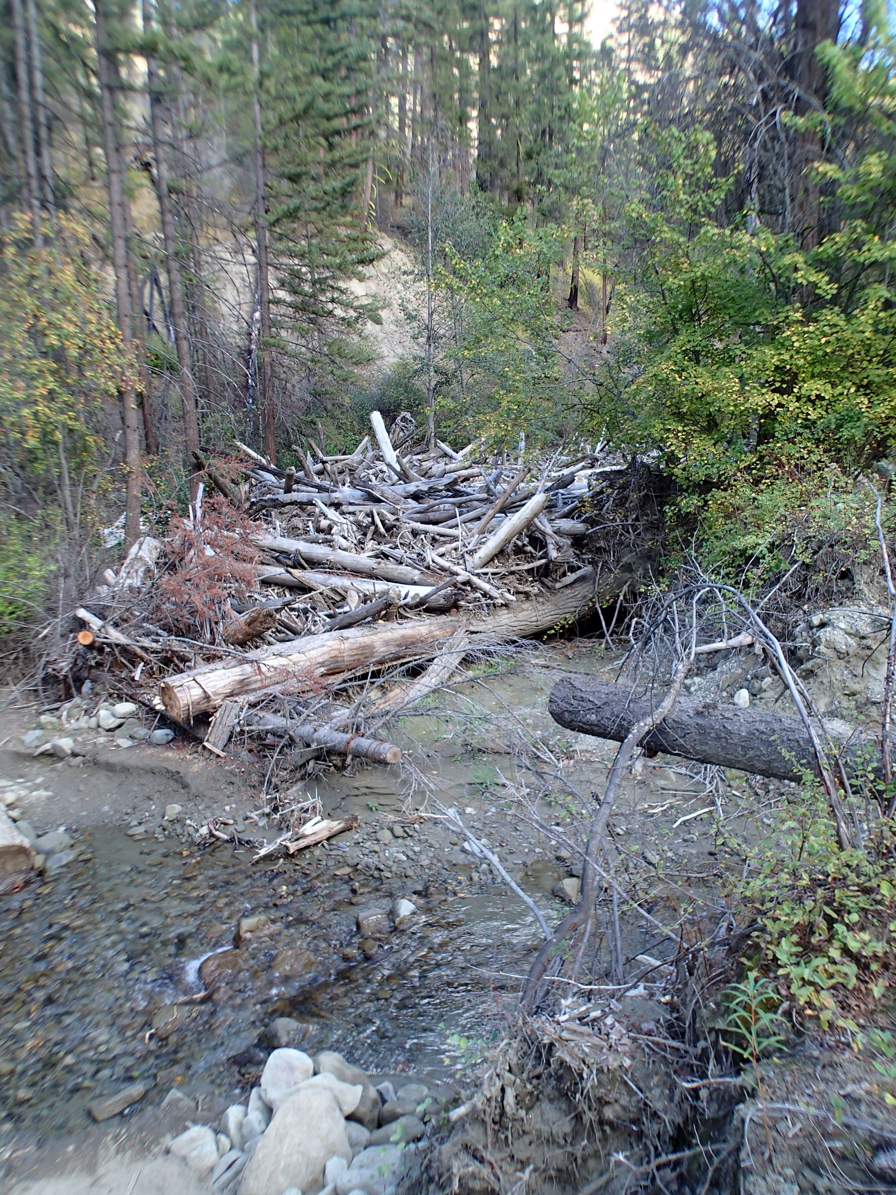
I took a shower before a ride, bought groceries and drove to Cashmere and devils gulch TH. One rig was in the lot, Alberta plates. As I was getting ready another rig arrived driven by Chris. Our ride plans were the same. He rides a 29ner. He told me that the logging road up Mission Creek was blocked by huge Kelly bumps. I saw what he described. Big ditch. The FS decomissioned the road by removing culverts and letting floods do the rest. It was all rideable. Ove the years I have ridden here many times. I remember the road climb as a real mental killer. At least there was no 4 wheel traffic dusting me. Just a big grunt.
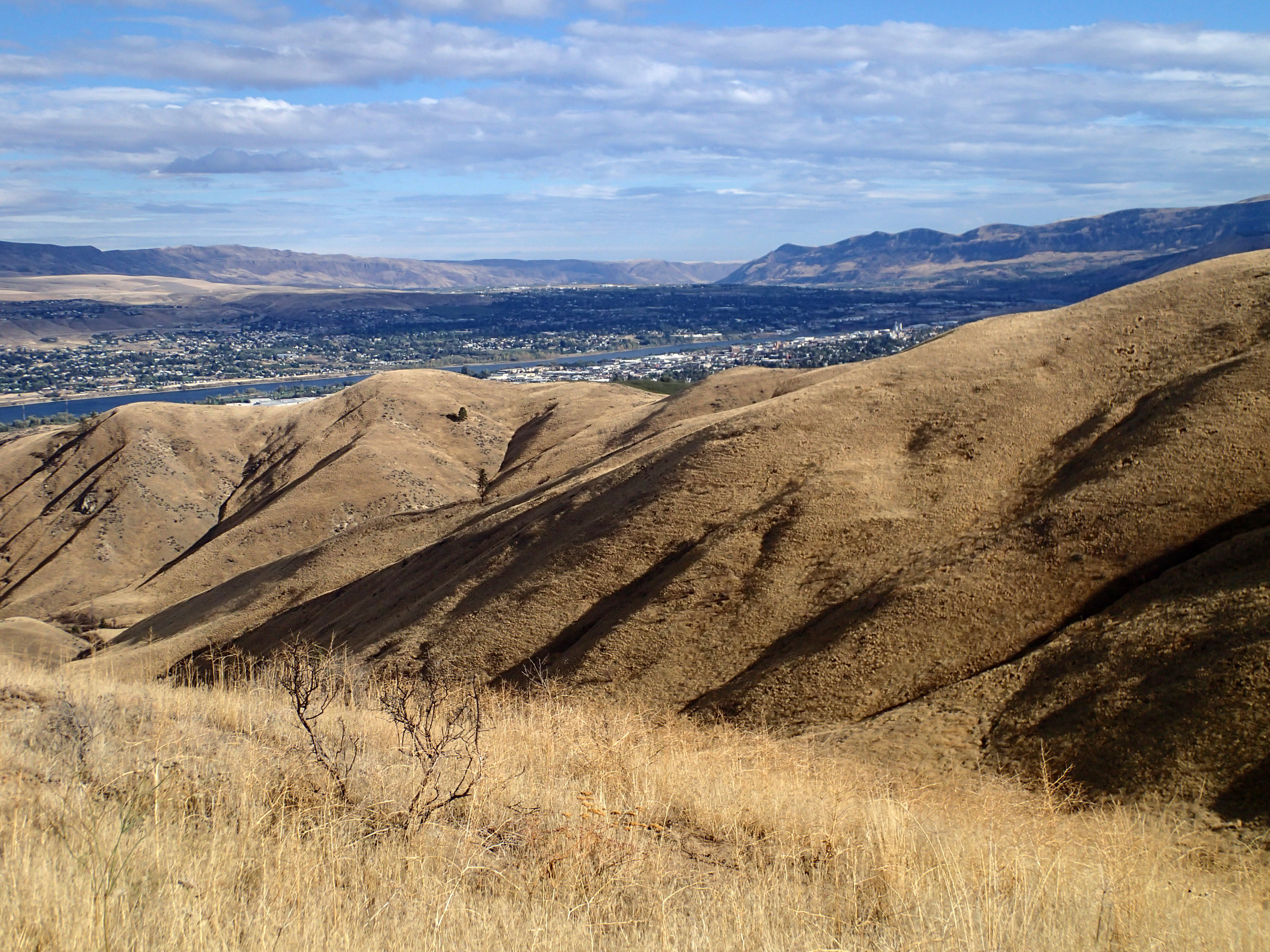
Chris’ buddy was riding a carbon frame fat tire bike whom we caught up w/ @ the Devils Gulch upper TH. Also was the Canadian couple. Mission Ridge TH was even further up the road which is open to traffic. The ride is drop in @ Mission Ridge then connect w/ Devils Gulch to the bottom. The road climb was 12.90 miles climbing 4,000′ took 2 hrs 26 mins.
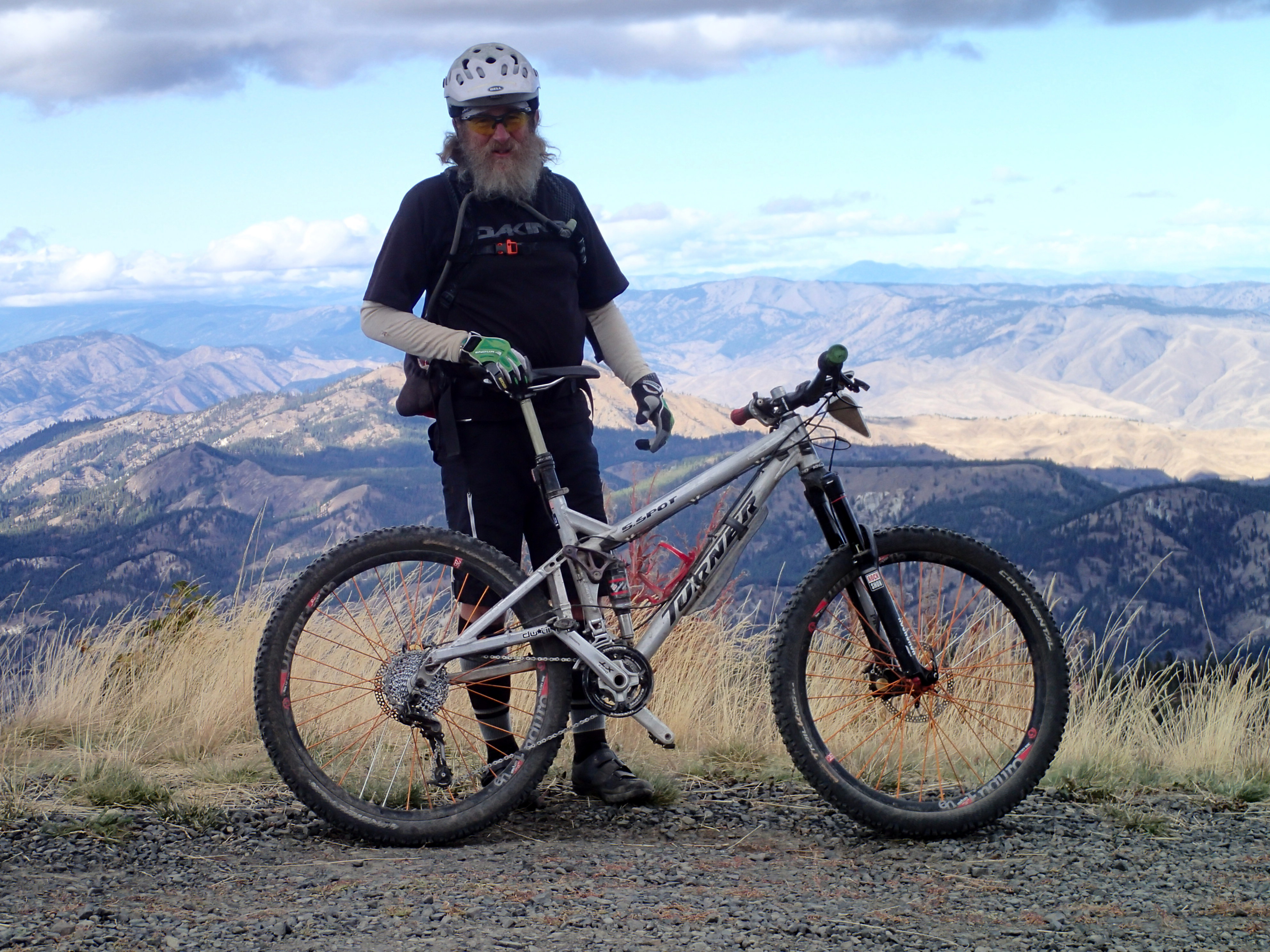
It took 1 hr 16 mins to get back to the van. The upper part was very rocky going over talus slopes w/ tight twisty turns and punchy climbs. My seat continually moved for going down and climbing back up. What a wonderful bike I ride. Lots of challenges successfully met. Best ride ever. I had the best control and handling w/ this set up. I run about 24psi in each tire, no flats. I could hear the low pressure tires impacting the sharp edged rocks. Low pressure tubeless was validated.
Last year parts of the forest were burned, a random patch work of burned areas, that the road and trails traveled thru. Years ago several large floods from spring snow melt course down the Mission feeder creeks, one blocked the creek just above the trail crossing
 I waited 30 mins @ the TH before leaving and the other folks had not arrived.
I read the map that showed an all weather road that continued past the closed creek road and climbing to a ridge b4 entering non FS land then dropping down Number 2 Canyon into Wenatchee. My idea was elevation would give me internet access. FS roads are maintained @ higher level than local municipalities. This road became a double track w/ no place to allow another vehicle to pass. Up higher grade reversals were added to spill the runoff. I invested effort to make to ridge but no internet access. The map indicated better road going down. I could have returned back to Cashmere but I wanted a shower in Wenatchee.
I ran out of water doing my dishes.
I dropped down Number 2 Canyon road. The first short piece was FS sandy water barred steep. Then the road became county. And got very rough, rocky, steep and washed out. I was committed. Second gear slow and spot on steering kept me out of frame swallowing gulleys. Nasty road I have ever driven in anything. I made it. How to recognize a primitive road shown on a map to avoid this experience.
I showered @ Anytime and scored an outside spigot to fill my tank up and fill my tree sprayer to wash my bike.
There, caught up.
I am resting today. Going to drive to Leavenworth and drink beer at a brew pub. Tomorrow is driving to Snoqualmie pass for the night staging myself for drive to Renton and furnace install.
Ride Devils Gulch, its the real deal.
The GPS computer looses reception and data gathering under tree canopy or sheltered by mountains. I might buy a small wireless computer to capture another view of my effort.
Craig, good to see you while you were here. Enjoy the West Side. Hopefully your new heater will work well for you. Les
Craig,
Garmin makes a wheel counter similar to other odometers that correct the mileage readout. I just installed it on my 810. Works fine.
Hi Craig –
Enjoyed meeting you at Devil’s Gulch. Great ride! Thanks for the conversation during the grueling ride to the top. Great pictures and descriptions in your blog.
Chris
Craig, I got stung by those Kelly bumps last July. No mention in the two guidebooks I had that the road had been closed and no indication at the TH. I can confirm that there is cell service at the top of Rd#2 though:) The detour only added another 1200′ of climbing to the ride. See ya in Sedona soon?
Joe