Or vice versa.
Crossed the Columbia into WA last week. Why do all the license plates look like mine?
Brief catch then I am back out in the woods. I drove north from Carson up into the mtns and into the volcanic activity area from the erupted MT ST Helens. I was inside the 20 mile red zone created to keep people sort of away from the shaking mtn b4 it blew its literal top.
Last week I rode Old Man’s Pass and Falls creek trails uphill from Carson, WA. Old Man’s trails were mellow deep woods riding w/ no vistas except when on the logging road.
The developed gravel roads throughout the USFS lands are resource extraction roads paid for by US tax payers to access the public timber. To call them fire roads is to somehow sanction the destruction of the natural resource. We drive on logging roads, fireroads are bulldozer scraped firebreaks.
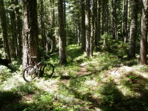
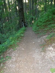
Falls Creek was an out or rather up and back hump mostly single track, I chose to focus on the deep woods single track. Trail tracked the creek off and on.Deep tree cover.
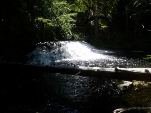
The creek deserves its namesake for all the small waterfalls.
10 miles up climbed 2510′, back down climbed 259′. I have been using my front brake almost inclusively as perhaps 70% of braking power is on the front wheel; be careful, learn about your better stopping friend to keep your chin on the correct side of the bar.
I moved a bit further and closer to ST Helens to ride the Lewis River trail.This is not just another river trail albeit that’s what it is: another 20 miler and 3000′ climbed w/ no climb or hike a bike was over 80′ elevation gain, just up and down and around. I was spent when I sipped my post ride old fashioned chocolate milk. Big trees.
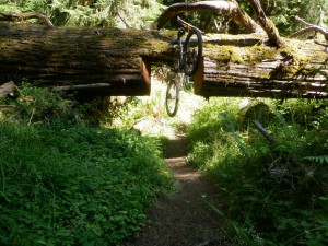
I drove the back paved roads along the eastern flank of ST Helens, saw MT Adams, then WOW, the Biggie: MT Rainier. Back woods yielded to rt 12 and small town of Randle and a bit bigger, Packwood. Drove thru MT Rainier NP to the east of the peak and over Cayuse Pass. I made a side trip and drove up to Chinook Pass to sightsee. Saw telemark tracks on the snow fields where I used to ski. Corn snow, my definition of hero snow. This late in the summer the snow surface is water rivuleted, dirty, sun cupped, but a solid surface. Could really throw up spray on a carved turn.
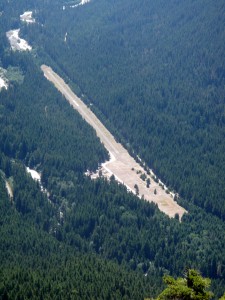
I drove down to Buck creek and Ranger creek airstrip where I had previously stayed. Place was crowded w/ horse people. Saw a sign announcing a Prize Ride on Sat. I camped on the lesser populated far side of the runway just nosed off a dusty access road. Drivers stirring up dust as they drove by w/ their windows up and air conditioning on. Lack of consideration, can’t be empathetic w/ someone choking on their dust.
Sat and Sun I rode from Ranger Creek on the White river so named because of the white color from the glacial melt running off Rainier. I needed to test my body w/ each ride’s killer road climbs. Corral Pass and the Palisades on Sat for the bigger climb of 21.5 miles and 4460′ climbed. Edge reported 4116 cals burned. Rode a lot of roots: just focus on anchor point and let the reflexes deal w/ the gnarl. Big road climb 4.9 miles climbed 2705′. Sure enjoying the 28′ wide handlebar.
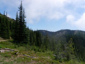
I actually spotted my van from up in the pallisades:
Sun I rode the other side of the valley up Suntop which sits just a little ways outside MT Rainier NP, another big road climb. First up was Skookum Flats trail alongside the river. Much work continues on the trail, most notable was the trail trench needed to evacuate the organic material and a new section blasted from a rock face that eliminated the nasty climb a bike section. I rode up to the logging road to the lookout that was open and manned by a volunteer. We could see the climbers’ route up the Emmons just like i climbed it so many years ago. Last time was 1984 because I have a carabineer w/ the summit date etched in received as a gift for our success. 21 miles and 4570′ climbed.This descent lacked the roots and exposure from yesterday. Found out I can still earn my downhills, it just takes longer and more effort to reach the top.
I need to add more to this post at a later time as I having reprovisioned in Enumclaw am heading back to the dry side via WA 410 over Chinook pass. Next stop is Leavenworth area for dirt biked out trails.
Gotta go.


